Route 14 is a numbered state highway in the U.S. state of Rhode Island. It runs approximately 23 miles (37 km) from Connecticut routes 14 and 14A at the border with Sterling, Connecticut, to Route 6 in Providence.

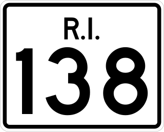
Route 138 is a numbered State Highway running 48.3 miles (77.7 km) in Rhode Island. It is the longest state numbered route in Rhode Island, and the second longest highway after US 1. Route 138 begins in Exeter at the Connecticut state line in the west and runs to the Massachusetts state line in Tiverton in the east, and is the only state-numbered route to completely cross Rhode Island. Route 138 also keeps the same route number on the other side of both state lines.

Route 138 is a 43.58-mile-long (70.14 km) north–south state highway in Massachusetts. From the state line in Tiverton, Rhode Island to Milton, Route 138 runs as an extension of Rhode Island Route 138, which is itself an extension of Connecticut Route 138. Route 138's northern terminus is at Route 28 in Milton.

Interstate 95 (I-95) is the main north–south Interstate Highway on the East Coast of the United States, running generally southwest–northeast through the US state of Rhode Island. It runs from the border with Connecticut near Westerly, through Warwick and Providence, and to the Massachusetts state line in Pawtucket. It has two auxiliary routes, both of which enter Massachusetts—I-195, a spur from Providence east to Cape Cod, and I-295, a western bypass of the Providence metropolitan area.

Connecticut Route 138 is the portion of the 118-mile-long (190 km) multi-state Route 138 within the state of Connecticut. It is one of several New England state highways that travel through three states while keeping their number designation. The route begins in Sprague at Route 97. From its western terminus up to the junction with Interstate 395 in Griswold, the road functions as a collector road. From the Interstate 395 junction, it then enters Voluntown before ending at the Rhode Island state line, where it continues as Rhode Island Route 138.

Connecticut Route 14 is one of several secondary routes from eastern Connecticut into Rhode Island. It runs from the Willimantic section of the town of Windham to the Rhode Island state line in Sterling.

North Carolina Highway 49 (NC 49) is a 177.8-mile primary state highway in the U.S. state of North Carolina. It traverses much of the Piedmont region, connecting the cities of Charlotte, Asheboro, and Burlington.

Route 49 is a Connecticut state highway from Route 2 in Stonington to Route 14A in Sterling, in the southeast part of the state. It is a scenic route that runs 21.74 miles (34.99 km) through the Pachaug State Forest.

Route 201 is a state highway in southeastern Connecticut, running in an inverted "L" pattern from Stonington to Griswold.

Route 164 is a minor state highway in southeastern Connecticut, United States, running from Route 2 in Preston through the village of Preston City to Route 138 in Griswold just south of the borough of Jewett City.

Route 198 is a 23.18-mile-long (37.30 km) state highway in northeastern Connecticut and southern Massachusetts, running from Chaplin, Connecticut to Southbridge, Massachusetts.

Route 101 is a state highway in northeastern Connecticut running from Pomfret to the Rhode Island state line in Killingly. The road originated as a 19th-century toll road known as the Connecticut and Rhode Island Turnpike. Route 101 was designated along the modern alignment in 1935 when an earlier Route 101 was renumbered to U.S. Route 44.

Route 184 is a state highway in southeastern Connecticut, running from Groton to North Stonington.
The Last Green Valley National Heritage Corridor is a federally designated National Heritage Corridor in northeastern Connecticut and portions of Massachusetts. It has a rural character with rolling hills, farmland and classic New England scenery. This area was designated because it is one of the last remaining stretches of green in the Boston to Washington, D.C. heavily urbanized corridor. The valley also has the largest stretch of dark night sky in the Northeast megalopolis corridor. It contains some of the largest unbroken forests in Southern New England, in a region of Connecticut known as the Quiet Corner.

The Pachaug River is a 16.0-mile-long (25.7 km) river arising from the Pachaug State Forest at the Connecticut - Rhode Island border and draining into the Quinebaug River. It is crossed by the Ashland Mill Bridge in Griswold, Connecticut, a bridge which is listed on the U.S. National Register of Historic Places.

The Nehantic Trail is a 13-mile (21 km) Connecticut hiking trail and is one of the Blue-Blazed hiking trails maintained by the Connecticut Forest and Park Association.

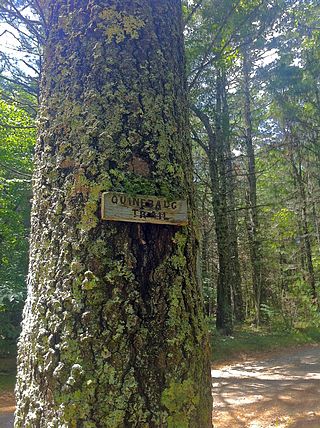
The Quinebaug Trail is a 8.1-mile (13.0 km) Connecticut hiking trail and is one of the Blue-Blazed hiking trails maintained by the Connecticut Forest and Park Association.

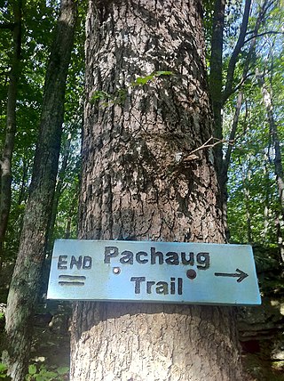
The Pachaug Trail is a 28-mile (45 km) Connecticut hiking trail and is one of the Blue-Blazed hiking trails maintained by the Connecticut Forest and Park Association. It is a horseshoe shaped trail.

The Narragansett Trail is a 16 miles (26 km) hiking trail located in Connecticut. It is one of the Blue-Blazed Trails maintained by the Connecticut Forest and Park Association, the Narragansett Council, and the Rhode Island chapter of Scouts BSA.

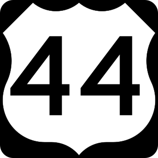
U.S. Route 44 (US 44) is an east–west United States Numbered Highway that runs for 237 miles (381 km) through four states in the Northeastern United States. The western terminus is at US 209 and New York State Route 55 (NY 55) in Kerhonkson, New York, a hamlet in the Hudson Valley region. The eastern terminus is at Route 3A in Plymouth, Massachusetts.


