
The Tallgrass prairie is an ecosystem native to central North America. Natural and anthropogenic fire, as well as grazing by large mammals, were historically agents of periodic disturbance, which regulates tree encroachment, recycles nutrients to the soil, and catalyzes some seed dispersal and germination processes. Prior to widespread use of the steel plow, which enabled conversion to agricultural land use, tallgrass prairies expanded throughout the American Midwest and smaller portions of southern central Canada, from the transitional ecotones out of eastern North American forests, west to a climatic threshold based on precipitation and soils, to the southern reaches of the Flint Hills in Oklahoma, to a transition into forest in Manitoba.

An oak savanna is a type of savanna, or lightly forested grassland, where oaks are the dominant trees. These savannas were maintained historically through wildfires set by lightning or humans, grazing, low precipitation, and/or poor soil.

Pawnee National Grassland is a United States National Grassland located in northeastern Colorado on the Colorado Eastern Plains. The grassland is located in the South Platte River basin in remote northern and extreme northeastern Weld County between Greeley and Sterling. It comprises two parcels totaling 193,060 acres (78,130 ha) largely between State Highway 14 and the Wyoming border. The larger eastern parcel lies adjacent to the borders of both Nebraska and Wyoming. It is administered in conjunction with the Arapaho-Roosevelt National Forest from the U.S. Forest Service office in Fort Collins, Colorado, with a local ranger district office in Greeley.

The Texas Blackland Prairies are a temperate grassland ecoregion located in Texas that runs roughly 300 miles (480 km) from the Red River in North Texas to San Antonio in the south. The prairie was named after its rich, dark soil.

Overland Park Arboretum and Botanical Gardens is a relatively new arboretum and botanical garden located a mile west of U.S. Highway 69 on 179th Street, Overland Park, Kansas. It is operated by the City of Overland Park, and championed by head supervisor Karen Kerkhoff.

The University of Wisconsin–Madison Arboretum is a teaching and research facility of the University of Wisconsin–Madison and the site of historic research in ecological restoration. In addition to its 1,260 acres (5 km2) in Madison, Wisconsin, the Arboretum also manages 520 acres of remnant forests and prairies throughout Wisconsin.
On Nature's Trail was a television show produced by the Maryland Center for Public Broadcasting in Owings Mills, Maryland in 1978. The show featured Elmer and Jean Worthley observing and discussing plants growing at different locations in Baltimore County, Maryland. Observations were made at the same locations during the Spring, Summer and Fall.

The Iroquois County State Wildlife Area is an Illinois state park that occupies 2,480 acres (1,004 ha) in northeastern Iroquois County, near the border with Indiana. The nearest municipality is Beaverville, Illinois, and the nearest exit on a limited-access highway is Exit 302 on Interstate 57.

The eastern savannas of the United States covered large portions of the southeast side of the continent until the early 20th century. These were in a fire ecology of open grassland and forests with low ground cover of herbs and grasses.

Thirty-seven species of mammals have been identified at Indiana Dunes National Park. Four other species are thought to inhabit the park, but have not been documented: the northern long-eared myotis, the Indiana bat, the hoary bat, and the southern bog lemming

Chaparral Prairie State Nature Preserve is a 67-acre (27 ha) nature preserve located in Adams County, Ohio, United States, near the city of West Union. The prairie is a remnant of what was once a larger ecosystem. These grassland openings were probably created by the extinct megafauna, such as mammoths and mastodons, that were once found in the area. Native American fires may have also played a role in maintaining this landscape. In modern times the prairie species found refuge on the dry, rocky openings in this part of the state. Today, controlled burns are used at Chaparral Prairie to keep woody species at bay.

Hoosier Prairie began in the 1970s as wasteland that conservation organization found of a unique interest. From a core of 304 acres (123 ha), it has grown to 1,547 acres (626 ha) of important prairie habitat. The area was designated a National Natural Landmark in 1974 and a State Nature Preserve in 1977 The sandy soil creates a variety of habitats, from oak barrens, wet prairie, including sedge meadows and prairie marshes. More than 350 native species of vascular plants have been identified. A minimum of 43 species are uncommon in the State of Indiana. It is a unit of Indiana Dunes National Park.

The Manitoba Tall Grass Prairie Preserve is located in southeastern Manitoba near Gardenton and Vita, this is about 50 kilometres (31 mi) south of Steinbach, Manitoba. It is one of the last remaining stands of tallgrass prairie in Manitoba and is part of the Tallgrass Aspen Parkland conservation area in Manitoba and Minnesota. Several groups and organizations help in land preservation in the Manitoba Tall Grass Prairie such as the Nature Conservancy of Canada, Nature Manitoba, Environment Canada, Manitoba Conservation and the Manitoba Habitat Heritage Corporation.

The Indiana Dunes comprise ten different habitats. Each provides for a unique combination of plants and animals. The range of the Indiana Dunes varies depending your source. The Indiana Lake Michigan Coastal Program uses the river drainage systems along the shoreline. This expands the area from the areas of lakeshore southward to the edges of the Valparaiso Moraine. This entire region has been dune landscapes since over 114,000 years before present (YBP). Traditionally, the Indiana Dunes area thought of as a narrow area along the shores of Lake Michigan, including the areas of Marquette Park in Gary, Indiana (1920), Indiana Dunes State Park (1926) and Indiana Dunes National Park,. The identified ten habitats can be found in these parks, where they have been preserved, but are also visible throughout the three counties of Northwest Indiana.

Lespedeza leptostachya is a rare species of flowering plant in the legume family known by the common names prairie lespedeza and prairie bush-clover. It occurs in the Upper Midwest region of the United States.
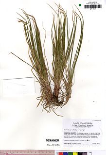
Carex inops is a species of sedge known as long-stolon sedge and western oak sedge. It is native to northern North America, where it occurs throughout the southern half of Canada and the western and central United States.

The Interior Low Plateaus are a physiographic region in eastern United States. It consists of a diverse landscape that extends from north Alabama across central Tennessee and Kentucky into southern Illinois, Indiana, and Ohio. Its natural communities are a matrix of temperate forests, woodlands, and prairies.
Revis Hill Prairie State Natural Area, also known as Revis Hill Prairie Nature Preserve, is a 412.7-acre (167.0 ha) state park located six miles south of Easton in Mason County, Illinois. It is operated by the Illinois Department of Natural Resources (IDNR) as a tallgrass prairie nature preserve and as a fish and wildlife area managed for deer hunting.

Pleasant Valley Conservancy is a Wisconsin Department of Natural Resources-dedicated State Natural Area. The area contains a variety of natural communities found in Wisconsin including oak woodland, oak savanna, dry and wet prairies, sedge meadow, shrub-carr, and an open marsh.
The Sand Prairie-Scrub Oak State Nature Preserve, formerly called the Mason County State Wildlife Refuge and Recreation Area, is a natural area located in the U.S. state of Illinois. Containing 1,460 acres, it is a dedicated state nature preserve. It is located in western Mason County. The nearest town is Kilbourne, Illinois and the nearest numbered highway is Illinois Route 97. It contains fragmentary examples of the ecosystem described in its name.


