Coominya railway station

Last updated

Coominya railway station
regional rail
Sign on Coominya Railway Station.JPG
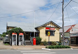
Coominya railway station, 2011
General information
Location Coominya, Australia
Coordinates 27°23′25″S152°30′07″E / 27.3903°S 152.5020°E / -27.3903; 152.5020
Line(s) Brisbane Valley
TracksSingle
History
Opened1886
Closed1988

Coominya railway station is central to all activities in historic Coominya village, located in the Somerset Region of South East Queensland.

Contents

Coominya village, a township of approximately 467 persons [1] is located in South East Queensland approximately 83 kilometres (52 miles) west of Brisbane, Queensland’s capital city, in Australia. Coominya village which is approximately two km from Wivenhoe Dam can be accessed by road from the Brisbane Valley Highway which crosses the wall of the Dam further south. The completion of the construction of Wivenhoe Dam took place in 1985. Its purpose was as a flood mitigation and water storage measure. [2] It also supplies drinking water to Brisbane and local regions. However, Coominya village and its historic buildings, such as the old railway station, are still dependent on tank water.

Coominya railway siding came into being on 9 August 1886 and became known as 'Bellevue'. [3] This occurred when the section of the Brisbane Valley railway line from Lowood to Esk which passed through Coominya was officially opened. The original goods platform siding was established over the rise, east of its current site, at the entrance to ‘Bellevue Station’, the cattle selection.

However, it was difficult for trains to start uphill and the siding was relocated to a more level site where it remains to this day. In 1887, it became a mail receiving station to complement Bellevue Station which was also a receiving station. A goods shed was built in 1891. [4]

In 1895, Bellevue became an electric telegraph station. The increased demand for services over the following ten years resulted in a name change for the railway station. It has been suggested that there may have been confusion between mail recipients of Bellevue (the railway station) and Bellevue Station (the cattle selection).

In 1905, Mr Lumley Hill, the proprietor of Bellevue Station suggested the name ‘Coominya’ for the rail siding. Indigenous Yugarabul dialect was probably spoken in the district and ‘Coominya’ a derivation of this dialect. According to Mr Lumley Hill it meant ‘I see water’. [5] However, as most of the visible water around Coominya is formed in man-made landscapes it has been suggested that swamps towards Clarendon may have been the water spoken of. There is a natural swampy area south of Coominya which may be the area referred to in the records.

Railway Station and Telegraph Office at Coominya Railway Station and Telegraph Office at Coominya, Queensland (8847765174).jpg
Railway Station and Telegraph Office at Coominya

Railways in rural Queensland extended as settlers cleared land and produced crops. Coominya settlers grew corn (maize), pumpkins and potatoes. Formerly transported via horse and German wagons, farm produce from Coominya districts such as Buaraba [6] and Tarampa, found its way into the nearby city of Ipswich. Coominya siding provided means of transport for these goods in large quantities and enabled selectors to receive necessities for the production of their crops.

In 1885, R Wilson & Co had been contracted to construct eight gatekeepers' and one porter cottages. The township grew and soon the need for an hotel became evident. Bellevue Hotel was built diagonally opposite the railway siding in 1903. Hoffman Brothers of Rosewood constructed the hotel and licensees were Mr Noble, Fred Webb, Jim McKeirnan and Jim Fitzpatrick.

Other industries, dependent on rail transport, thrived in and around Coominya during the first three quarters of the 20th century. These included the timber industry, wine production, and cattle. However, little of these industries remain excepting for an abattoir. The steam train ceased passing through Coominya in 1969 and in 1988 the rail motor service came to an end. The tracks were removed from 1993 onwards.

In 2012, the Brisbane Valley railway track exists as a rail trail that encourages horse riding, bicycle riding, and foot slogging. Donkey owners from Coominya travelled the Lowood to Fernvale connection in June 2011.

As far as transportation of organic olives, pumpkins, melons, potatoes, tomatoes, garlic, Asian and other vegetable farm produce goes, this area once again depends on road transport. Time has gone the full circle. Some farmers choose to use older methods of farming and reliable older machinery.

The old Coominya railway station still stands and is central to markets, the circus, and community events. Coominya resident, Mr Fred Banff of historic Clinton Homestead, wanted the community and tourists to commemorate history. [7] Hence, a series of murals form a public art scape around the old railway station. The first of several murals was unveiled in 2007. Each portrays an historic legend. The official unveiling of the railway mural occurred in December 2009 and was considered to be a 150th birthday gift to the State of Queensland. [8]

See also

Related Research Articles

Lake Wivenhoe is the name both an artificial lake formed by the Wivenhoe Dam and the locality which contains it in the Somerset Region, Queensland, Australia. In the 2016 census, Lake Wivenhoe had a population of three people.

<span class="mw-page-title-main">Wivenhoe Dam</span> Dam in South East Queensland

The Wivenhoe Dam is a rock and earth-fill embankment dam with a concrete spillway across the Brisbane River in South East Queensland, Australia. The dam takes it names from the local Wivenhoe Pocket rural community. The dam wall is located about 80 kilometres (50 mi) by road from the centre of Brisbane. The primary purpose of the dam is the supply of potable water for the Brisbane and Ipswich regions. The dam also provides for flood mitigation control, hydroelectricity, and recreation. The impounded reservoir is called Lake Wivenhoe and the dam, the lake and a narrow strip of surrounding land forms a locality also called Lake Wivenhoe.

<span class="mw-page-title-main">Lockyer Creek</span> River in Queensland, Australia

The Lockyer Creek is a creek in South East Queensland, Australia. A tributary of the Brisbane River, the creek is a major drainage system in the Lockyer Valley. Rising on the eastern slopes of the Great Dividing Range, the creek flows generally north-easterly for more than 100 kilometres (62 mi) before it reaches its confluence with the Brisbane River north-northeast of Lowood, and downstream from the Wivenhoe Dam. The creek is named after Edmund Lockyer.

<span class="mw-page-title-main">Lowood, Queensland</span> Town in Queensland, Australia

Lowood is a rural town and locality in the Somerset Region, Queensland, Australia. In the 2016 census, the locality of Lowood had a population of 4,159 people.

<span class="mw-page-title-main">Coominya, Queensland</span> Town in Queensland, Australia

Coominya is a rural town and locality in the Somerset Region in South East Queensland, Australia. The town is located 83 kilometres (52 mi) west of the state capital, Brisbane and approximately 2 kilometres (1.2 mi) from Wivenhoe Dam. In the 2016 census, Coominya had a population of 1,200 people.

<span class="mw-page-title-main">Fernvale, Queensland</span> Town in Queensland, Australia

Fernvale is a rural town and locality in the Somerset Region, Queensland, Australia. In the 2016 census, the locality of Fernvale had a population of 3,209 people.

<span class="mw-page-title-main">Somerset Region</span> Local government area in Queensland, Australia

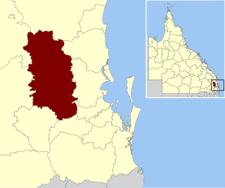
The Somerset Region is a local government area located in the West Moreton region of South East Queensland, Australia, about 100 kilometres (62 mi) northwest of Brisbane and centred on the town of Esk. It was created in 2008 from a merger of the Shire of Esk and the Shire of Kilcoy. It is commonly known as the Brisbane Valley, due to the Brisbane River which courses through the region, although significant parts of the region lie outside the hydrological Brisbane Valley itself.

<span class="mw-page-title-main">Vernor, Queensland</span> Suburb of Somerset Region, Queensland, Australia

Vernor is a rural locality in the Somerset Region, Queensland, Australia. In the 2021 census, Vernor had a population of 235 people.

<span class="mw-page-title-main">Bellevue Homestead</span> Historic site in Queensland, Australia

Bellevue Homestead is a heritage-listed homestead currently located in Coominya, Somerset Region, Queensland, Australia. It was built from c. 1872 to c. 1910. It was added to the Queensland Heritage Register on 21 October 1992.

<span class="mw-page-title-main">Brisbane Valley railway line</span>

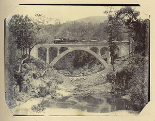
The Brisbane Valley railway line was a railway connection in Queensland, Australia connecting Ipswich, west of Brisbane, to the upper Brisbane River valley. Progressively opened between 1884 and 1913, the railway provided a vital transport link between Ipswich and Yarraman and forged development and prosperity along its path. The line acquired its serpentine reputation because it did not take a straight course when faced with a hill or gully.

<span class="mw-page-title-main">Mungar Junction to Monto railway line</span> Former railway line in Queensland, Australia

The Mungar Junction to Monto railway line is a 267-kilometre (166 mi) railway in Queensland, Australia. Progressively opened in eleven stages between 1889 and 1928 the line branched from the North Coast line at Mungar Junction a short distance west of Maryborough and followed a westerly route towards Biggenden and Gayndah before turning north via Mundubbera and Eidsvold to Monto. It is also known as the Gayndah Monto Branch Railway. In 2012, the line was officially closed.

<span class="mw-page-title-main">Brisbane Valley Rail Trail</span> Rail trail in Queensland, Australia

The Brisbane Valley Rail Trail (BVRT) is a 161-kilometre (100 mi) recreation trail from Wulkuraka to Yarraman in Queensland, Australia. The trail follows the old Brisbane Valley railway line and is open to walkers, touring cyclists and horse riders. The trail details the history and landscape of the Brisbane Valley. It is the longest rail trail in Queensland.

<span class="mw-page-title-main">Dundas, Queensland</span> Suburb of Somerset Region, Queensland, Australia

Dundas is a rural locality in the Somerset Region, Queensland, Australia. In the 2016 census Dundas had a population of 77 people.

Coominya Soldier Settlement was a soldier settlement in Coominya in the present-day Somerset Region local government area of South East Queensland, Australia. 100 soldiers settled in the settlement, each on approximately 30-acre (12 ha) blocks.

<span class="mw-page-title-main">Caboonbah Homestead</span> Historic site in Queensland, Australia

Caboonbah Homestead was a heritage-listed homestead at Esk-Kilcoy Road, Lake Wivenhoe, Somerset Region, Queensland, Australia. It was built from 1889 to 1890. It was added to the Queensland Heritage Register on 12 December 1996. It was destroyed by fire in 2009 and removed from the Queensland Heritage Register in 2014.

<span class="mw-page-title-main">Harlin Rail Bridge</span> Historic site in Queensland, Australia

Harlin Rail Bridge is a heritage-listed railway bridge over Ivory Creek at Harlin, Somerset Region, Queensland, Australia. It was designed by Queensland Railways and built in 1910 by Queensland Railways. It was added to the Queensland Heritage Register on 27 November 2008. It was destroyed in 2013 as a consequence of flooding associated with Cyclone Oswald.

<span class="mw-page-title-main">Yimbun Railway Tunnel</span> Historic site in Queensland, Australia

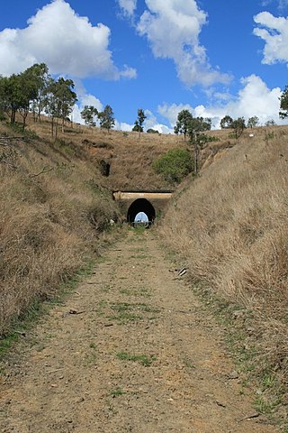
Yimbun Railway Tunnel is a heritage-listed tunnel at Sinnamons Lane, Harlin, Somerset Region, Queensland, Australia. It was designed by Queensland Railways and built from 1909 to 1910 by Queensland Railways. It was added to the Queensland Heritage Register on 27 November 2008.

<span class="mw-page-title-main">Wivenhoe Hill, Queensland</span> Suburb of Somerset Region, Queensland, Australia

Wivenhoe Hill is a locality in the Somerset Region, Queensland, Australia. In the 2016 census, Wivenhoe Hill had a population of 9 people.

Moombra is a rural locality in the Somerset Region, Queensland, Australia. In the 2021 census, Moombra had a population of 9 people.

Mount Hallen is a rural locality in the Somerset Region, Queensland, Australia. In the 2021 census, Mount Hallen had a population of 457 people.

References

  1. "Census 2006". Australian Bureau of Statistics. Retrieved 28 October 2007.
  2. "Fact Sheet: Somerset and Wivenhoe Dams" (PDF). SEQ Water. Archived from the original (PDF) on 21 March 2012. Retrieved 16 June 2012.
  3. Coominya - from Settlement to Subdivision. Coominya: Coominya State School. 1987. p. 3.
  4. Environmental Protection Agency (Queensland) (2000). Heritage Trails of the Great South East. State of Queensland. p. 46. ISBN   0-7345-1008-X.
  5. September 1987. 'Coominya - from Settlement to Subdivision', Coominya State school. Preface.
  6. (20 January 1912). The Buaraba Estate. The Brisbane Courier. p. 13.
  7. Phillip Smith (26 August 2011). Take a drive in the country - go on! Archived 31 December 2012 at archive.today . ABC Brisbane. Australian Broadcasting Corporation.
  8. (16 December 2009). 'Another Mural Unveiled'. The Somerset. p. 5.