Related Research Articles

Sully County is a county in the U.S. state of South Dakota. As of the 2020 census, the population was 1,446, making it the fifth-least populous county in South Dakota. Its county seat is Onida. The county was created in 1873 and organized in 1883. It is named after General Alfred Sully, who built Fort Sully.

Stanley County is a county in the U.S. state of South Dakota. As of the 2020 census, the population was 2,980. Its county seat is Fort Pierre. The county was created in 1873, and was organized in 1890. It is named for David S. Stanley, a commander at Fort Sully from 1866 to 1874, which was located nearby.
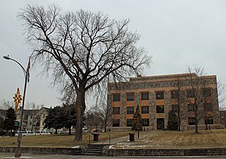
Hughes County is a county in the U.S. state of South Dakota. As of the 2020 United States Census, the population was 17,765, making it the least populous capital county in the nation, and the twelfth-most populous county in South Dakota. Its county seat is Pierre, which is also the state capital. The county was created in 1873, and was organized in 1880. It was named for Alexander Hughes, a legislator. On 4 June 1891, the county's area was increased by the addition of Farm Island, in the Missouri River downstream of Pierre.

The Oahe Dam is a large earthen dam on the Missouri River, just north of Pierre, South Dakota, United States. The dam creates Lake Oahe, the fourth-largest man-made reservoir in the United States. The reservoir stretches 231 miles (372 km) up the course of the Missouri to Bismarck, North Dakota. The dam's power plant provides electricity for much of the north-central United States. It is named for the Oahe Indian Mission established among the Lakota Sioux in 1874.

Lake Oahe is a large reservoir behind Oahe Dam on the Missouri River; it begins in central South Dakota and continues north into North Dakota in the United States. The lake has an area of 370,000 acres (1,500 km2) and a maximum depth of 205 ft (62 m). By volume, it is the fourth-largest reservoir in the US. Lake Oahe has a length of approximately 231 mi (372 km) and has a shoreline of 2,250 mi (3,620 km). 51 recreation areas are located along Lake Oahe, and 1.5 million people visit the reservoir every year. The lake is named for the 1874 Oahe Indian Mission.
The Standing Rock Reservation lies across the border between North and South Dakota in the United States, and is inhabited by ethnic "Hunkpapa and Sihasapa bands of Lakota Oyate and the Ihunktuwona and Pabaksa bands of the Dakota Oyate," as well as the Hunkpatina Dakota. The Ihanktonwana Dakota are the Upper Yanktonai, part of the collective of Wiciyena. The sixth-largest Native American reservation in land area in the US, Standing Rock includes all of Sioux County, North Dakota, and all of Corson County, South Dakota, plus slivers of northern Dewey and Ziebach counties in South Dakota, along their northern county lines at Highway 20.

This is a list of properties and historic districts in the U.S. state of South Dakota that are listed on the National Register of Historic Places. The state's more than 1,300 listings are distributed across all of its 66 counties.

This is a list of properties on the National Register of Historic Places in the U.S. state of Michigan.
This National Park Service list is complete through NPS recent listings posted May 27, 2022.

Mille Lacs Kathio State Park, also known as Kathio Site, is a Minnesota state park on Mille Lacs Lake. The park preserves habitation sites and mound groups, believed to date between 3000 BC and 1750 AD, that document Dakota Indian culture and Ojibwe-Dakota relationships. The park contains 19 identified archaeological sites, making it one of the most significant archaeological collections in Minnesota. The earliest site dates to the Archaic period and shows evidence of copper tool manufacture. The Dakota lived in this area roughly until the 18th century, when many bands of them were moving southward into the prairies and river areas of southern Minnesota. At the same time, Ojibwe (Anishinaabe) were moving in from the east. Ojibwe oral tradition, published by William Whipple Warren, suggests that there was a battle in which they successfully took control of the area from the Lakota.
Big Mound City (8PB48) is a prehistoric site near Canal Point, Florida, United States. It is located 10 miles east of Canal Point, off U.S. Route 98. On May 24, 1973, it was added to the U.S. National Register of Historic Places. It is located inside the J.W. Corbett Wildlife Management Area.

Huff is an unincorporated town in Morton County, North Dakota, United States. Huff is located about 20 miles south of Bismarck, North Dakota on the Missouri River at the top of Lake Oahe, a reservoir created by a dam. It is located on North Dakota Highway 1806. The Huff Archeological Site, a U.S. National Historic Landmark, is nearby to the southeast. As of 2018, the population is estimated to be less than 15, no businesses are currently in operation. Present at the townsite are the remains of a one-room school, an abandoned repair shop/gas station, a few occupied homes, and a restored stone church.
The Vanderbilt Archeological Site is an archaeological site located on the shore of Lake Oahe in Campbell County, South Dakota, near Pollock, South Dakota. The site contains the remains of a Native American Plains village which has been tentatively dated to about 1300 AD. Despite the fact that the site is subject to erosive destruction from wave action on the lake, it has been determined likely to yield significant information about the movements and living patterns of prehistoric Native Americans in the region. The site was declared a National Historic Landmark in 1997.

Molstad Village, designated by the Smithsonian trinomial 39DW234, is an archaeological site in Dewey County, South Dakota, United States, near the city of Mobridge. It was declared a National Historic Landmark in 1964. The site contains the remains of a small fortified Native America village, consisting of earth lodges surrounded by a bastioned palisade, with further lodges scattered in the area outside the fortification. Evidence gathered at the site indicates it was occupied for a relatively brief period in the mid-1500s CE, and was assigned to the Chouteau aspect of Middle Missouri taxonomy, later known as the Extended Coalescent phase. Four lodge sites were excavated in the early 1960s, uncovering post holes and cache pits, one of which contained skull-less human remains. Finds at the site included pottery fragments and stone tools. Bone tools were also found, including plows made from bison shoulder blades.

This is a list of the National Register of Historic Places listings in Dewey County, South Dakota.

This is a list of the National Register of Historic Places listings in Sully County, South Dakota.
Nununyi was a historic village of the Cherokee people in western North Carolina, located on the eastern side of the Oconaluftee River. Today it is within the boundaries of the present-day city of Cherokee in Swain County. It was classified by English traders and colonists as among the "Out Towns" of the Cherokee in this area east of the Appalachian Mountains.

The Dakota Access Pipeline (DAPL) or Bakken pipeline is a 1,172-mile-long (1,886 km) underground oil pipeline in the United States. It begins in the shale oil fields of the Bakken Formation in northwest North Dakota and continues through South Dakota and Iowa to an oil terminal near Patoka, Illinois. Together with the Energy Transfer Crude Oil Pipeline from Patoka to Nederland, Texas, it forms the Bakken system.
Cow Creek is an unincorporated community and census-designated place in Sully County, South Dakota, United States. Its population was 30 as of the 2010 census. The community is located on the eastern shore of Lake Oahe.
South Dakota Highway 1806 is a state highway in the U.S. state of South Dakota. It exists in four distinct sections. Its longest section begins at SD 273 and runs along the Missouri River nearly its whole length, serving Pierre. SD 1806 along with SD 1804 are numbered from the years of the Lewis and Clark Expedition.
References
- 1 2 "National Register Information System". National Register of Historic Places . National Park Service. July 9, 2010.
- ↑ "A Cultural Resource Survey of the East Shore of Lake Oahe" (PDF). US Army Corps of Engineers. Archived (PDF) from the original on November 29, 2014. Retrieved 2014-11-23.
