
Antillia is a phantom island that was reputed, during the 15th-century age of exploration, to lie in the Atlantic Ocean, far to the west of Portugal and Spain. The island also went by the name of Isle of Seven Cities.

Albertinus de Virga was a 15th-century Venetian cartographer.

Abraham Cresques, whose real name was Cresques (son of) Abraham, was a 14th-century Jewish cartographer from Palma, Majorca, then part of the Crown of Aragon. In collaboration with his son, Jehuda Cresques, Cresques is credited with the authorship of the celebrated Catalan Atlas of 1375.

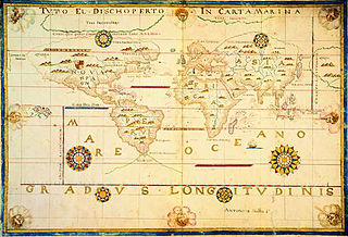
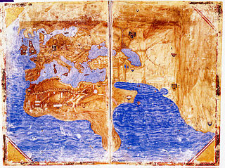
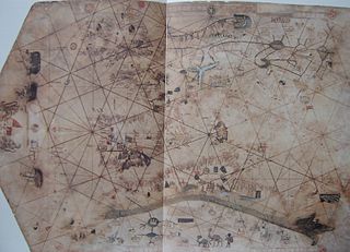
Portolan charts are nautical charts, first made in the 13th century in the Mediterranean basin and later expanded to include other regions. The word portolan comes from the Italian portulano, meaning "related to ports or harbors", and which since at least the 17th century designates "a collection of sailing directions".

Battista Agnese was a cartographer from the Republic of Genoa, who worked in the Venetian Republic.
Antonio Millo, also mentioned as Antonio da Millo or Antonio Milo, active during 1557–1590, was captain and cartographer with significant work in map making, isolarios and portolan charts.

The Bianco World Map is a map created by Andrea Bianco, a 15th-century Venetian sailor and cartographer. This map was a part of a nautical atlas including ten pages made of vellum. These vellum pages were previously held in an 18th-century binding, but the current owner, Venetian library Biblioteca Marciana, separated the pages for individual exhibition.

"Majorcan cartographic school" is the term coined by historians to refer to the collection of predominantly Jewish cartographers, cosmographers and navigational instrument-makers and some Christian associates that flourished in Majorca in the 13th, 14th and 15th centuries until the expulsion of the Jews. The label is usually inclusive of those who worked in Catalonia. The Majorcan school is frequently contrasted with the contemporary Italian cartography school.

Pietro Vesconte was a Genoese cartographer and geographer. A pioneer of the field of the portolan chart, he influenced Italian and Catalan mapmaking throughout the fourteenth and fifteenth centuries. He appears to have been the first professional mapmaker to sign and date his works regularly.
Gabriel de Vallseca, also referred to as Gabriel de Valseca and Gabriel de Valsequa was a cartographer of Jewish descent connected to the Majorcan cartographic school. His most notable map is the portolan of 1439, containing the first depiction of the recently-discovered Azores islands.
Domenico and Francesco Pizzigano, known as the Pizzigani brothers, were 14th-century Venetian cartographers. Their surname is sometimes given as Pizigano in older sources.

Zuane Pizzigano, was a 15th-century Venetian cartographer. He is the author of a famous 1424 portolan chart, the first known to depict the phantom islands of the purported Antillia archipelago, in the north Atlantic Ocean.
The Weimar map is an anonymous 15th-century Italian portolan chart, held by the Grand Ducal Library of Weimar. Although frequently dated as 1424, most historians believe it was probably composed a half century later. The author is unknown, although said to be a member of the Freducci family of cartographers of Ancona, most probably Conte di Ottomano Freducci. Faint and fragile, the Weimar map is rarely photographed and has been hard to decipher.
The island of Satanazes is a legendary island once thought to be located in the Atlantic Ocean, and depicted on many 15th-century maps.
The Medici-Laurentian Atlas, also known simply as the Medici Atlas, is an anonymous 14th-century set of maps, probably composed by a Genoese cartographer and explicitly dated 1351, although most historians believe it was composed, or at least retouched, later. The atlas is currently held by the Biblioteca Medicea Laurenziana in Florence, Italy.
Battista Beccario, also known as Baptista Beccharius, was a 15th-century Genoese cartographer.
The Tammar Luxoro Atlas, or Atlante Luxoro, is an anonymous collection of Italian portolan charts from the early 15th century, currently held at the Biblioteca Civica Berio in Genoa, Italy. The author is unknown, although believed to have been made by Francesco de Cesanis of Venice.
The Pinelli–Walckenaer Atlas is a late 14th-century atlas of portolan charts, explicitly dated 1384, primarily composed by an anonymous Venetian cartographer, and held by the British Library.

The Douce Atlas is an early 15th-century nautical atlas by an anonymous Italian cartographer, currently held by the Bodleian Library in Oxford, created by an anonymous Italian cartographer. No attribution to known cartographers or place of origin. Venice and Genoa have been suggested. The Bodleian-Douce Atlas is currently held by the Bodleian Library at the University of Oxford in Oxford, UK.

The Cornaro Atlas is an extensive Venetian collection of nautical charts and tracts, currently held by the British Library.
 Corbitis Atlas, p. 1 (East Mediterranean and Black Sea)
 Corbitis Atlas, p. 2 (Central Mediterranean)
 Corbitis Atlas, p. 3 (West Mediterranean and north Atlantic)
 Corbitis Atlas, p. 4 (South Atlantic and islands)


