Related Research Articles
Berrymount is a townland in the Parish of Tomregan, Barony of Loughtee Lower, County Cavan, Ireland.
Cloncollow is a townland in the Parish of Tomregan, Barony of Loughtee Lower, County Cavan, Ireland.

Carrigan is a townland in the Parish of Tomregan, Barony of Loughtee Lower, County Cavan, Ireland.

Milltown is a small village in County Cavan, Ireland. The population as at 2021 was around 100. During a nineteenth century O'Donavan townlands survey of County Cavan it was noted that the Milltown area was traditionally referred to as Bellanaleck, there are no other records with this name. The Archaeological Inventory of County Cavan notes (507) Derrygeeraghan, a raised circular Rath area with two substantial earthen banks and a wide deep fosse dating from earlier medieval times. The present Milltown Electoral Division and catchment area comprises several neighboring townlands within an ancient Barony of Loughtee Lower, County Cavan and Drumlane Civil Parish in County Cavan.

Castlelost is a townland in County Westmeath, Ireland. The townland is located in the civil parish of Castlelost. The R446 regional road runs through the middle of the area, and a section of the R400 regional road links the townland with the M6 motorway. The western side of the town of Rochfortbridge lies in the townland, with the east laying in the neighbouring townland of Rahanine.
The Milltown River is a river in Ireland. It flows from a small swampland in Milltownpass, a small village in the south of County Westmeath.

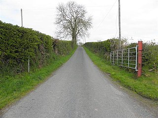
Pass of Kilbride is a civil parish in County Westmeath, Ireland. It is located about 11.97 kilometres (7 mi) south‑south‑east of Mullingar.
Altbrean is a townland in the civil parish of Kinawley, barony of Tullyhaw, County Cavan, Ireland.
Gaulstown, also spelt Gallstown is a townland in County Westmeath, Ireland. The townland is located in between the towns of Rochfortbridge and Milltownpass, close to the R446 regional road.. Neighbouring townlands include Bellfield, Corcloon, Drumman, Milltown and Windmill to the east, Gibbonstown and Gortumly to the west and Mahonstown to the north.
Robinstown (Levinge) is a townland in Mullingar in County Westmeath, Ireland. The townland, which is 0.48 square miles (1.2 km2) in area, is named for the Levinge baronets.
Monganstown is a townland in County Westmeath, Ireland. The townland is in the civil parish of Killucan. The R446 road runs through the middle, with the Kinnegad River forming the border to the south. The town of Kinnegad is directly to the east of the townland.
Farthingstown is a townland in County Westmeath, Ireland. The townland is located on the border with County Offaly and is in the civil parish of Castlelost. The M6 Motorway runs through the middle, with a junction linking up with the R400 regional road. The Monagh River flows through the south of the area. The town of Rochfortbridge is to the north.

Pass of Kilbride is a townland in County Westmeath, Ireland. The townland is located on the border with County Offaly and is in the civil parish of the same name. The M6 Motorway runs through the south, with the R400 regional road running through the middle. The Monagh River flows through the south of the area, with the Milltown River forming the western border as it meets the village of Milltownpass, and the Kinnegad River forming the eastern border. The Milltownpass Bog is in the northern part of the townland.
Drumman, also known as Drummond is a townland in Milltownpass in County Westmeath, Ireland. The townland is in the civil parish of Pass of Kilbride and is on the border with County Offaly. The M6 Motorway cuts through the middle of the townland, and the R446 regional road forms the northern border with the townlands of Milltown and Corcloon. The village of Milltownpass is located to the east of the townland, with Rochfortbridge to the west.
Clontytallon is a rural townland in County Westmeath, Ireland. The townland is located in the civil parish of Castlelost. The townland is bordered by the townlands of Fearmore, Whitewell, Castlelost and Derry to the east, Castlelost West to the west and Kilbride to the north. The town of Rochfortbridge is to the south, with Tyrrellspass to the south-west.
Cookanamuck is a small uninhabited island (isthmus) in County Westmeath, Ireland. It is located near Friars Island in Lough Ree. It is in the civil parish of St. Mary's.
Killmacuagh (Cooke) is a townland in Athlone, County Westmeath, Ireland. The townland is in the civil parish of St. Mary's.
Kilnafaddoge is a small townland in Athlone, County Westmeath, Ireland. The townland, which is 0.12 square kilometres (0.05 sq mi) in area, is in the civil parish of St. Mary's. As of the 2011 census, Kilnafaddoge contained no occupied houses and zero population.

Kildallan is a townland in the civil parish of Templeoran, barony of Moygoish, County Westmeath, Ireland.
Kildallan North is a townland in the civil parish of Templeoran, barony of Moygoish, County Westmeath, Ireland.
References
- ↑ "Corcloon Townland, Co. Westmeath". www.townlands.ie. Retrieved 9 April 2020.
- ↑ "Corcloon". Logainm.ie. Retrieved 9 April 2020.
- ↑ "Griffith's Valuation". www.askaboutireland.ie. Retrieved 9 April 2020.
- ↑ "Griffith's Valuation". www.askaboutireland.ie. Retrieved 10 August 2020.
- ↑ "National Archives: Census of Ireland 1911". www.census.nationalarchives.ie. Retrieved 10 August 2020.