Athlone is a town on the border of County Roscommon and County Westmeath, Ireland. It is located on the River Shannon near the southern shore of Lough Ree. It is the second most populous town in the Midlands Region with a population of 21,349 in the 2016 census.

County Westmeath is a county in Ireland. It is in the province of Leinster and is part of the Eastern and Midland Region. It formed part of the historic Kingdom of Meath, which was named Mide because the kingdom was located in the geographical centre of Ireland. Westmeath County Council is the administrative body for the county, and the county town is Mullingar. At the 2022 census, the population of the county was 95,840.

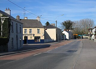
Moate is a town in County Westmeath, Ireland.

Kilbeggan is a town in the barony of Moycashel, County Westmeath, Ireland.

Kinnegad or Kinagad is a town in County Westmeath, Ireland. It is on the border with County Meath, near the junction of the M6 and the M4 motorways - two of Ireland's main east–west roads. It is roughly 60 km from the capital, Dublin.
The N6 road is a national primary road in Ireland from junction 11 on the M4 motorway at Kinnegad to Galway city. The N6 and N4 form a continuous motorway or dual carriageway from Dublin city centre to Galway City passing in an east–west direction through the midlands of Ireland. Most of the road is motorway standard with the exception of the Athlone bypass and stretches of urban road in Galway City, which are the only sections of the road that remain designated as N6 dual carriageway. There is one toll on the road outside Galway city. Major upgrades to the road were completed in December 2009 completing the first intercity motorway/dual carriageway in Ireland and the New Junctions of M6 are built and will be 164 km.

A regional road in the Republic of Ireland is a class of road not forming a major route, but nevertheless forming a link in the national route network. There are over 11,600 kilometres of regional roads. Regional roads are numbered with three-digit route numbers, prefixed by "R". The equivalent road category in Northern Ireland are B roads.

The R148 road is one of Ireland's regional roads which was classified following the opening of a by-passed national primary road.
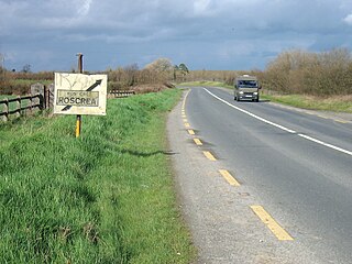
The N62 road is a national secondary road in Ireland. It links the M6 motorway east of Athlone, County Westmeath with junction 6 of the M8 motorway at Kilnoe near Horse and Jockey in County Tipperary, 96.625 kilometres (60.040 mi) to the south. The route also forms a junction with the M7 motorway south of Roscrea.

Westmeath Intermediate Football Championship is an annual Gaelic Athletic Association competition organised by Westmeath GAA between Gaelic football clubs in County Westmeath. The winner of the competition qualifies to represent the county in the Leinster Intermediate Club Football Championship, the winner of which progresses to the All-Ireland Intermediate Club Football Championship.
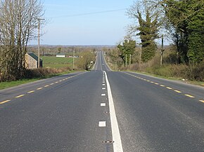
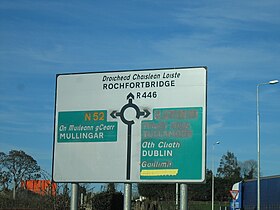
Milltownpass is a village in County Westmeath, Ireland. It is located in the south of the county on the R446 regional road. The old route was replaced by a dual-carriageway from Kinnegad to Tyrrellspass in 2006, bypassing the village. Milltownpass is the second largest village in the parish of Rochfortbridge. It was one of the first villages in Ireland to have its own electricity supply: a mill on the Milltown River providing power to the village long before rural electrification.

The R400 road is a regional road in Ireland, linking Mullingar, County Westmeath to the R419 at Cushina, County Offaly.

The R401 road is a regional road in Ireland, linking Kinnegad in County Meath to Kildare town in County Kildare.

The R420 road is a regional road in Ireland, which runs northwest-southeast from the R446 near Moate in County Westmeath to the R445 just west of Monasterevin. The road travels through the towns of Clara, Tullamore & Portarlington. The route is 35 km (22 mi) long.

Moycashel, previously the barony of Rossaughe, and before that, Delamares country, is a barony in south County Westmeath, in the Republic of Ireland. It was formed by 1542. It is bordered by three other baronies: Clonlonan to the west, Rathconrath to the north, Moyashel and Magheradernon to the north-east and Fartullagh to the west. The largest population centre is Kilbeggan.
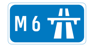
The M6 motorway is a motorway in Ireland, which runs from Dublin to Galway. The M6 extends from its junction with the M4 at Kinnegad all the way west to the outskirts of Galway City, but the Athlone bypass and the approach to Galway city - while of dual carriageway standard - have not been designated motorway and are still signed as N6. The motorway was officially completed and opened to traffic on 18 December 2009, and was the first city-to-city direct major inter-urban route to be completed in Ireland. The M6 and M4, which form the Galway-Dublin route, consist of a grade-separated 2+2 dual carriageway road with a top speed limit of 120 km/h. At approximately 144 km (90 mi), the M6 is the third longest motorway in the state and will be 159 km.

The Dublin-Galway Greenway is a partially completed 'coast-to-coast' greenway and partial rail trail, in Ireland, funded by the Department of Transport, which is due to become the western section of EuroVelo EV2, a cycle route from Galway, Ireland, crossing Europe and ending in Moscow, Russia. The 276 km route was planned to be completed by 2020. It due to be the fourth greenway in Ireland, after the Great Southern Trail, the Great Western Greenway and the Waterford Greenway.

Clonlonan is a barony in south–west County Westmeath, Ireland. It was formed by 1672. It is bordered by County Offaly to the south and a small part of County Roscommon at Long Island on the River Shannon to the west. It also borders four other Westmeath baronies: Kilkenny West and Rathconrath, Moycashel and Brawny. The largest centre of population in the barony is the town of Moate.
The Athlone to Mullingar Cycleway is a long-distance cycling and walking trail in County Westmeath, which forms a section of the Dublin-Galway Greenway. It is a 42 kilometres long rail-trail over the disused Athlone-Mullingar rail line beginning in Athlone and ending in Mullingar.