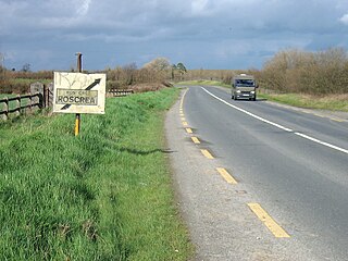
The R336 road is a regional road in County Galway in Ireland which connects the N59 road at Leenaun beside Killary Harbour – via Inverin – to the N6 and N83 in Galway, 83 kilometres (52 mi) to the southeast.

The N62 road is a national secondary road in Ireland. It links the M6 motorway east of Athlone, County Westmeath with junction 6 of the M8 motorway at Kilnoe near Horse and Jockey in County Tipperary, 96.625 kilometres (60.040 mi) to the south. The route also forms a junction with the M7 motorway south of Roscrea.

The R756 road is a regional road in Ireland running west–east from Dunlavin to Laragh. Its entire 32 km (20 mi) length is within County Wicklow crossing east–west through the Wicklow Gap.
The R683 road is a regional road in Ireland. Located in the south of Ireland at Waterford, it connects the city to the village of Passage East, County Waterford and to County Wexford via a car ferry connection, which operates across the Waterford estuary between Passage East and the village of Ballyhack, County Wexford.

The R684 road is a regional road in Ireland. Located in the south of Ireland near Waterford City, it links the junction with the R683 at Blenheim Cross to the village of Dunmore East in County Waterford.

The R116 road is a regional road in Ireland which runs east-west from the N11 at Loughlinstown to the R115 in Ballyboden. It runs through the South of County Dublin for its entire length.

The R446 road is a regional road in Ireland. The road connects Kinnegad in County Westmeath to Galway City. Prior to the construction of the M6 motorway the R446 formed the main N6 road connecting Dublin and Galway. Following the opening of the M6; the old N6 road was downgraded to regional road status and was designated as the R446. The road is an alternative route between Galway and Dublin and runs in parallel to the M6.

The R639 road is one of Ireland's regional roads. Once designated the N8 national primary road, it was reclassified in stages as the R639 following the progressive opening of sections of the M8 motorway, which rendered the single carriageway N8 redundant as a national primary road. By-passed sections of the old N8 were generally reclassified as R639 as soon as a new section of M8 opened, thereby increasing the length of the R639. With the completion of the M8 on 28 May 2010, the R639 now stretches from Durrow, County Laois to Cork, running through counties Laois, Kilkenny, Tipperary, Limerick and Cork.

The R117 road is a regional road in Ireland. The route (north-south) starts Harcourt Road at the end of the South Circular Road on the southside of Dublin city centre. It crosses the Grand Canal and goes through the suburbs of Ranelagh, Milltown, Windy Arbour, Dundrum, Sandyford, Stepaside and Kilternan before passing through the Scalp into County Wicklow.

The R415 road is a regional road in Ireland, which runs north-south from its junction with the R403 in Allenwood to the R448 at Crookstown, passing through Kildare town, and crossing the N78 between Kilcullen and Athy. The route is entirely within County Kildare.

The R323 road is a regional road in County Mayo, Ireland. Going from west to east, the route connects the towns of Kiltimagh, Knock, and Ballyhaunis. En route it crosses over the N17 national primary road at a grade separated junction in the village of Knock.

The R413 road is a regional road in Ireland, which runs west-east from Kildare to Ballymore Eustace, all in County Kildare. En route, it skirts, and largely demarcates, 10 km (6.2 mi) of the northern edge of the Curragh.

The R702 road is a regional road in Ireland which runs west-east from the R712 at Coolgrange in County Kilkenny through Gowran before crossing into County Carlow at Goresbridge. It continues to Borris, passes through the Blackstairs Mountains via the Scullogue Gap into County Wexford and continues east until it terminates at a junction with the R890 in Enniscorthy.

The R421 road is a regional road in Ireland which runs southwest-northeast from the R445 south of Roscrea to the N52 north of Tullamore. The route also passes through Clareen, Kinnitty and Killurin. The bulk of the route is in County Offaly with small sections in counties Tipperary and Laois. The route is 50 km (31 mi) long.

The R284 road is a regional road in Ireland linking Sligo to Leitrim village in County Leitrim. En route it passes through Ballygawley, Ballyfarnan, Geevagh and Keadue. The road is 46 km (29 mi) long.

The R507 road is a regional road in the east of County Limerick, Ireland which runs south-north from its junction with the N24 national road at Cluggin Cross and its junction with the R505 regional road in the village of Doon.

The R131 road is a regional road in Dublin, Ireland.

The R809 road is a regional road in three sections in Dublin and Fingal, Ireland. It connects the R807 in Bettyglen to the R105 in Sutton following a roughly semicircular path that runs north, then east, then south, connecting one point on the coast road of Dublin Bay with another point, further northeast.

The R814 road, or Lombard Street East, is a regional road in Dublin, Ireland.

The R320 road is a regional road in east County Mayo in Ireland. It connects Swinford to Claremorris via Kiltimagh, and links the N5 and N26 roads near Swinford with the N60 and N17 roads near Claremorris. The R320 connects with six other regional roads along its route. The road is in three discontiguous segments which add up to 27.1 kilometres (16.8 mi) in length.


