| |
|---|---|
| Route information | |
| Length | 2.6 km (1.6 mi) |
| Location | |
| Primary destinations |
|
| Road network | |

The R934 road is a regional road in Ireland which links the M1 motorway with the R132 regional road in Dundalk in County Louth. [1]
The road is 2.6 km (1.6 mi) long.
| |
|---|---|
| Route information | |
| Length | 2.6 km (1.6 mi) |
| Location | |
| Primary destinations |
|
| Road network | |
The R934 road is a regional road in Ireland which links the M1 motorway with the R132 regional road in Dundalk in County Louth. [1]
The road is 2.6 km (1.6 mi) long.

The island of Ireland, comprising Northern Ireland and the Republic of Ireland, has an extensive network of tens of thousands of kilometres of public roads, usually surfaced. These roads have been developed and modernised over centuries, from trackways suitable only for walkers and horses, to surfaced roads including modern motorways. The major routes were established before Irish independence and consequently take little cognisance of the border other than a change of identification number and street furniture. Northern Ireland has had motorways since 1962, and has a well-developed network of primary, secondary and local routes. The Republic started work on its motorway network in the early 1980s; and historically, the road network there was once somewhat less well developed. However, the Celtic Tiger economic boom and an influx of European Union structural funding, saw national roads and regional roads in the Republic come up to international standard quite quickly. In the mid-1990s, for example, the Republic went from having only a few short sections of motorway to a network of motorways, dual carriageways and other improvements on most major routes as part of a National Development Plan. Road construction in Northern Ireland now tends to proceed at a slower pace than in the Republic, although a number of important bypasses and upgrades to dual carriageway have recently been completed or are about to begin.

A national primary road is a road classification in Ireland. National primary roads form the major routes between the major urban centres. There are 2649 km of national primary roads. This category of road has the prefix "N" followed by one or two digits. Motorways are prefixed "M" followed by one or two digits.

The R115 road is a regional road in counties Dublin and Wicklow in Ireland. It follows the Military Road for its entire length. The R115 is 40.5 km (25.2 mi) long; the full length of the Military Road is 57.9 km (36.0 mi).

The R759 road is a regional road in Ireland running south-east to north-west through the Sally Gap in the Wicklow Mountains, from the R755 near Roundwood in East Wicklow to the N81 in West Wicklow. The other route through the Wicklow Mountains from east to west is the Wicklow Gap which is crossed by the R756.

The R755 road is a regional road in Ireland. It runs for its entire length in County Wicklow. From the village of Kilmacanogue on the N11 national primary road it goes north/south for 36 km (22 mi) to the town of Rathdrum.

The R117 road is a regional road in Ireland. The route (north-south) starts Harcourt Road at the end of the South Circular Road on the southside of Dublin city centre. It crosses the Grand Canal and goes through the suburbs of Ranelagh, Milltown, Windy Arbour, Dundrum, Sandyford, Stepaside and Kilternan before passing through the Scalp into County Wicklow.

The R413 road is a regional road in Ireland, which runs west-east from Kildare to Ballymore Eustace, all in County Kildare. En route, it skirts, and largely demarcates, 10 km (6.2 mi) of the northern edge of the Curragh.
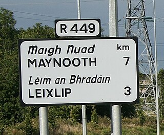
The R449 road is a regional road in County Kildare, Ireland. It is just 3 km (1.9 mi) long and was completed in 2003 as part of the construction of a grade separated interchange to connect both West Leixlip and North Celbridge to the M4 motorway at Junction 6.

The North Circular Road - designated as R101 regional road - is an important thoroughfare on the northside of Dublin, in Ireland. The regional road was long considered the northern boundary of the city and still separates the city centre from the inner suburbs. It runs from the Phoenix Park in the west through Phibsboro, to North Wall in the east. A number of important institutions are located along the road, including the Mater Hospital, Dalymount Park and Mountjoy Prison, and both Croke Park and St. Brendan's Hospital are nearby. The R101 and the NCR overlap for most of their lengths, and the entire NCR forms a section of the R101. In the west the R101 connects the NCR to Parkgate Street via the short Infirmary Road ; at the eastern end the R101 becomes Portland Row after the junction with Summerhill. It continues the northern loop through Saville Place , then turning east for its final kilometre via Sheriff Street (Upper) before terminating at North Wall Road.
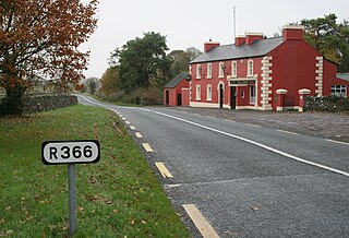
The R366 road is a regional road in Ireland linking R362 regional road to the N63 national secondary road in Roscommon Town. It passes through the hamlets of Castlecoote and Fuerty en route.

The R107 road is a regional road in north Dublin, Ireland with a length of 10.5 kilometres (6.5 mi). It traverses a route from Fairview to Malahide, via Coolock, Balgriffin, and ultimately reaches the western edge of Portmarnock. Its main component is the Malahide Road.

The R134 road is a regional road in South Dublin, Ireland connecting the R110 to the R120.

The R820 road is a regional road in Dublin, Ireland.

The R322 road is a regional road in central County Mayo in Ireland. It connects the R320 road at Kiltimagh to the N17 road at Cloonturk, 9.7 kilometres (6.0 mi) away. The road passes just to the north of Cloonfallagh about halfway between the N17 and Kiltimagh.

The R375 road is a regional road in central County Mayo in Ireland. It connects the R320 road at Swinford to the N17 road at Liscosker, 11 kilometres (6.8 mi) away.

The R329 road is a regional road in east central County Mayo in Ireland. It connects the N17 road at Shanvaghera – via Knock – to the N17 road at Ballyfarnagh, 6.6 kilometres (4.1 mi) away.

The R330 road is a regional road in west central County Mayo in Ireland. It connects the N5 and N59 roads at Westport to the N84 road at the village of Partry, 21.9 kilometres (13.6 mi) away. It meets the R300 road between Cloonee and Partry.

The R763 road is a regional road in County Wicklow in Ireland. It connects the R764 road near Ashford to the R755 road at Annamoe, 10.8 kilometres (6.7 mi) away.

The R316 road is a regional road in County Mayo in Ireland. It connects the R312 at Boghadoon to the R315 road at Ballybrinoge near Crossmolina, 11 kilometres (6.8 mi) away.

The R150 road is a regional road in Ireland. It runs from Drogheda to the Meath coast and back inland across east County Meath.
| This Irish road or road transport-related article is a stub. You can help Wikipedia by expanding it. |