 | |
|---|---|
| Bóthar R196 | |
| Route information | |
| Length | 5.4 km (3.4 mi) |
| Location | |
| Country | Ireland |
| Primary destinations |
|
| Highway system | |
The R196 road is a regional road in Ireland linking Ballyjamesduff and the N3 in County Cavan. [1]
The road is 5.4 km (3.4 mi) long.
| | |
|---|---|
| Bóthar R196 | |
| Route information | |
| Length | 5.4 km (3.4 mi) |
| Location | |
| Country | Ireland |
| Primary destinations |
|
| Highway system | |
The R196 road is a regional road in Ireland linking Ballyjamesduff and the N3 in County Cavan. [1]
The road is 5.4 km (3.4 mi) long.

Belfast is the capital and largest city of Northern Ireland, standing on the banks of the River Lagan on the east coast. It is the 12th-largest city in the United Kingdom and the second-largest in Ireland. It had a population of 345,418 in 2021.

The island of Ireland, comprising Northern Ireland and the Republic of Ireland, has an extensive network of tens of thousands of kilometres of public roads, usually surfaced. These roads have been developed and modernised over centuries, from trackways suitable only for walkers and horses, to surfaced roads including modern motorways. Driving is on the left-hand side of the road. The major routes were established before Irish independence and consequently take little cognisance of the border other than a change of identification number and street furniture. Northern Ireland has had motorways since 1962, and has a well-developed network of primary, secondary and local routes. The Republic started work on its motorway network in the early 1980s; and historically, the road network there was once somewhat less well developed. However, the Celtic Tiger economic boom and an influx of European Union structural funding, saw national roads and regional roads in the Republic come up to international standard quite quickly. In the mid-1990s, for example, the Republic went from having only a few short sections of motorway to a network of motorways, dual carriageways and other improvements on most major routes as part of a National Development Plan. Road construction in Northern Ireland now tends to proceed at a slower pace than in the Republic, although a number of important bypasses and upgrades to dual carriageway have recently been completed or are about to begin.
The N7 road is a national primary road in Ireland, connecting Limerick and Dublin. The majority of the route is motorway standard and is designated as the M7 motorway. At the Rosbrien interchange in Limerick the route continues as the N18 dual carriageway to Shannon and Ennis. The road passes through the midlands of Ireland, and acts as a trunk route out of Dublin for the N8 and N9 national primary routes to Cork and Waterford respectively. It forms part of European route E20.

The N4 road is a national primary road in Ireland, running from Dublin to the northwest of Ireland and Sligo town. The M6 to Galway diverges from this route after Kinnegad, while the N5 to Westport diverges at Longford town. Most sections of the N4 that are motorway-standard are designated the M4 motorway.
The N3 road is a national primary road in the Republic of Ireland, running between Dublin, Cavan and the border with County Fermanagh. The A509 and A46 roads in Northern Ireland form part of an overall route connecting to Enniskillen, and northwest to the border again where the N3 reappears to serve Ballyshannon in County Donegal.
The N2 road is a national primary road in Ireland, running from Dublin to the border with Northern Ireland at Moy Bridge near Aughnacloy, County Tyrone to connect Dublin with Derry via the A5. A section of the route near Dublin forms the M2 motorway.

The N12 road is one of the shortest national primary roads in the Republic of Ireland, running 6.87 km (4.27 mi) from outside Monaghan to the border with County Armagh, Northern Ireland, at Ardgonnell Bridge outside Middletown. The N12 is part of an overall route running from Cavan Town to Belfast.

The N16 road is a national primary road in Ireland. It begins in County Sligo in the northwest of Ireland, and ends at Blacklion, County Cavan, at the border with Northern Ireland, where it becomes the A4 road. At 47.49 kilometres (29.51 mi), The N16 is one of the shorter national primary routes, as it forms only part of a major route from Sligo to Enniskillen and onwards to Belfast.

A national primary road is a road classification in Ireland. National primary roads form the major routes between the major urban centres. There are 2649 km of national primary roads. This category of road has the prefix "N" followed by one or two digits. Motorways are prefixed "M" followed by one or two digits.
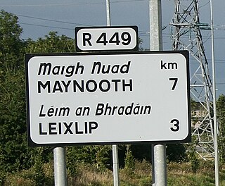
The R449 road is a regional road in County Kildare, Ireland. It is just 3 km (1.9 mi) long and was completed in 2003 as part of the construction of a grade separated interchange to connect both West Leixlip and North Celbridge to the M4 motorway at Junction 6.

The N87 road is a national secondary road in the north of County Cavan, Ireland.

In Ireland, the highest category of road is a motorway, indicated by the prefix M followed by a one- or two-digit number. The motorway network consists entirely of motorway-grade dual carriageways and is largely focused upon Dublin. There are also several three-lane motorways, while Ireland's busiest road, the M50, incorporates four-lane, five-lane, and six-lane stretches.

Ireland has an extensive network of public roads which connect all parts of the country with each other. Roads in Ireland are currently classified as motorways, National Primary routes, National secondary routes, Regional roads and Local roads. The introduction of this classification system began in 1977.

The R318 road is a regional road in County Mayo in Ireland. It connects the N26 at Foxford to the R310 at Cuingbeg, 4.3 kilometres (2.7 mi) away.

The R169 road is a regional road in Ireland linking Mollyrue and Dunleer in County Louth.

The R177 road is a regional road in Ireland linking Lisdoo and the Border with Northern Ireland in County Louth. The road continues as the A29 across the border in Northern Ireland. The road is 5.5 km (3.4 mi) long.

The R835 road is a regional road in Ireland which links Lucan with the N4 in County Dublin.

The R193 road is a regional road in Ireland which links Rockcorry with the R190 regional road in County Monaghan. The road is 3.4 km (2.1 mi) long.

The R485 road is a regional road in Ireland which links the Kilmurry McMahon with the N68 road in County Clare.

The R510 road is a regional road in Ireland which links the N69 road and the R526 regional road in County Limerick.