 | |
|---|---|
| Bóthar N70 | |
| Route information | |
| Length | 141.691 km (88.043 mi) |
| Location | |
| Country | Ireland |
| Primary destinations | (bypassed routes in italics)
|
| Highway system | |
The N70 road is a national secondary road in Ireland. It comprises most of the Ring of Kerry.
| | |
|---|---|
| Bóthar N70 | |
| Route information | |
| Length | 141.691 km (88.043 mi) |
| Location | |
| Country | Ireland |
| Primary destinations | (bypassed routes in italics)
|
| Highway system | |
The N70 road is a national secondary road in Ireland. It comprises most of the Ring of Kerry.
(N70 Killarney Road at Kenmare) – Sneem – Castlecove – Caherdaniel – Waterville – Cahersiveen – Killorglin – (N72) – Milltown – Castlemaine – (N86) – Tralee (At Camp on N22/N69 Tralee Bypass) .
N70 is mostly of poor quality single carriageway road, with many sections are bending or narrow especially from Castlemaine to Tralee and also from Waterville to Kenmare.
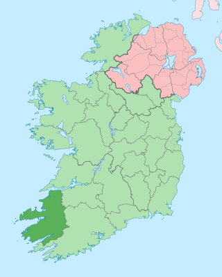
County Kerry is a county in Ireland. It is in the Southern Region and the province of Munster. It is named after the Ciarraige who lived in part of the present county. The population of the county was 156,458 at the 2022 census.

The island of Ireland, comprising Northern Ireland and the Republic of Ireland, has an extensive network of tens of thousands of kilometres of public roads, usually surfaced. These roads have been developed and modernised over centuries, from trackways suitable only for walkers and horses, to surfaced roads including modern motorways. Driving is on the left-hand side of the road. The major routes were established before Irish independence and consequently take little cognisance of the border other than a change of identification number and street furniture. Northern Ireland has had motorways since 1962, and has a well-developed network of primary, secondary and local routes. The Republic started work on its motorway network in the early 1980s; and historically, the road network there was once somewhat less well developed. However, the Celtic Tiger economic boom and an influx of European Union structural funding, saw national roads and regional roads in the Republic come up to international standard quite quickly. In the mid-1990s, for example, the Republic went from having only a few short sections of motorway to a network of motorways, dual carriageways and other improvements on most major routes as part of a National Development Plan. Road construction in Northern Ireland now tends to proceed at a slower pace than in the Republic, although a number of important bypasses and upgrades to dual carriageway have recently been completed or are about to begin.
The N8 road is a national primary road in Ireland, connecting Cork with Dublin via the M7. The N8 is further classified by the United Nations as the entirety of the European route E 201, part of the trans-Europe International E-road network. The road is motorway standard from junction 19 on the M7 to the Dunkettle interchange in Cork City and is designated as the M8 motorway. From here the route continues into Cork city centre and terminates at the N22 road at St. Patrick's Street. The M8 motorway was completed in May 2010, replacing the single carriageway sections of the old N8 and bypassing towns on the main Cork to Dublin road. It is now possible to travel from Cork to Dublin on the M/N8 in about 2 hours 30 minutes. The route commences just south of Portlaoise, and reaches Cork via the midlands and the Golden Vale of Ireland, through Counties Laois, Kilkenny, Tipperary, Limerick and Cork.

The N11 road is a national primary road in Ireland, running for 129 km (80 mi) along the east side of Ireland from Dublin to Wexford. It passes close to Bray, Greystones, Wicklow, Arklow, Gorey, and Enniscorthy. Beyond Wexford, the route continues to Rosslare as the N25. The road forms part of European route E01. As of July 2019 the N11/M11 is of dual carriageway or motorway standard from Dublin as far as Oilgate in County Wexford.

The N22 road is a national primary road in Ireland which goes through counties Kerry and Cork, from Tralee in the west through Killarney, Macroom and Ballincollig to Cork City in the east.

The Ring of Kerry is a 179-kilometre-long (111-mile) circular tourist route in County Kerry, south-western Ireland. Clockwise from Killarney it follows the N71 to Kenmare, then the N70 around the Iveragh Peninsula to Killorglin – passing through Sneem, Waterville, Cahersiveen, and Glenbeigh – before returning to Killarney via the N72.

The N17 road is a national primary road in Ireland, and is part of the Atlantic Corridor route. It begins in County Galway and ends in County Sligo. On 27 September 2017 the southern, Tuam–Galway, section was upgraded to motorway status and designated M17.

The N18 road is a national primary road in Ireland, connecting the cities of Limerick and Galway. Ennis and Gort are two major towns on the route, and Shannon Airport is reached via the connecting N19. The west coast route continues on to Sligo as the N17. The section from Limerick to the N19 junction forms part of European route E20, and the entire route is part of the proposed Atlantic Corridor. The section of motorway from Shannon to Claregalway is designated the M18 motorway. The tolled Limerick Tunnel forms part of the route.
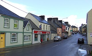
Milltown is a small town on the N70 national secondary road between the major towns of Tralee and Killarney in County Kerry, Ireland. It is approximately 7 kilometres (4 mi) from Killorglin.

The N21 road is a national primary road in Ireland. The route runs from the M20 outside Limerick to Tralee with connecting roads to other parts of County Kerry. It is 84.37 km (52.43 mi) in length. It runs through the towns of Abbeyfeale, Newcastle West, Adare and the village of Templeglantine. Prior to October 2010 the N21 also ran through the town of Castleisland. The town has since been bypassed. Rathkeale was also bypassed in 1992.

A national secondary road is a category of road in Ireland. These roads form an important part of the national route network but are secondary to the main arterial routes which are classified as national primary roads. National secondary roads are designated with route numbers higher than those used for primary roads, but with the same "N" prefix. Routes N51 and higher are all national secondary roads.

The N71 road is a national secondary road traversing counties Cork and Kerry in Ireland. Towns and villages along the route, westward from Cork city, include Innishannon, Bandon, Clonakilty, Skibbereen, Bantry and Glengarriff in County Cork. Continuing westwards from Glengarriff into County Kerry, the route passes Kenmare and terminates at Killarney.

Castlemaine is a village in County Kerry, Ireland. It lies on the N70 national secondary road between Killorglin and Tralee.

A national primary road is a road classification in Ireland. National primary roads form the major routes between the major urban centres. There are 2649 km of national primary roads. This category of road has the prefix "N" followed by one or two digits. Motorways are prefixed "M" followed by one or two digits.

The N72 road is a national secondary road in Ireland that runs east-west from its junction with the N25 near Dungarvan in County Waterford to the N70 in Killorglin in County Kerry.

The N86 road is a national secondary road in County Kerry, Ireland. It runs from Tralee to Dingle and passes through Annascaul and Lispole en route and passes by Gallaunmore. It is 50.235 kilometres (31.215 mi) in length. It has, in recent years, seen significant improvements to certain stretches of road.

The N69 road is a national secondary road in Ireland. It runs from Limerick to Tralee and passes through Mungret, Clarina, Kildimo, Askeaton (bypassed), Foynes, Loghill, Glin, Tarbert, and Listowel.

In Ireland, the highest category of road is a motorway, indicated by the prefix M followed by a one- or two-digit number. The motorway network consists entirely of motorway-grade dual carriageways and is largely focused upon Dublin. There are also several three-lane motorways, while Ireland's busiest road, the M50, incorporates four-lane, five-lane, and six-lane stretches.

The R561 road is a regional road in Ireland. It is on the Dingle Peninsula in County Kerry. Part of the road is on the Wild Atlantic Way.
| | This Irish road or road transport-related article is a stub. You can help Wikipedia by expanding it. |