The N7 road is a national primary road in Ireland, connecting Limerick and Dublin. The majority of the route is motorway standard and is designated as the M7 motorway. At the Rosbrien interchange in Limerick the route continues as the N18 dual carriageway to Shannon and Ennis. The road passes through the midlands of Ireland, and acts as a trunk route out of Dublin for the N8 and N9 national primary routes to Cork and Waterford respectively. It forms part of European route E20.
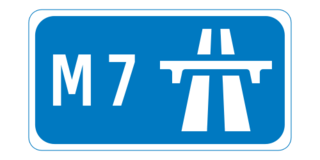
The M7 motorway is a motorway in Ireland. The motorway runs continuously from the outskirts of Naas in County Kildare to Rossbrien on the outskirts of Limerick City. The M7 forms part of the Dublin to Limerick N7 national primary road. The section of the motorway bypassing Naas, an 8 km stretch, was the first section of motorway to open in Ireland, in 1983. Following substantial works to extend the M7 to Limerick, by the end of 2010, the motorway replaced all of the old single-carriageway N7 route which is now designated as R445. At 166.5 km, the M7 is the longest motorway in Ireland.
County Offaly is a county in Ireland. It is part of the Eastern and Midland Region and the province of Leinster. It is named after the ancient Kingdom of Uí Failghe. It was formerly known as King's County, in honour of Philip II of Spain. Offaly County Council is the local authority for the county. The county population was 82,668 at the 2022 census.

Tullamore is the county town of County Offaly in Ireland. It is on the Grand Canal, in the middle of the county, and is the fourth most populous town in the midlands region, with 14,607 inhabitants at the 2016 census.

A regional road in the Republic of Ireland is a class of road not forming a major route, but nevertheless forming a link in the national route network. There are over 11,600 kilometres of regional roads. Regional roads are numbered with three-digit route numbers, prefixed by "R". The equivalent road category in Northern Ireland are B roads.

The N20 road is a national primary road in Ireland, connecting the cities of Cork and Limerick. Buttevant, Croom, Charleville, Mallow and Blarney are major towns along the route. A short section of the route is motorway standard and is designated as the M20 Motorway.

The R445 road is a regional road in Ireland. The route is a non-motorway alternative route to the N7/M7 motorway between Naas and Limerick, and at 170 km it is one of the longest regional roads in Ireland. Indeed, much of the route comprises roads that were formerly part of the N7 between the cities, prior to motorway and other bypasses. Some of the R445 route also comprises local link roads to new N7/M7 route sections.
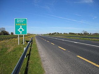
The N52 road is a national secondary road in Ireland. It links the M7 motorway from just south of Nenagh, County Tipperary to the M1 motorway north of Dundalk in County Louth. The route forms a connection between the north east of Ireland and the mid west traversing the midlands. It interchanges with the M6 at Kilbeggan and at Tyrrellspass, the N4 at Mullingar, the N3 at Kells, and the N2 at Ardee before continuing towards Dundalk.

Kinnitty is a village in County Offaly, Ireland. It is located 13 km east of Birr on the R440 and R421 regional roads.

Clonaslee is a village in north County Laois, Ireland, situated in the foothills of the Slieve Bloom Mountains on the R422 Mountmellick to Birr road. Clonaslee is approximately 100 km west of Dublin, and is close to the towns of Portlaoise and Tullamore.
The N62 road is a national secondary road in Ireland. It links the M6 motorway east of Athlone, County Westmeath with junction 6 of the M8 motorway at Kilnoe near Horse and Jockey in County Tipperary, 96.625 kilometres (60.040 mi) to the south. The route also forms a junction with the M7 motorway south of Roscrea.

The N80 road is a national secondary road in Ireland that runs southeastwards from its junction with the N52 and R443 in the town of Tullamore in County Offaly, to the N30 at Ballynahallin, just north of Enniscorthy in County Wexford, a distance of 114.683 km. Total length is 114.683 km (71.261 mi).

The R446 road is a regional road in Ireland. The road connects Kinnegad in County Westmeath to Galway City. Prior to the construction of the M6 motorway the R446 formed the main N6 road connecting Dublin and Galway. Following the opening of the M6; the old N6 road was downgraded to regional road status and was designated as the R446. The road is an alternative route between Galway and Dublin and runs in parallel to the M6.

The R639 road is one of Ireland's regional roads. Once designated the N8 national primary road, it was reclassified in stages as the R639 following the progressive opening of sections of the M8 motorway, which rendered the single carriageway N8 redundant as a national primary road. By-passed sections of the old N8 were generally reclassified as R639 as soon as a new section of M8 opened, thereby increasing the length of the R639. With the completion of the M8 on 28 May 2010, the R639 now stretches from Durrow, County Laois to Cork, running through counties Laois, Kilkenny, Tipperary, Limerick and Cork.

Moneygall is a small village on the border of counties Offaly and Tipperary, in Ireland. It is situated on the R445 road between Dublin and Limerick. There were 313 people living in the village as of the 2016 census. Moneygall has a Catholic church, motorway service station, a car sales and repair centre, a national school, a Garda station and two pubs. The nearest Church of Ireland church, Borrisnafarney, is 2 km from the village beside the former Loughton Demesne.

Clareen is a village in the parish of Seir Kieran in County Offaly, Ireland. It is located 8 km east of Birr on the R421 regional road.

The R420 road is a regional road in Ireland, which runs northwest-southeast from the R446 near Moate in County Westmeath to the R445 just west of Monasterevin. The road travels through the towns of Clara, Tullamore & Portarlington. The route is 35 km (22 mi) long.

The R494 road is a regional road in Ireland which runs southwest-northeast from Junction 27 of the M7 at Birdhill, County Tipperary to the N52 at Nenagh - all in County Tipperary. It leaves the M7 and loops around the Arra Mountains between the hills and Lough Derg returning to what was the N7 in Nenagh.

The R443 road is a regional road in Ireland, which forms the northern and western part of an orbital route around the town of Tullamore. The southern and eastern part is formed by the N52 Tullamore bypass. The R443 commences at a roundabout junction with the N52/N80. From here it travels along Clonminch Road and O'Moore Street; it then joins the R421 for a distance of 400 metres along Cormac Street. The road then continues along the "Western Relief Road" along the western edge of the town. It has roundabout junctions with the R420 Clara Road and the R421 Arden Road in addition to other roundabouts for industrial, retail and residential estates. The road terminates at a roundabout with the N52 Tullamore bypass on the northern side of the town. The total length of the road is 8.2km.

Seir Kieran is a Gaelic Athletic Association club located in a parish and Electoral Division of the same name. Seir Kieran takes its name from Saint Ciarán of Saighir, who founded the parish as a civitas in the 5th century. The club's playing facilities are based in the village of Clareen in County Offaly, Ireland.