| R333 road | |
|---|---|
| Bóthar R333 | |
| Location | |
| Country | Ireland |
| Primary destinations |
|
| Highway system | |
The R333 road is a regional road in Ireland connecting the N83 southwest of Tuam, County Galway, to the N84 in Headford, County Galway.
| R333 road | |
|---|---|
| Bóthar R333 | |
| Location | |
| Country | Ireland |
| Primary destinations |
|
| Highway system | |
The R333 road is a regional road in Ireland connecting the N83 southwest of Tuam, County Galway, to the N84 in Headford, County Galway.

A regional road in the Republic of Ireland is a class of road not forming a major route, but nevertheless forming a link in the national route network. There are over 11,600 kilometres of regional roads. Regional roads are numbered with three-digit route numbers, prefixed by "R". The equivalent road category in Northern Ireland are B roads.

The N59 road is a national secondary road in Ireland. It commences in County Sligo, south of Sligo Town at the Belladrehid interchange with the N4 north of Ballysadare. The route circles around the west of Ireland, passing west from Sligo into County Mayo and through Ballina. The N59 continues around Mayo, proceeding indirectly to Westport. Continuing south through Mayo into County Galway, the road passes through the village of Leenaun. The 182-year-old bridge in the centre of the village, carrying the road across the River Lahill, collapsed in floods on 18 July 2007. Due to the local terrain and road network, the diversionary route for getting from the south of the village to Westport was 110 km long. A temporary bridge was opened eight days after the floods, on 27 July. It has since been replaced by a new bridge.

The R336 road is a regional road in County Galway in Ireland which connects the N59 road at Leenaun beside Killary Harbour – via Inverin – to the N6 and N83 in Galway, 83 kilometres (52 mi) to the southeast.

The R446 road is a regional road in Ireland. The road connects Kinnegad in County Westmeath to Galway City. Prior to the construction of the M6 motorway the R446 formed the main N6 road connecting Dublin and Galway. Following the opening of the M6; the old N6 road was downgraded to regional road status and was designated as the R446. The road is an alternative route between Galway and Dublin and runs in parallel to the M6.

The N65 road is a national secondary road in Ireland. It links the N52 at Borrisokane, County Tipperary to the M6 north of Loughrea in County Galway.

The N83 road is a national secondary road in Ireland that runs from its junction with the N17 just south of Ireland West Airport Knock in County Mayo to a point just north of Tuam, County Galway where it rejoins the N17. On 27 September 2017, the old N17 from the Kilmore Roundabout in Tuam to the junction with the N6 in Galway city was redesignated as the N83.

The R327 road is a regional road in Ireland connecting the N60 east of Claremorris, County Mayo, to the R360 in County Galway.

The N84 road is a national secondary road in Ireland. It is a major route in the West connecting Galway city with Castlebar. The route is of poor quality with a few short good sections in County Mayo between Ballintubber and Ballinrobe. Ballinrobe has become a bottleneck on the route in recent years with up to 8,000 vehicles passing through the town's one-way streets. A bypass for the town is in the planning.

The N66 road was a national secondary road in Ireland.

The R335 road is a regional road in counties Mayo and Galway in Ireland. It starts in Westport, County Mayo and ends in Leenaun, County Galway. The N59 is a much more direct route between the two towns. The R335 passes through Murrisk, Lecanvey, Louisburgh and Delphi before terminating in Leenaun. It is approximately 52 kilometres (32 mi) long with a speed limit of 80 km/h (50 mph).

The R358 road is a regional road in Ireland linking the N63 at Mountbellew to the R446 at Ballinasloe, all in County Galway. The road is 27 km (17 mi) long.
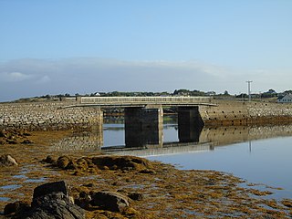
The R374 road is a regional road in County Galway, Ireland.

The R328 road is a regional road in Counties Mayo and Galway in Ireland, connecting Ballindine on the N17 to Moylough on the N63.
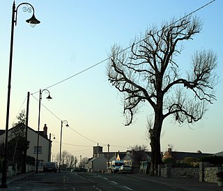
The R364 road is a regional road in County Galway, Ireland connecting Moylough on the N63 to near Ballymoe on the N60.

The R300 road is a regional road in southwest County Mayo and north County Galway in Ireland. It connects the R330 road at Cloonee and the nearby N84 road at Partry to the R345 road at Clonbur, 36.2 kilometres (22.5 mi) to the south. It passes through the area known as Joyce Country between the Partry Mountains and Lough Mask.
The R334 road is a regional road in south County Mayo and north County Galway in Ireland. It connects the N84 road at Ballinrobe to the N84 road again at Headford, 20.8 kilometres (12.9 mi) to the south. It passes to the east of Lough Mask and Lough Corrib.
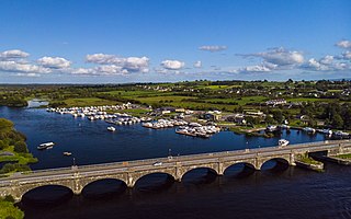
The R356 road is a regional road in Ireland; it links Killimor, County Galway with Cloghan, County Offaly. The road also travels through the towns of Eyrecourt and Banagher. At Banagher, the road crosses the River Shannon via a seven arch bridge. This bridge was erected by the Commissioners for the Improvement of Navigation of the Shannon in 1841–1843.

The R332 road is a regional road in County Galway and County Mayo in Ireland. It connects the N63 road at Horseleap Cross near Moylough in County Galway, via Tuam, to the N84 road at Kilmaine in County Mayo, 38 kilometres (24 mi) away.

The R341 road is a regional road in Ireland. It is a loop road from the N59 road in County Galway. South of the R342, the road is part of the Wild Atlantic Way.
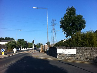
The R339 road is a regional road in Ireland which links the R358 regional road with Galway in County Galway.