The island of Ireland, comprising Northern Ireland and the Republic of Ireland, has an extensive network of tens of thousands of kilometres of public roads, usually surfaced. These roads have been developed and modernised over centuries, from trackways suitable only for walkers and horses, to surfaced roads including modern motorways. The major routes were established before Irish independence and consequently take little cognisance of the border other than a change of identification number and street furniture. Northern Ireland has had motorways since 1962, and has a well-developed network of primary, secondary and local routes. The Republic started work on its motorway network in the early 1980s; and historically, the road network there was once somewhat less well developed. However, the Celtic Tiger economic boom and an influx of European Union structural funding, saw national roads and regional roads in the Republic come up to international standard quite quickly. In the mid-1990s, for example, the Republic went from having only a few short sections of motorway to a network of motorways, dual carriageways and other improvements on most major routes as part of a National Development Plan. Road construction in Northern Ireland now tends to proceed at a slower pace than in the Republic, although a number of important bypasses and upgrades to dual carriageway have recently been completed or are about to begin.
The N8 road is a national primary road in Ireland, connecting Cork with Dublin via the M7. The N8 is further classified by the United Nations as the entirety of the European route E 201, part of the trans-Europe International E-road network. The road is motorway standard from junction 19 on the M7 to the Dunkettle interchange in Cork City and is designated as the M8 motorway. From here the route continues into Cork city centre and terminates at the N22 road at St. Patrick's Street. The M8 motorway was completed in May 2010, replacing the single carriageway sections of the old N8 and bypassing towns on the main Cork to Dublin road. It is now possible to travel from Cork to Dublin on the M/N8 in about 2 hours 30 minutes. The route commences just south of Portlaoise, and reaches Cork via the midlands and the Golden Vale of Ireland, through Counties Laois, Kilkenny, Tipperary, Limerick and Cork.

Fermoy is a town on the River Blackwater in east County Cork, Ireland. As of the 2016 census, the town and environs had a population of approximately 6,500 people. It is located in the barony of Condons and Clangibbon, and is in the Dáil constituency of Cork East.

The N20 road is a national primary road in Ireland, connecting the cities of Cork and Limerick. Buttevant, Croom, Charleville, Mallow and Blarney are major towns along the route. A short section of the route is motorway standard and is designated as the M20 Motorway.

The R148 road is one of Ireland's regional roads which was classified following the opening of a by-passed national primary road.

The R403 road is a regional road in Ireland, linking the N4 at Lucan in County Dublin to Carbury in County Kildare.
The N25 road is a national primary road in Ireland, forming the route from Cork to Rosslare Europort via Waterford City. The road is part of the E30 European route and a short section is also part of the E01 European route. It forms part of the proposed Atlantic Corridor route.

The Blackwater or Munster Blackwater is a river which flows through counties Kerry, Cork, and Waterford in Ireland. It rises in the Mullaghareirk Mountains in County Kerry and then flows in an easterly direction through County Cork, through Mallow and Fermoy. It then enters County Waterford where it flows through Lismore, before abruptly turning south at Cappoquin, and finally draining into the Celtic Sea at Youghal Harbour. In total, the Blackwater is 169 km (105 mi) long. The total catchment area of the River Blackwater is 3,324 km2. The long term average flow rate of the River Blackwater is 89.1 cubic metres per second (m3/s) The Blackwater is notable for being one of the best salmon fishing rivers in the country. Like many Irish and British rivers, salmon stocks declined in recent years, but the Irish government banned commercial netting of salmon off the coast of Ireland in November 2006.

New Inn is a village in County Tipperary in Ireland. It is also in the barony of Middle Third, and part of the parish of New Inn and Knockgraffon in the Roman Catholic Archdiocese of Cashel and Emly.

The N76 road is a national secondary road in Ireland. It links the N10 national primary on the ring road south of Kilkenny, County Kilkenny to the N24 national primary route east of Clonmel in County Tipperary.

The N72 road is a national secondary road in Ireland that runs east-west from its junction with the N25 near Dungarvan in County Waterford to the N70 in Killorglin in County Kerry.

Glanworth is a village on the R512 regional road in County Cork, Ireland. It lies approximately 8 kilometres (5 mi) northwest of the town of Fermoy and 40 km (25 mi) northeast of Cork city. As of 2016, Glanworth's population was 603.

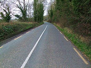
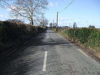
The R639 road is one of Ireland's regional roads. Once designated the N8 national primary road, it was reclassified in stages as the R639 following the progressive opening of sections of the M8 motorway, which rendered the single carriageway N8 redundant as a national primary road. By-passed sections of the old N8 were generally reclassified as R639 as soon as a new section of M8 opened, thereby increasing the length of the R639. With the completion of the M8 on 28 May 2010, the R639 now stretches from Durrow, County Laois to Cork, running through counties Laois, Kilkenny, Tipperary, Limerick and Cork.

Kilworth is a village in north County Cork, located about 2 kilometres north of Fermoy near the river Funcheon. The M8 Cork–Dublin motorway passes nearby. Kilworth has an army camp, located on the R639 regional road between Mitchelstown and Fermoy. Kilworth is part of the Cork East Dáil constituency.
The N73 road is a national secondary road in Ireland. It is made up entirely of single carriageway with few overtaking opportunities and only a small amount of hard shoulder.

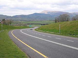
The M8 motorway is an inter-urban motorway in Ireland, which forms part of the motorway from the capital Dublin to Cork city. The 149 km motorway commences in the townland of Aghaboe, County Laois and runs through the counties of Kilkenny, Tipperary and Limerick, terminating at the Dunkettle interchange in Cork City. First called for in the Road Needs Study (1998), it was later incorporated into the National Development Plan (2000–2006) and later still formed part of the Irish Government's Transport 21 plan for infrastructural development. The majority of the M8 (115 km) was built between 2006 and 2010. On 28 May 2010, the motorway was completed and had replaced almost all of the single-carriageway N8 except for a short section of urban road in Cork City.

There have been routes and trackways in Ireland connecting settlements and facilitating trade since ancient times and the country now has an extensive network of public roads connecting all parts of the island.
The R670 road is a regional road in Ireland. The route runs from its junction with the R639 and N24 at Cloughabreeda 2 km north of Cahir through Cahir town and onwards for a further 8 km to Ardfinnan, where it joins the R665 road. The R670 is located entirely in County Tipperary.

The R667 road is a regional road in Ireland. The route runs from its junction with the N8 1 km from Kilworth for approximately 5 km until it meets the R666 road northeast of Fermoy. The R667 was once part of the main road from Dublin to Cork, and was mapped as such by Herman Moll in his New Map of Ireland in 1714. The road is located entirely in County Cork.
The River Blackwater, also called the Enfield Blackwater, or Kildare Blackwater is a river that flows through the counties of Kildare and Meath in Ireland. It is a tributary of the River Boyne which flows into the Irish Sea at Drogheda.