 | |
|---|---|
| Route information | |
| Length | 28 km (17 mi) |
| Location | |
| Primary destinations | |
| Road network | |
The R181 is a regional road in Ireland, running from the R162 near Shercock to the border with Northern Ireland near Keady, where it meets the B32.
| | |
|---|---|
| Route information | |
| Length | 28 km (17 mi) |
| Location | |
| Primary destinations | |
| Road network | |
The R181 is a regional road in Ireland, running from the R162 near Shercock to the border with Northern Ireland near Keady, where it meets the B32.
The R181 begins on the R162 road near Shercock in County Cavan. It soon enters County Monaghan and continues to Castleblayney, where it runs along the main street before reaching a junction with the R182. It then heads to the border, which it crosses, becoming the B32, which continues to Keady.


The island of Ireland, comprising Northern Ireland and the Republic of Ireland, has an extensive network of tens of thousands of kilometres of public roads, usually surfaced. These roads have been developed and modernised over centuries, from trackways suitable only for walkers and horses, to surfaced roads including modern motorways. The major routes were established before Irish independence and consequently take little cognisance of the border other than a change of identification number and street furniture. Northern Ireland has had motorways since 1962, and has a well-developed network of primary, secondary and local routes. The Republic started work on its motorway network in the early 1980s; and historically, the road network there was once somewhat less well developed. However, the Celtic Tiger economic boom and an influx of European Union structural funding, saw national roads and regional roads in the Republic come up to international standard quite quickly. In the mid-1990s, for example, the Republic went from having only a few short sections of motorway to a network of motorways, dual carriageways and other improvements on most major routes as part of a National Development Plan. Road construction in Northern Ireland now tends to proceed at a slower pace than in the Republic, although a number of important bypasses and upgrades to dual carriageway have recently been completed or are about to begin.

County Cavan is a county in Ireland. It is in the province of Ulster and is part of the Border Region. It is named after the town of Cavan and is based on the historic Gaelic territory of East Breffny (Bréifne). Cavan County Council is the local authority for the county, which had a population of 76,176 at the 2016 census.
The N3 road is a national primary road in the Republic of Ireland, running between Dublin, Cavan and the border with County Fermanagh. The A509 and A46 roads in Northern Ireland form part of an overall route connecting to Enniskillen, and northwest to the border again where the N3 reappears to serve Ballyshannon in County Donegal.

Shercock is a small town situated in the east of County Cavan, Ireland. As of the 2016 census, the population of the town was 588.

The R178 road is a regional road in Ireland. It runs from Dundalk, County Louth via Carrickmacross, County Monaghan and Shercock to Virginia, County Cavan.
The R173 road is a regional road in Ireland, running its full length in County Louth. It loops around Cooley Peninsula, mainly along the coast. It nearly encircles the Cooley Mountains.

The N14 road is a national primary road in the Republic of Ireland. The entirety of the route is located in the northwest of Ireland, in County Donegal, connecting Manorcunningham to Lifford in the east. Here it connects to the N15 near the border with Northern Ireland and along the A38 to Strabane in County Tyrone.

The R236 road runs in County Donegal in Ulster, and links Stranorlar, via Convoy and Raphoe, to St. Johnston and Carrigans, becoming the A40 into Derry in Northern Ireland.
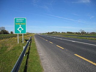
The N52 road is a national secondary road in Ireland. It links the M7 motorway from just south of Nenagh, County Tipperary to the M1 motorway north of Dundalk in County Louth. The route forms a connection between the north east of Ireland and the mid west traversing the midlands. It interchanges with the M6 at Kilbeggan and at Tyrrellspass, the N4 at Mullingar, the N3 at Kells, and the N2 at Ardee before continuing towards Dundalk.

Keady is a village and civil parish in County Armagh, Northern Ireland. It is south of Armagh and near the border with the Republic of Ireland. It is situated mainly in the historic barony of Armagh with six townlands in the barony of Tiranny. It had a population of 3,051 people in the 2011 Census.

The A29 is a major road in Northern Ireland; it is mostly a single carriageway and goes through a number of main towns and connects in several places to other major roads.

The A4 is a major east–west road in Northern Ireland. It travels for 69.2 miles from Portadown to Belcoo through County Armagh, County Tyrone and County Fermanagh.

The A5 is a major primary route in Northern Ireland. It links the city of Derry in County Londonderry with Aughnacloy, County Tyrone via the towns of Strabane and Omagh. Just south of Aughnacloy is the border with the Republic of Ireland, where the A5 meets the N2 to Dublin. Between them the A5 and N2 are the main road link between County Donegal in the Republic and Dublin.

Kingscourt, historically known as Dunaree, is a town in County Cavan, Ireland. It is located near the Cavan–Meath border. The town was founded near the site of the old village of Cabra, by Mervyn Pratt, towards the end of the 18th century, and was completed by his brother, The Rev. Joseph Pratt.

The R115 road is a regional road in counties Dublin and Wicklow in Ireland. It follows the Military Road for its entire length. The R115 is 40.5 km (25.2 mi) long; the full length of the Military Road is 57.9 km (36.0 mi).

The N87 road is a national secondary road in the north of County Cavan, Ireland.
The R162 road is a regional road in Ireland, linking Monaghan Town to Navan, County Meath. The route is 80 km (50 mi) long.
The R420 road is a regional road in Ireland, which runs northwest-southeast from the R446 near Moate in County Westmeath to the R445 just west of Monasterevin. The road travels through the towns of Clara, Tullamore & Portarlington.
Armagh railway station was a railway station that served Armagh in County Armagh, Northern Ireland.
The R192 road is a regional road in Ireland, linking Cootehill to Shercock in County Cavan. The route is 17 km (11 mi) long.
| | This Irish road or road transport-related article is a stub. You can help Wikipedia by expanding it. |