The M50 motorway is a C-shaped orbital motorway in Dublin and the busiest motorway in Ireland. The current route was built in various sections over the course of 27 years, from 1983 to 2010. It begins at Dublin Port, running northward through the Dublin Port Tunnel and along a portion of the Airport Motorway. It then turns west at its junction with the M1, circling the northern, western and southern suburbs of Dublin, before merging with the M11 at Shankill in South East Dublin. The road forms part of European route E01.

The N11 road is a national primary road in Ireland, running for 129 km (80 mi) along the east side of Ireland from Dublin to Wexford. It passes close to Bray, Greystones, Wicklow, Arklow, Gorey, and Enniscorthy. Beyond Wexford, the route continues to Rosslare as the N25. The road forms part of European route E01. As of July 2019 the N11/M11 is of dual carriageway or motorway standard from Dublin as far as Oilgate in County Wexford.

The N4 road is a national primary road in Ireland, running from Dublin to the northwest of Ireland and Sligo town. The M6 to Galway diverges from this route after Kinnegad, while the N5 to Westport diverges at Longford town. Most sections of the N4 that are motorway-standard are designated the M4 motorway.

Kinnegad or Kinagad is a town in County Westmeath, Ireland. It is on the border with County Meath, near the junction of the M6 and the M4 motorways - two of Ireland's main east–west roads. It is roughly 60 km from the capital, Dublin.

The N6 road is a national primary road in Ireland from junction 11 on the M4 motorway at Kinnegad to Galway city. The N6 and N4 form a continuous motorway or dual carriageway from Dublin city centre to Galway City passing in an east–west direction through the midlands of Ireland. Most of the road is motorway standard with the exception of the Athlone bypass and stretches of urban road in Galway City, which are the only sections of the road that remain designated as N6 dual carriageway. There is one toll on the road outside Galway city. Major upgrades to the road were completed in December 2009 completing the first intercity motorway/dual carriageway in Ireland and the New Junctions of M6 are built and will be 164 km.

A regional road in the Republic of Ireland is a class of road not forming a major route, but nevertheless forming a link in the national route network. There are over 11,600 kilometres of regional roads. Regional roads are numbered with three-digit route numbers, prefixed by "R". The equivalent road category in Northern Ireland are B roads.

The R403 road is a regional road in Ireland, linking the N4 at Lucan in County Dublin to Carbury in County Kildare.

Enfield, also known as Innfield, is a town in south County Meath, Ireland, situated between Kilcock and Kinnegad and very close to the border with County Kildare. The town is on the Dublin-Sligo railway line. It is located on the R148 regional road, formerly the N4 national primary road connecting Dublin to Connacht.
Raharney is a village in east County Westmeath, Ireland. It has a population of 221 according to the 2016 census.

Clonard is a small village in County Meath, Ireland. It lies on the R148 regional road between the towns of Kinnegad and Enfield. This road was the main road between Dublin and Galway until the construction of the M4 motorway. It is still used by traffic avoiding the toll on the M4.

The R446 road is a regional road in Ireland. The road connects Kinnegad in County Westmeath to Galway City. Prior to the construction of the M6 motorway the R446 formed the main N6 road connecting Dublin and Galway. Following the opening of the M6; the old N6 road was downgraded to regional road status and was designated as the R446. The road is an alternative route between Galway and Dublin and runs in parallel to the M6.
The R402 road is a regional road in Ireland, linking the M4 at Enfield, County Meath to the R420 east of Tullamore in County Offaly.

The R401 road is a regional road in Ireland, linking Kinnegad in County Meath to Kildare town in County Kildare.
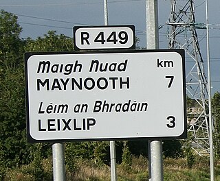
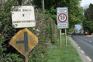
The R449 road is a regional road in County Kildare, Ireland. It is just 3 km (1.9 mi) long and was completed in 2003 as part of the construction of a grade separated interchange to connect both West Leixlip and North Celbridge to the M4 motorway at Junction 6.

The R158 road is a regional road in Ireland, linking Trim in County Meath to Kilcock in County Kildare. The road, which is single-carriageway throughout, has been extensively realigned in recent years at a cost of €22m, the section between Kilcock and Summerhill having been completed by Fallon Construction in August 2008.
The M6 motorway is a motorway in Ireland, which runs from Dublin to Galway. The M6 extends from its junction with the M4 at Kinnegad all the way west to the outskirts of Galway City, but the Athlone bypass and the approach to Galway city - while of dual carriageway standard - have not been designated motorway and are still signed as N6. The motorway was officially completed and opened to traffic on 18 December 2009, and was the first city-to-city direct major inter-urban route to be completed in Ireland. The M6 and M4, which form the Galway-Dublin route, consist of a grade-separated 2+2 dual carriageway road with a top speed limit of 120 km/h. At approximately 144 km (90 mi), the M6 is the third longest motorway in the state and will be 159 km.

In Ireland, the highest category of road is a motorway, indicated by the prefix M followed by a one- or two-digit number. The motorway network consists entirely of motorway-grade dual carriageways and is largely focused upon Dublin. There are also several three-lane motorways, while Ireland's busiest road, the M50, incorporates four-lane, five-lane, and six-lane stretches.

The R125 road is a regional road in Ireland, linking Kilcock on the County Meath / County Kildare border to Swords in County Dublin via the towns of Dunshaughlin and Ratoath.

The R149 road is a regional road in Ireland from Leixlip, County Kildare to Clonee, County Meath. It starts in Leixlip at the junction with the R148 at Main Street. It passes through Confey in Kildare; Passifyoucan and Barnhill in Fingal and Hilltown in Meath before ending in Clonee at the junction with the R156.

Farbill is a barony in east County Westmeath, in Ireland. It was formed by 1672. It is bordered by County Meath to the south and east and three other baronies: Fartullagh, Moyashel and Magheradernon and Delvin. The largest centre of population in the barony is the town of Kinnegad.


 Clickable image