
Derry, officially Londonderry, is the second-largest city in Northern Ireland and the fifth-largest city on the island of Ireland. The old walled city lies on the west bank of the River Foyle, which is spanned by two road bridges and one footbridge. The city now covers both banks.

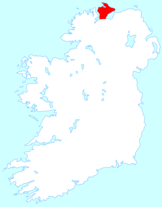
County Donegal is a county of Ireland in the province of Ulster and in the Northern and Western Region. It is named after the town of Donegal in the south of the county. It has also been known as County Tyrconnell, after the historic territory of the same name, on which it was based. Donegal County Council is the local council and Lifford the county town.
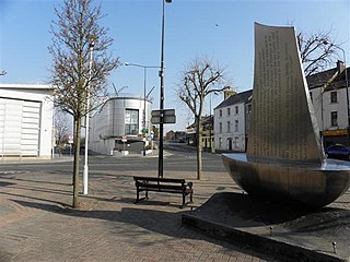
Strabane is a town in County Tyrone, Northern Ireland.

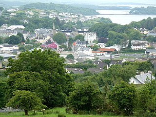
Letterkenny, nicknamed 'the Cathedral Town', is the largest and most populous town in County Donegal, a county in Ulster, the northern province in Ireland. Letterkenny lies on the River Swilly in East Donegal in the north-west of Ulster, and has a population of 19,274. It is the 36th largest settlement in all of Ireland by population, and is the 15th largest settlement by population in the province of Ulster. Along with the nearby city of Derry, Letterkenny is considered a regional economic gateway for the north-west of Ireland. Letterkenny acts as an urban gateway to the Ulster Gaeltacht, similar to Galway's relationship to the Connemara Gaeltacht.

Lifford is the county town of County Donegal, Ireland, the administrative centre of the county and the seat of Donegal County Council, although the town of Letterkenny is often mistaken as holding this role.
Inishowen is a peninsula in the north of County Donegal in Ireland. Inishowen is the largest peninsula on the island of Ireland.
Donegal is a town in County Donegal, Ireland. The name was also historically spelt 'Dunnagall'. Although Donegal gave its name to the county, now Lifford is the county town. From the 15th until the early 17th century, Donegal was the 'capital' of Tyrconnell, a Gaelic kingdom controlled by the O'Donnell dynasty of the Northern Uí Néill.

Buncrana is a town in County Donegal, Ireland. It is beside Lough Swilly on the Inishowen peninsula, 23 kilometres (14 mi) northwest of Derry and 43 kilometres (27 mi) north of Letterkenny. In the 2016 census, the population was 6,785 making it the second most populous town in County Donegal, after Letterkenny, and the largest in Inishowen.
The River Foyle is a river in west Ulster in the northwest of the island of Ireland, which flows from the confluence of the rivers Finn and Mourne at the towns of Lifford in County Donegal, Republic of Ireland, and Strabane in County Tyrone, Northern Ireland. From here it flows to the city of Derry, where it discharges into Lough Foyle and, ultimately, the Atlantic Ocean. The total length of the River Foyle is 32 km (20 mi). The river separates part of County Donegal from parts of both County Londonderry and County Tyrone. The district of County Donegal that borders the western bank of the River Foyle is traditionally known as the Laggan. This district includes the villages of St. Johnston and Carrigans, both of which are nestled on the banks of the River.

Stranorlar is a town, townland and civil parish in the Finn Valley of County Donegal, in Ireland. Stranorlar and Ballybofey form the Twin Towns.

The N13 road is a national primary road in Ireland, running in County Donegal in Ulster from Stranorlar to just outside Derry. This road connects Letterkenny to Sligo, Derry and onwards to other destinations.

The N14 road is a national primary road in the Republic of Ireland. The entirety of the route is located in the northwest of Ireland, in County Donegal, connecting Manorcunningham to Lifford in the east. Here it connects to the N15 near the border with Northern Ireland and along the A38 to Strabane in County Tyrone.

The R236 road runs in County Donegal in Ulster, and links Stranorlar, via Convoy and Raphoe, to St. Johnston and Carrigans, becoming the A40 into Derry in Northern Ireland.
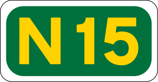
The N15 road is a national primary road in the north-west of Ireland. It runs from Sligo to Lifford, County Donegal. It forms part of the proposed Atlantic Corridor route. It also goes to the border with Northern Ireland.
Convoy is a village in the east of County Donegal in the north-west of Ulster, the northern province in Ireland. The village is located in the Finn Valley district and is part of the Barony of Raphoe South. It is situated on the Burn Dale, and is located on the R236 road to Raphoe.

The River Swilly is a river in County Donegal, Ireland, which flows in an eastern direction through Letterkenny. Letterkenny, the largest town in County Donegal, is built on the river and became the first crossing point on the river in the 17th century.

The A5 is a major primary route in Northern Ireland. It links the city of Derry in County Londonderry with Aughnacloy, County Tyrone via the towns of Strabane and Omagh. Just south of Aughnacloy is the border with the Republic of Ireland, where the A5 meets the N2 to Dublin. Between them the A5 and N2 are the main road link between County Donegal in the Republic and Dublin.

The N56 road is a national secondary road in the Republic of Ireland that runs from Donegal Town clockwise to Letterkenny. As originally designated, it included the section of the N13 between Stranorlar and Letterkenny, forming a circular route including parts of the N15.

The Border Region is a NUTS Level III statistical region of Ireland. The name of the region refers to its location along the Republic of Ireland–United Kingdom border. It is not a cross-border region. It comprises the Irish counties of Cavan, Donegal, Leitrim, Monaghan and Sligo. The Border Region spans 11,516 km2, 16.4% of the total area of the state, and has a population of 392,837 persons, 8.28% of the state total.
The Drumenny Burn, also known as the Drumonny Burn, the Drumenny River, the Drummenny River or the Drimminy River, is a burn in the south of County Donegal in Ulster, the northern province in Ireland. The lower stretch of the burn flows around the eastern edge of Donegal Town, where it flows into the River Eske. In the Ulster Scots dialect, a 'burn' is a stream or small river. The Drumenny Burn probably takes its name from the townland of Drumenny Upper, through which it flows, or else from the townlands of Drumenny Middle and Drumenny Lower, around the edges of which it flows. Almost all of the burn flows within the Civil Parish of Donegal.

