R374 road (Ireland)

Last updated

R374 Regional Route Shield Ireland.png

R374 road
Road network

The R374 road is a regional road in County Galway, Ireland.

Regional road (Ireland) Class of road in Ireland

A regional road in Ireland is a class of road not forming a major route, but nevertheless forming a link in the national route network. There are over 11,600 kilometres of regional roads. Regional roads are numbered with three-digit route numbers, prefixed by "R".

County Galway County in the Republic of Ireland

County Galway is a county in Ireland. It is located in the West of Ireland, part of the province of Connacht.

Republic of Ireland Ireland, a country in north-western Europe, occupying 5/6 of the island of Ireland; succeeded the Irish Free State (1937)

Ireland, also known as the Republic of Ireland, is a country in north-western Europe occupying 26 of 32 counties of the island of Ireland. The capital and largest city is Dublin, which is located on the eastern side of the island. Around a third of the country's population of 4.8 million people resides in the greater Dublin area. The sovereign state shares its only land border with Northern Ireland, a part of the United Kingdom. It is otherwise surrounded by the Atlantic Ocean, with the Celtic Sea to the south, St George's Channel to the south-east, and the Irish Sea to the east. It is a unitary, parliamentary republic. The legislature, the Oireachtas, consists of a lower house, Dáil Éireann, an upper house, Seanad Éireann, and an elected President who serves as the largely ceremonial head of state, but with some important powers and duties. The head of government is the Taoiseach, who is elected by the Dáil and appointed by the President; the Taoiseach in turn appoints other government ministers.

The official description of the R374 from the Roads Act 1993 (Classification of Regional Roads) Order 2006 [1] reads:

R374: Casla - Lettermullen, County Galway
Between its junction with R343 at Doire an Fhéich and its terminal point at its junction with local road 5234 at Leitir Mealláin Post Office via An Cheathrú Thair, Droichead Bhéal an Daingin, Leitir Móir, Droichead Charraig an Logáin, Tír an Fhia and Kiggaul Bridge all in the county of Galway.

See also

Roads in Ireland

The island of Ireland, comprising Northern Ireland and the Republic of Ireland, has an extensive network of tens of thousands of kilometres of public roads, usually surfaced. These roads have been developed and modernised over centuries, from trackways suitable only for walkers and horses, to surfaced roads including modern motorways. The major routes were established before Irish independence and consequently take little cognisance of the border other than a change of identification number and street furniture. Northern Ireland has had motorways since 1962, and has a well-developed network of primary, secondary and local routes. The Republic started work on its motorway network in the early 1980s; and historically, the road network there was once somewhat less well developed. However, the Celtic Tiger economic boom and an influx of European Union structural funding, saw national roads and regional roads in the Republic come up to international standard quite quickly. In the mid-1990s, for example, the Republic went from having only a few short sections of motorway to a network of motorways, dual carriageways and other improvements on most major routes as part of a National Development Plan. Road construction in Northern Ireland now tends to proceed at a slower pace than in the Republic, although a number of important bypasses and upgrades to dual carriageway have recently been completed or are about to begin.

National primary road Ireland

A national primary road is a road classification in Ireland. National primary roads form the major routes between the major urban centres. There are 2649 km of national primary roads. This category of road has the prefix "N" followed by one or two digits. Motorways are prefixed "M" followed by one or two digits.

National secondary road Wikimedia list article

A national secondary road is a category of road in Ireland. These roads form an important part of the national route network, but are secondary to the main arterial routes which are classified as national primary roads. National secondary roads are designated with route numbers higher than those used for primary roads, but with the same "N" prefix. Routes N51 and higher are all national secondary roads.

Related Research Articles

R336 road (Ireland)

The R336 road is a regional road in County Galway in Ireland which connects the N59 road at Leenaun beside Killary Harbour – via Inverin – to the N6 and N83 in Galway, 83 kilometres (52 mi) to the southeast.

R446 road (Ireland)

The R446 road a regional road in Ireland. The road connects Kinnegad in County Westmeath to Galway City. Prior to the construction of the M6 motorway the R446 formed the main N6 road connecting Dublin and Galway. Following the opening of the M6; the old N6 road was downgraded to regional road status and was designated as the R446. The road is an alternative route between Galway and Dublin and runs in parallel to the M6.

R135 road (Ireland)

The R135 road is one of Ireland's newest regional roads, being a reclassification of those sections of the former N2 which were bypassed when the N2(M2) Ashbourne By-Pass dual carriageway opened in 2006, and when the Carrickmacross, Castleblayney & Monaghan bypasses were completed.

N83 road (Ireland) road in Ireland

The N83 road is a national secondary road in Ireland that runs from its junction with the N17 just south of Ireland West Airport Knock in County Mayo to a point just north of Tuam, County Galway where it rejoins the N17. On 27 September 2017, the old N17 from the Kilmore Roundabout in Tuam to the junction with the N6 in Galway city was redesignated as the N83.

R323 road (Ireland)

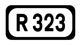
The R323 road is a regional road in County Mayo, Ireland. Going from west to east, the route connects the towns of Kiltimagh, Knock, and Ballyhaunis. En route it crosses over the N17 national primary road at a grade separated junction in the village of Knock.

R327 road (Ireland)

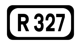
The R327 road is a regional road in Ireland connecting the N60 east of Claremorris, County Mayo, to the R360 in County Galway.

R284 road (Ireland)

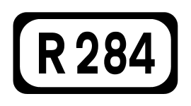
The R284 road is a regional road in Ireland linking Sligo to Leitrim village in County Leitrim. En route it passes through Ballygawley, Ballyfarnan, Geevagh and Keadue. The road is 46 km (29 mi) long.

R147 road (Ireland)

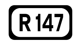
The R147 is a regional road in Ireland. Its first section runs from St Peters Church in Phibsborough, Dublin to its junction with the M50. It then follows the route of a former section of the N3 between Clonee and Kells. It serves as an alternative route for non-motorway traffic and traffic wishing to avoid tolls on the M3.

R331 road (Ireland)

The R331 road is a regional road in southeast County Mayo, Ireland. The route connects the towns of Claremorris and Ballinrobe, and links the N60 road with the N84 road.

R806 road (Ireland)

The R806 road is a regional road in Dublin, Ireland.

R819 road (Ireland)

The R819 road is a regional road in Dublin, Ireland.

R328 road (Ireland)

The R328 road is a regional road in Counties Mayo and Galway in Ireland, connecting Ballindine on the N17 to Moylough on the N63.

R364 road (Ireland)

The R364 road is a regional road in County Galway, Ireland connecting Moylough on the N63 to near Ballymoe on the N60.

R300 road (Ireland)

The R300 road is a regional road in southwest County Mayo and north County Galway in Ireland. It connects the R330 road at Cloonee and the nearby N84 road at Partry to the R345 road at Clonbur, 36.2 kilometres (22.5 mi) to the south. It passes through the area known as Joyce Country between the Partry Mountains and Lough Mask.

R345 road (Ireland)

The R345 road is a regional road in north County Galway and southwest County Mayo in Ireland. It connects the R336 road at Maum to the R334 road at Neale, 26.4 kilometres (16.4 mi) to the east. It crosses the winding border between the two counties a number of times.

R334 road (Ireland)

The R334 road is a regional road in south County Mayo and north County Galway in Ireland. It connects the N84 road at Ballinrobe to the N84 road again at Headford, 20.8 kilometres (12.9 mi) to the south. It passes to the east of Lough Mask and Lough Corrib.

R356 road (Ireland)

The R356 road is a regional road in Ireland linking Killimor, County Galway with Cloghan, County Offaly. The road also travels through the towns of Eyrecourt and Banagher. At Banagher the road crosses the River Shannon via a seven arch bridge erected by the Commissioners for the Improvement of Navigation of the Shannon in 1841–1843.

R313 road (Ireland)

The R313 road is a regional road in County Mayo in Ireland. It connects the town of Bangor Erris to Blacksod at the tip of the Mullet Peninsula, 40 kilometres (25 mi) away.

R332 road (Ireland)

The R332 road is a regional road in County Galway and County Mayo in Ireland. It connects the N63 road at Horseleap Cross near Moylough in County Galway, via Tuam, to the N84 road at Kilmaine in County Mayo, 38 kilometres (24 mi) away.

R200 road (Ireland)

The R200 road is a regional road in County Leitrim and County Cavan, Ireland. Going from west to east, the route connects the towns of Drumkeeran, Dowra, Glangevlin and Derrynacreeve. En route it crosses the R207 at Dowra, is joined by the R206 at Glengavlen, passes through the Bellavally Gap before terminating in Derrynacreeve at the N87 national secondary route.

References