| |
|---|---|
| Route information | |
| Length | 2.4 km (1.5 mi) |
| Location | |
| Primary destinations |
|
| Road network | |

The R773 road is a regional road in Ireland. The road connects Jack White's with Brittas Bay and the coast.
| |
|---|---|
| Route information | |
| Length | 2.4 km (1.5 mi) |
| Location | |
| Primary destinations |
|
| Road network | |
The R773 road is a regional road in Ireland. The road connects Jack White's with Brittas Bay and the coast.
The route begins at its junction with the M11 near Jack White's Pub. The route travels east towards Brittas Bay passing a few housing estates. The route terminates at its junction with the R750 in Brittas Bay.

The island of Ireland, comprising Northern Ireland and the Republic of Ireland, has an extensive network of tens of thousands of kilometres of public roads, usually surfaced. These roads have been developed and modernised over centuries, from trackways suitable only for walkers and horses, to surfaced roads including modern motorways. The major routes were established before Irish independence and consequently take little cognisance of the border other than a change of identification number and street furniture. Northern Ireland has had motorways since 1962, and has a well-developed network of primary, secondary and local routes. The Republic started work on its motorway network in the early 1980s; and historically, the road network there was once somewhat less well developed. However, the Celtic Tiger economic boom and an influx of European Union structural funding, saw national roads and regional roads in the Republic come up to international standard quite quickly. In the mid-1990s, for example, the Republic went from having only a few short sections of motorway to a network of motorways, dual carriageways and other improvements on most major routes as part of a National Development Plan. Road construction in Northern Ireland now tends to proceed at a slower pace than in the Republic, although a number of important bypasses and upgrades to dual carriageway have recently been completed or are about to begin.

The N81 road is a national secondary road in Ireland, from the M50 motorway to Tullow, County Carlow, north to south. The N81 continues past Tullow for another 8 km to terminate at the village of Closh, County Carlow, where it intersects the N80. The N81 is 76.784 km (47.711 mi) long. The road is a dual carriageway between M50 motorway and west of Tallaght, known as the Tallaght Bypass or Blessington Road. It intersects with the M50 motorway at Junction 11. There are plans to extend the dual carriageway by 5 km (3.1 mi) to the urban boundary.

The R113 road is a regional road in Ireland. Located in Dublin, it forms a semi-orbital route around the south of the city. As of 2007, clockwise, it starts at the N31 at Temple Hill in Blackrock and ends at a junction with the N4 at Palmerstown.

The R148 road is one of Ireland's regional roads which was classified following the opening of a by-passed national primary road.

A national secondary road is a category of road in Ireland. These roads form an important part of the national route network, but are secondary to the main arterial routes which are classified as national primary roads. National secondary roads are designated with route numbers higher than those used for primary roads, but with the same "N" prefix. Routes N51 and higher are all national secondary roads.

The R336 road is a regional road in County Galway in Ireland which connects the N59 road at Leenaun beside Killary Harbour – via Inverin – to the N6 and N83 in Galway, 83 kilometres (52 mi) to the southeast.

Brittas Bay in County Wicklow, Ireland is a 4 kilometres (2.5 mi) stretch of beach on the Irish Sea coast, about 12 kilometres (7.5 mi) south of Wicklow. The beach and associated dunes are very popular with Dubliners and are one of the most frequented beaches by residents of the capital during the summer.
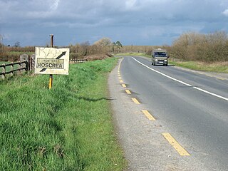
The N62 road is a national secondary road in Ireland. It links the M6 motorway east of Athlone, County Westmeath with junction 6 of the M8 motorway at Kilnoe near Horse and Jockey in County Tipperary, 96.625 kilometres (60.040 mi) to the south. The route also forms a junction with the M7 motorway south of Roscrea.

The R446 road is a regional road in Ireland. The road connects Kinnegad in County Westmeath to Galway City. Prior to the construction of the M6 motorway the R446 formed the main N6 road connecting Dublin and Galway. Following the opening of the M6; the old N6 road was downgraded to regional road status and was designated as the R446. The road is an alternative route between Galway and Dublin and runs in parallel to the M6.
The R415 road is a regional road in Ireland, which runs north-south from its junction with the R403 in Allenwood to the R448 at Crookstown, passing through Kildare town, and crossing the N78 between Kilcullen and Athy. The route is entirely within County Kildare.

The R750 road is a regional road in County Wicklow, Ireland. From its junction with the R772 in Rathnew on the outskirts of Wicklow Town it takes a generally southerly route to its junction with the R772 in Ferrybank in Arklow, where it terminates.

The R413 road is a regional road in Ireland, which runs west-east from Kildare to Ballymore Eustace, all in County Kildare. En route, it skirts, and largely demarcates, 10 km (6.2 mi) of the northern edge of the Curragh.

The R284 road is a regional road in Ireland linking Sligo to Leitrim village in County Leitrim. En route it passes through Ballygawley, Ballyfarnan, Geevagh and Keadue. The road is 46 km (29 mi) long.

The R114 road is a regional road in south Dublin, Ireland. The road runs from the city centre to Brittas in remote southwest County Dublin via Rathmines, Rathgar, Rathfarnham, Knocklyon, Firhouse and the mountainous area of Boharnabreena. The final stretch of the road runs just north of the border between County Dublin and County Wicklow, parallel to the Brittas River and a canal to the River Camac, which rises just to the north.

The R111 road is a regional road in south Dublin, Ireland, and includes a major element of the Dublin Outer Orbital Route.

The R147 is a regional road in Ireland. Its first section runs from St Peters Church in Phibsborough, Dublin to its junction with the M50. It then follows the route of a former section of the N3 between Clonee and Kells. It serves as an alternative route for non-motorway traffic and traffic wishing to avoid tolls on the M3.

The R134 road is a regional road in South Dublin, Ireland connecting the R110 to the R120.

The R315 road is a regional road in County Mayo in Ireland. It connects the R310 road at Pontoon to the R314 road at Ballycastle, 41.7 kilometres (25.9 mi) away.

The R378 road is a regional road in County Mayo in Ireland. It runs along the south shore of Clew Bay and connects the R335 in Louisburgh to Roonagh Quay, 7.2 kilometres (4.5 mi) away.

The R137 road is a road in Dublin, Ireland connecting College Green in the City Centre to the junction of the M50 and N81 routes, via Dame Street, Patrick Street, Harold's Cross, Terenure, and Templeogue.