
The island of Ireland, comprising Northern Ireland and the Republic of Ireland, has an extensive network of tens of thousands of kilometres of public roads, usually surfaced. These roads have been developed and modernised over centuries, from trackways suitable only for walkers and horses, to surfaced roads including modern motorways. Driving is on the left-hand side of the road. The major routes were established before Irish independence and consequently take little cognisance of the border other than a change of identification number and street furniture. Northern Ireland has had motorways since 1962, and has a well-developed network of primary, secondary and local routes. The Republic started work on its motorway network in the early 1980s; and historically, the road network there was once somewhat less well developed. However, the Celtic Tiger economic boom and an influx of European Union structural funding, saw national roads and regional roads in the Republic come up to international standard quite quickly. In the mid-1990s, for example, the Republic went from having only a few short sections of motorway to a network of motorways, dual carriageways and other improvements on most major routes as part of a National Development Plan. Road construction in Northern Ireland now tends to proceed at a slower pace than in the Republic, although a number of important bypasses and upgrades to dual carriageway have recently been completed or are about to begin.
The N8 road is a national primary road in Ireland, connecting Cork with Dublin via the M7. The N8 is further classified by the United Nations as the entirety of the European route E 201, part of the trans-Europe International E-road network. The road is motorway standard from junction 19 on the M7 to the Dunkettle interchange in Cork City and is designated as the M8 motorway. From here the route continues into Cork city centre and terminates at the N22 road at St. Patrick's Street. The M8 motorway was completed in May 2010, replacing the single carriageway sections of the old N8 and bypassing towns on the main Cork to Dublin road. It is now possible to travel from Cork to Dublin on the M/N8 in about 2 hours 30 minutes. The route commences just south of Portlaoise, and reaches Cork via the midlands and the Golden Vale of Ireland, through Counties Laois, Kilkenny, Tipperary, Limerick and Cork.

The R756 road is a regional road in Ireland running west–east from Dunlavin to Laragh. Its entire 32 km (20 mi) length is within County Wicklow crossing east–west through the Wicklow Gap.

The R730 road is a regional road in County Wexford, Ireland. From its junction with the R702 in Kiltealy it takes a southeasterly route to its junction with the R741 in the centre of Wexford Town, continuing south to Blackhorse to its junction on a roundabout with the N25 Wexford bypass. En route it crosses the N30 national primary road. The road is 35 km (22 mi) long.

The R666 road is a regional road in Ireland which runs west-east from the R639 in Fermoy town centre to the bridge over the River Blackwater on the outskirts of Lismore. The road passes through Ballyduff, and beneath the River Blackwater viaduct which carries the M8 motorway. The R666 begins in Fermoy as the Rathhealy Road. From here to its merger with the R667 road 3km south of Kilworth, the R666 was once part of the historic road linking Dublin and Cork. It was mapped as such by Herman Moll in his 1714 New Map of Ireland.
The R670 road is a regional road in Ireland. The route runs from its junction with the R639 and N24 at Cloughabreeda 2 km north of Cahir through Cahir town and onwards for a further 8 km to Ardfinnan, where it joins the R665 road. The R670 is located entirely in County Tipperary.

The R667 road is a regional road in Ireland. The route runs from its junction with the N8 1 km from Kilworth for approximately 5 km until it meets the R666 road northeast of Fermoy. The R667 was once part of the main road from Dublin to Cork, and was mapped as such by Herman Moll in his New Map of Ireland in 1714. The road is located entirely in County Cork.

The R106 road is a regional road in north Dublin, Ireland. It runs from Sutton, passing Baldoyle, Portmarnock and Malahide before finishing in Swords.

The R109 road is a regional road in west Dublin, Ireland. It runs from Kylemore Road via Chapelizod, the Phoenix Park and the western edge of the city centre.

The R123 road is a regional road in Fingal, Ireland.

The R124 road is a regional road in Fingal, Ireland.
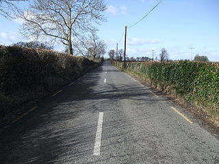
The R131 road is a regional road in Dublin, Ireland.

The R804 road is a regional road in Dublin, Ireland.

The R820 road is a regional road in Dublin, Ireland.
The R829 road is a regional road in Dún Laoghaire–Rathdown, Ireland connecting Monkstown and Dalkey.
The B136 links the A47 at facing junction on the left from the Belleek direction before proceeding onwards on the north shore of Lower Lough Erne and opposite Boa Island which the A47 traverses. The B136 continues along the 'Triangle' of County Fermanagh with the former Great Northern Railway of Ireland trackbed of the closed railway on the righthand side. The road continues into County Donegal at Mulnagoad and into Aghafoy with a junction into the R232 Pettigoe Road with a connection on the left for Laghy and on the right for Pettigo.

The R729 road is a regional road in County Carlow and County Wexford in Ireland. It connects the R702 near Borris to the R714 near New Ross, 22.1 km (13.7 mi) to the south.

The R181 is a regional road in Ireland, running from the R162 near Shercock to the border with Northern Ireland near Keady, where it meets the B32.
The R234 road is a regional road in Ireland which links the Republic of Ireland–United Kingdom border with the R232 near Pettigo in County Donegal.

