County Waterford is a county in Ireland. It is in the province of Munster and is part of the South-East Region. It is named after the city of Waterford. Waterford City and County Council is the local authority for the county. The population of the county at large, including the city, was 116,176 according to the 2016 census. The county is based on the historic Gaelic territory of the Déise. There is an Irish-speaking area, Gaeltacht na nDéise, in the south-west of the county.

Waterford is a city in County Waterford in the south-east of Ireland. It is located within the province of Munster. The city is situated at the head of Waterford Harbour. It is the oldest and the fifth most populous city in Ireland. It is the ninth most populous settlement on the island of Ireland. Waterford City and County Council is the local government authority for the city. According to the 2016 Census, 53,504 people live in the city, with a wider metropolitan population of 82,963.

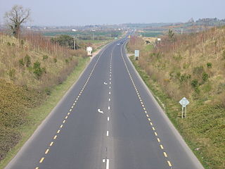
Dungarvan is a coastal town and harbour in County Waterford, on the south-east coast of Ireland. Prior to the merger of Waterford County Council with Waterford City Council in 2014, Dungarvan was the county town and administrative centre of County Waterford. Waterford City and County Council retains administrative offices in the town. The town's Irish name means "Garbhann's fort", referring to Saint Garbhann who founded a church there in the seventh century. The town lies on the N25 road, which connects Cork, Waterford and Rosslare Europort.
The N9 road is a national primary road in Ireland running from Junction 11 on the M7, located near Kilcullen, County Kildare, to Waterford city. The route connects Dublin and Waterford. The section of the route from junction 11 on the M7 at Kilcullen to the intersection with the N24 road outside Waterford is motorway standard since 2010 and is designated as the M9 motorway. In line with Irish practice, all sections previously designated N9 were renumbered at that time. Only a short (550-metre) section of the route is still designated as N9 between the Quarry roundabout junction with the N24 and the N25 Grannagh Roundabout junction. This section is dual carriageway.

The N10 road is a national primary road in Ireland, connecting Kilkenny to the M9 Dublin – Waterford route. It consists of a route from northeast of Kilkenny, a ring road around the city, and a route southeast of the city.

A regional road in the Republic of Ireland is a class of road not forming a major route, but nevertheless forming a link in the national route network. There are over 11,600 kilometres of regional roads. Regional roads are numbered with three-digit route numbers, prefixed by "R". The equivalent road category in Northern Ireland are B roads.
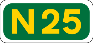
The N25 road is a national primary road in Ireland, forming the route from Cork to Rosslare Europort via Waterford City. The road is part of the E30 European route and a short section is also part of the E01 European route. It forms part of the proposed Atlantic Corridor route.

The Waterford County Board of the Gaelic Athletic Association (GAA) or Waterford GAA is one of the 32 county boards of the GAA in Ireland, and is responsible for all levels of Gaelic games in County Waterford. The County Board is also responsible for the Waterford county teams. The county board's offices are based at Walsh Park in the city of Waterford. The Waterford County Board was founded in 1886.
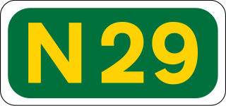
The N29 road is a national primary road in Ireland. It connects the Port of Waterford at Belview, County Kilkenny to Waterford City via the N25. The road and port are located on the north bank of the River Suir.

The N72 road is a national secondary road in Ireland that runs east-west from its junction with the N25 near Dungarvan in County Waterford to the N70 in Killorglin in County Kerry.

The R710 road is a regional road in Ireland. Located in the south of Ireland at Waterford, it forms the Outer Ring Road around the south of the city. As of December 2006 it commences on the Old Kilmeaden Road at Knockhouse Lower, west of Waterford City and ends at a junction with the R683 on the Dunmore Road in the south-east of the city.

The R683 road is a regional road in County Waterford, Ireland. It connects Waterford city to the village and ferry port of Passage East. The ferry operates across the River Barrow estuary to the village of Ballyhack, County Wexford.
The R684 road is a regional road in County Waterford, Ireland. It runs near Waterford City, linking the junction with the R683 at Blenheim Cross to the village of Dunmore East.

Tallow is a town, civil parish and townland in County Waterford, Ireland. Tallow is in the province of Munster near the border between County Cork and County Waterford and situated on a small hill just south of the River Bride.

The M9 motorway is a motorway in Ireland linking the M7 between Naas and Newbridge near Kilcullen to Waterford. Opened in sections between 1994 and 2010, the final section opened on 9 September 2010.

The R448 road is a regional road in Ireland. It is the designation given to the former N9 national primary road when it was bypassed by the M9 motorway.

The R665 road is a regional road in Ireland. The route runs from Mitchelstown to Clonmel via Ballyporeen, Clogheen and Ardfinnan, passing through parts of counties Cork, Tipperary and Waterford. The R665 was once a key part of the historic route from Dublin to Cork and was mapped as such as late as 1778. A turnpike road, it was also a key part of the route linking Mallow with Dublin, via today's N73.
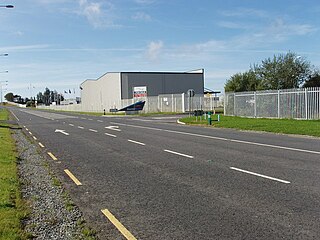
The R708 road is a regional road in County Waterford, Ireland. It travels from Waterford city centre to Waterford Airport and then to the R685. The road is 10.3 kilometres (6.4 mi) long.
The R634 road is a regional road in Ireland. It travels from the N25 road outside Youghal, County Cork, north to the N72 in County Waterford, via Youghal town centre and the village of Tallow, County Waterford. The road is 28.8 kilometres (17.9 mi) long.

The R671 road is a regional road in Ireland. It travels from Clonmel, County Tipperary to the N25 road in County Waterford, via the villages of Ballymacarbry and Clashmore. It follows the route of the former national trunk road T27. The road is 55.4 kilometres (34.4 mi) long.