
A ring road is a road or a series of connected roads encircling a town, city, or country. The most common purpose of a ring road is to assist in reducing traffic volumes in the urban centre, such as by offering an alternate route around the city for drivers who do not need to stop in the city core. Ring roads can also serve to connect suburbs to each other, allowing efficient travel between them.

The London Inner Ring Road, or Ring Road as signposted, is a 12-mile (19 km) route with an average diameter of 2.75–5.5 miles (4.43–8.85 km) formed from a number of major roads that encircle Central London. The ring road forms the boundary of the London congestion charge zone, although the ring road itself is not part of the zone.

The island of Ireland, comprising Northern Ireland and the Republic of Ireland, has an extensive network of tens of thousands of kilometres of public roads, usually surfaced. These roads have been developed and modernised over centuries, from trackways suitable only for walkers and horses, to surfaced roads including modern motorways. Driving is on the left-hand side of the road. The major routes were established before Irish independence and consequently take little cognisance of the border other than a change of identification number and street furniture. Northern Ireland has had motorways since 1962, and has a well-developed network of primary, secondary and local routes. The Republic started work on its motorway network in the early 1980s; and historically, the road network there was once somewhat less well developed. However, the Celtic Tiger economic boom and an influx of European Union structural funding, saw national roads and regional roads in the Republic come up to international standard quite quickly. In the mid-1990s, for example, the Republic went from having only a few short sections of motorway to a network of motorways, dual carriageways and other improvements on most major routes as part of a National Development Plan. Road construction in Northern Ireland now tends to proceed at a slower pace than in the Republic, although a number of important bypasses and upgrades to dual carriageway have recently been completed or are about to begin.
The N7 road is a national primary road in Ireland, connecting Limerick and Dublin. The majority of the route is motorway standard and is designated as the M7 motorway. At the Rosbrien interchange in Limerick the route continues as the N18 dual carriageway to Shannon and Ennis. The road passes through the midlands of Ireland, and acts as a trunk route out of Dublin for the N8 and N9 national primary routes to Cork and Waterford respectively. It forms part of European route E20.

The N11 road is a national primary road in Ireland, running for 129 km (80 mi) along the east side of Ireland from Dublin to Wexford. It passes close to Bray, Greystones, Wicklow, Arklow, Gorey, and Enniscorthy. Beyond Wexford, the route continues to Rosslare as the N25. The road forms part of European route E01. As of July 2019 the N11/M11 is of dual carriageway or motorway standard from Dublin as far as Oilgate in County Wexford.

The Leeds Inner Ring Road is part-motorway and part-A roads in Leeds, West Yorkshire, England, which forms a ring road around the city centre. It has six different road numbers that are all sections of longer roads. Clockwise, the roads are the A58(M), a motorway section of the A58 road; the A64(M), part of the A64 road; the A61 between York Road and the M621; the M621 between junctions 4 and 2; and the A643 between the M621 and A58. The motorway section is in total is 2.5 miles (4.0 km) long and is subject to a 40 miles per hour (64 km/h) speed limit throughout.

The N10 road is a national primary road in Ireland, connecting Kilkenny to the M9 Dublin – Waterford route. It consists of a route from northeast of Kilkenny, a ring road around the city, and a route southeast of the city.

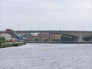
The R509 road, the Childers Road, is a regional road in Ireland, running through the southeastern side of Limerick City. It forms what is somewhat akin to an inner ring road.

The A4150 Wolverhampton Inner Ring Road is a ring road that encircles the city centre of Wolverhampton in the West Midlands, England. The circumference of the road is around 2.1 miles (3.4 km). Technically, the route is listed as an "Inner Ring Road", although only a tiny section of the "Outer Ring Road" was ever constructed with only one of the two designed carriageways built. A second carriageway was built in 2017 along a short stretch between Patshull Avenue and Stafford Road. The section of outer ring road is called Wobaston Road and classified as U119.

Bundesautobahn 10 is an orbital motorway around the German capital city of Berlin. Colloquially called Berliner Ring, it is predominantly located in the state of Brandenburg, with a short stretch of 5 km in Berlin itself. It should not be confused with the Berliner Stadtring around Berlin's inner city.
The Glasgow Inner Ring Road was a proposed ring road encircling the city centre of Glasgow, Scotland. Construction of the roads began in 1965, and half of its circumference was completed by 1972, but no subsequent construction was made and the remaining plans were formally abandoned in 1980. After 30 years, a route following roughly the southern section of the proposals have also been created as the new M74.

The R136 road is a regional road in Ireland, located in the southwest of Dublin. Named the Outer Ring Road, the route, which is dual carriageway, runs from the N4 at Lucan to the N81 at Tallaght, bypassing west of Clondalkin and crossing the N7 near Citywest. It was built as part of the planning for the new town of Adamstown.

The R710 road is a regional road in Ireland. Located in the south of Ireland at Waterford, it forms the Outer Ring Road around the south of the city. As of December 2006 it commences on the Old Kilmeaden Road at Knockhouse Lower, west of Waterford City and ends at a junction with the R683 on the Dunmore Road in the south-east of the city.
Sheffield Inner Ring Road is a dual-carriageway circling central Sheffield, South Yorkshire, England. Marked up as the A61 all the way around, it was built from the 1960s onwards. The Ring Road connects to the Sheffield Parkway, which itself connects with the M1 motorway. Many of Sheffield's current and under construction major office premises and luxury apartments are located on the Ring Road.

The R686 road is a regional road in Ireland, located in Waterford City. It runs roughly north–south, to the west of the inner city.

The M8 motorway is an inter-urban motorway in Ireland, which forms part of the motorway from the capital Dublin to Cork city. The 149 km motorway commences in the townland of Aghaboe, County Laois and runs through the counties of Kilkenny, Tipperary and Limerick, terminating at the Dunkettle interchange in Cork City. First called for in the Road Needs Study (1998), it was later incorporated into the National Development Plan (2000–2006) and later still formed part of the Irish Government's Transport 21 plan for infrastructural development. The majority of the M8 (115 km) was built between 2006 and 2010. On 28 May 2010, the motorway was completed and had replaced almost all of the single-carriageway N8 except for a short section of urban road in Cork City.

The North Circular Road, designated as the R101 regional road, is an important thoroughfare on the northside of Dublin, in Ireland. It is the northside equivalent of the South Circular Road.
Adelaide has two city ring routes, that loop around the Adelaide city centre and North Adelaide, known as the Inner and Outer Ring Routes.
This article deals with transport in Waterford city in Ireland. The city is connected by road, rail, bus, air and sea. There are currently proposals for a bus rapid transit (BRT) system, consisting of bus trams, or streetcars, to be used in future.

The N40 road is a national primary road in Cork City, Ireland. The road runs through Cork City forming a distributor route through the south side of the city, linking the N22 at Ballincollig in the west to the N25 at the Dunkettle Interchange in the east. The present N40 was created on 23 February 2012 via statutory instrument. The newly designated N40 was formed from parts of both the N22 and N25. It is intended that once the Cork North Ring Road is completed, that the N40 will comprise a complete orbital route through the inner city.
