
Thomastown, historically known as Grennan, is a town in County Kilkenny in the province of Leinster in the south-east of Ireland. It is a market town along a stretch of the River Nore which is known for its salmon and trout, with a number of historical landmarks in the vicinity. Visitor attractions include Jerpoint Abbey, Kilfane Glen gardens, and Mount Juliet Golf Course. The town is in a civil parish of the same name.

The N81 road is a national secondary road in Ireland, from the M50 motorway to Tullow, County Carlow, north to south. The N81 continues past Tullow for another 8 km to terminate at the village of Closh, County Carlow, where it intersects the N80. The N81 is 76.784 km (47.711 mi) long. The road is a dual carriageway between M50 motorway and west of Tallaght, known as the Tallaght Bypass or Blessington Road. It intersects with the M50 motorway at Junction 11. There are plans to extend the dual carriageway by 5 km (3.1 mi) to the urban boundary.
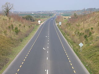
The N9 road is a national primary road in Ireland running from Junction 11 on the M7, located near Kilcullen, County Kildare, to Waterford city. The route connects Dublin and Waterford. The section of the route from junction 11 on the M7 at Kilcullen to the intersection with the N24 road outside Waterford is motorway standard since 2010 and is designated as the M9 motorway. In line with Irish practice, all sections previously designated N9 were renumbered at that time. Only a short (550-metre) section of the route is still designated as N9 between the Quarry roundabout junction with the N24 and the N25 Grannagh Roundabout junction. This section is dual carriageway.

A regional road in the Republic of Ireland is a class of road not forming a major route, but nevertheless forming a link in the national route network. There are over 11,600 kilometres of regional roads. Regional roads are numbered with three-digit route numbers, prefixed by "R". The equivalent road category in Northern Ireland are B roads.

The R445 road is a regional road in Ireland. The route is a non-motorway alternative route to the N7/M7 motorway between Naas and Limerick, and at 170 km it is one of the longest regional roads in Ireland. Indeed, much of the route comprises roads that were formerly part of the N7 between the cities, prior to motorway and other bypasses. Some of the R445 route also comprises local link roads to new N7/M7 route sections.

A national secondary road is a category of road in Ireland. These roads form an important part of the national route network but are secondary to the main arterial routes which are classified as national primary roads. National secondary roads are designated with route numbers higher than those used for primary roads, but with the same "N" prefix. Routes N51 and higher are all national secondary roads.

The N24 road is a national primary road in Ireland forming a route from Limerick to Waterford, running through County Tipperary and passing Tipperary town, Cahir, Carrick-on-Suir and Clonmel. The route begins at its junction with the Limerick Southern M7 ring road.
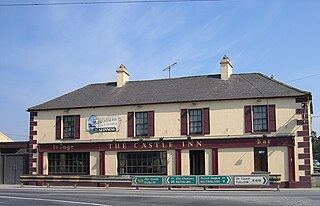
Castledermot is an inland town in the south-east of Ireland in County Kildare, about 75 km (47 mi) from Dublin, and 10 km (6.2 mi) from the town of Carlow. The N9 road from Dublin to Waterford previously passed through the village but upon completion of a motorway bypass in 2010, it was re-designated the R448. The town is in a townland and civil parish of the same name.

Kilcullen, formally Kilcullen Bridge, is a small town on the River Liffey in County Kildare, Ireland. Its population of 3,815 at the 2022 census made it the 13th largest settlement in County Kildare. From 2002 to 2011, it was one of the fastest growing towns in the county, doubling its population from 1,483 to 3,473. It is situated primarily in the Barony of Kilcullen, with a part in the Barony of Naas South, and subsidiary areas include Logstown, Harristown, Carnalway and Brannockstown, Gilltown, Nicholastown, and Castlemartin.

The R747 road is a regional road in Ireland running north-west/south-east from the M9 near Ballitore in County Kildare to Arklow in County Wicklow, a distance of 66 km (41 mi).

The R639 road is one of Ireland's regional roads. Once designated the N8 national primary road, it was reclassified in stages as the R639 following the progressive opening of sections of the M8 motorway, which rendered the single carriageway N8 redundant as a national primary road. By-passed sections of the old N8 were generally reclassified as R639 as soon as a new section of M8 opened, thereby increasing the length of the R639. With the completion of the M8 on 28 May 2010, the R639 now stretches from Durrow, County Laois to Cork, running through counties Laois, Kilkenny, Tipperary, Limerick and Cork.

The N78 road is a national secondary road in Ireland. The 50-kilometer-long (31 mi) road links the N77 national secondary road north of Kilkenny, County Kilkenny to the M9 national primary route at Mullamast in County Kildare. En route it passes through the towns of Castlecomer in County Kilkenny, Ballylynan in County Laois, and Athy in County Kildare. It is single carriageway throughout.

The R418 road is a regional road in Ireland, which runs north-south from the R448 at Kilcullen to Athy, County Kildare, and then to the N81 in Tullow, County Carlow.
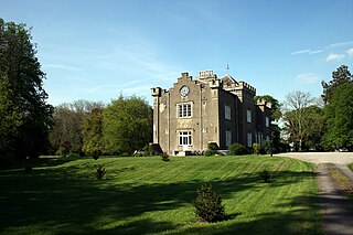
Paulstown is a small village in County Kilkenny in Ireland.
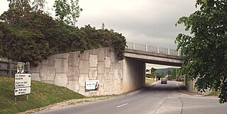
The R724 road is a regional road in County Carlow, Ireland. From its junction with the R448 at Royal Oak on the western edge of Bagenalstown Town it takes an easterly route crossing the River Barrow, the R705 regional road and the Dublin – Kilkenny railway line in the town.
The R415 road is a regional road in Ireland, which runs north-south from its junction with the R403 in Allenwood to the R448 at Crookstown, passing through Kildare town, and crossing the N78 between Kilcullen and Athy. The route is entirely within County Kildare.

The R413 road is a regional road in Ireland, which runs west-east from Kildare to Ballymore Eustace, all in County Kildare. En route, it skirts, and largely demarcates, 10 km (6.2 mi) of the northern edge of the Curragh.

The R417 road is a regional road in Ireland, which runs north-south from the R445 in Monasterevin, County Kildare to the R448 in Carlow, County Carlow.

The R702 road is a regional road in Ireland which runs west-east from the R712 at Coolgrange in County Kilkenny through Gowran before crossing into County Carlow at Goresbridge. It continues to Borris, passes through the Blackstairs Mountains via the Scullogue Gap into County Wexford and continues east until it terminates at a junction with the R890 in Enniscorthy.

The M9 motorway is a motorway in Ireland linking the M7 between Naas and Newbridge near Kilcullen to Waterford. Opened in sections between 1994 and 2010, the final section opened on 9 September 2010.


