County Waterford is a county in Ireland. It is in the province of Munster and is part of the Southern Region. It is named after the city of Waterford. Waterford City and County Council is the local authority for the county. The population of the county at large, including the city, was 127,363 according to the 2022 census. The county is based on the historic Gaelic territory of the Déise. There is an Irish-speaking area, Gaeltacht na nDéise, in the southwest of the county.

County Tipperary is a county in Ireland. It is in the province of Munster and the Southern Region. The county is named after the town of Tipperary, and was established in the early 13th century, shortly after the Norman invasion of Ireland. It is Ireland's largest inland county and shares a border with eight counties, more than any other. The population of the county was 167,895 at the 2022 census. The largest towns are Clonmel, Nenagh and Thurles.
The Golden Vale is the historic name given to an area of rolling pastureland in the province of Munster in southwestern Ireland. The area covers parts of three counties: Cork, Limerick and Tipperary. Considered the best land in Ireland for dairy farming, the region has been described as the "heart of the Munster dairying country".
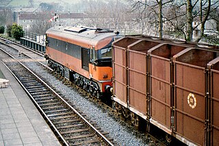
Cahir railway station serves the town of Cahir, County Tipperary in Ireland.

Tipperary Station is a railway station that serves the town of Tipperary, County Tipperary in Ireland. It is approximately 500 metres from centre of town.

The R639 road is one of Ireland's regional roads. Once designated the N8 national primary road, it was reclassified in stages as the R639 following the progressive opening of sections of the M8 motorway, which rendered the single carriageway N8 redundant as a national primary road. By-passed sections of the old N8 were generally reclassified as R639 as soon as a new section of M8 opened, thereby increasing the length of the R639. With the completion of the M8 on 28 May 2010, the R639 now stretches from Durrow, County Laois to Cork, running through counties Laois, Kilkenny, Tipperary, Limerick and Cork.

Curreeny is a townsland in North County Tipperary, Ireland. It is situated 16 km from Nenagh, in the Roman Catholic parish of Templederry. Curreeny is on the R497 regional road, which is the main road from Nenagh to Tipperary Town. Curreeny is in close proximity to Dolla, Templederry and Kilcommon villages and within reasonable driving distance from Limerick city, Nenagh, Thurles, Templemore, Tipperary, Newport and Cashel.
Tipperary Racecourse is a horse racing venue in County Tipperary, Ireland which stages both National Hunt and Flat racing. The course is located adjacent to Limerick Junction railway station and approximately two miles from Tipperary town. Tipperary Racecourse is owned by Horse Racing Ireland. The course is left-handed and flat and measures one mile and two furlongs round. There is a five furlong sprint track which joins the main racecourse at the start of the straight.

The Nenagh River rises in the Silvermine Mountains in County Tipperary, Ireland. It flows east of Nenagh and into Lough Derg just north of Dromineer.
The Ollatrim River rises in County Tipperary, Ireland. It joins the Nenagh River east of Nenagh town and together they flow into Lough Derg north of Dromineer. A short section of the river forms the border between County Offaly and County Tipperary. The river flows through the Townland of Ollatrim.

The R885 road is a very short regional road in Ireland, located in Carrick-on-Suir, County Tipperary.

The R465 road, also called the Broadford Road, is a regional road in Ireland, located in County Clare.

The R441 road, also called the Rhode–Edenderry Road, is a regional road in Ireland, located in County Offaly.

The R496 road is a regional road in Ireland, located in County Clare and County Tipperary.

The R662 road is a regional road in Ireland, located in County Limerick and County Tipperary.

The R678 road is a regional road in Ireland, located in County Tipperary and County Waterford.
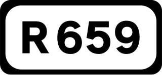
The R659 road is a regional road in Ireland, located in County Tipperary.

The R640 road is a regional road in Ireland, located near Cahir, County Tipperary.

The River Anner is a river in Ireland, flowing through County Tipperary, a tributary of the Suir.
Ballymackey is a townland and a civil parish in County Tipperary, Ireland. It is located between Toomevara and Cloughjordan It is in the Dáil constituency of Offaly which incorporates 24 electoral divisions that were previously in the constituency of North Tipperary.