The N7 road is a national primary road in Ireland, connecting Limerick and Dublin. The majority of the route is motorway standard and is designated as the M7 motorway. At the Rosbrien interchange in Limerick the route continues as the N18 dual carriageway to Galway, Shannon and Ennis. The road passes through the midlands of Ireland, and acts as a trunk route out of Dublin for the N8 and N9 national primary routes to Cork and Waterford respectively. It forms part of European route E20.

The R113 road is a regional road in Ireland. Located in Dublin, it forms a semi-orbital route around the south of the city. As of 2007, clockwise, it starts at the N31 at Temple Hill in Blackrock and ends at a junction with the N4 at Palmerstown.

The N14 road is a national primary road in the Republic of Ireland. The entirety of the route is located in the northwest of Ireland, in County Donegal, connecting Manorcunningham to Lifford in the east. Here it connects to the N15 near the border with Northern Ireland and along the A38 to Strabane in County Tyrone.
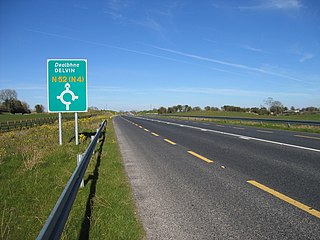
The N52 road is a national secondary road in Ireland. It links the M7 motorway from just south of Nenagh, County Tipperary to the M1 motorway north of Dundalk in County Louth. The route forms a connection between the north east of Ireland and the mid west traversing the midlands. It interchanges with the M6 at Kilbeggan and at Tyrrellspass, the N4 at Mullingar, the N3 at Kells, and the N2 at Ardee before continuing towards Dundalk.

The N59 road is a national secondary road in Ireland. It commences in County Sligo, south of Sligo Town at the Belladrehid interchange with the N4 north of Ballysadare. The route circles around the west of Ireland, passing west from Sligo into County Mayo and through Ballina. The N59 continues around Mayo, proceeding indirectly to Westport. Continuing south through Mayo into County Galway, the road passes through the village of Leenaun. The 182-year-old bridge in the centre of the village, carrying the road across the River Lahill, collapsed in floods on 18 July 2007. Due to the local terrain and road network, the diversionary route for getting from the south of the village to Westport was 110 km long. A temporary bridge was opened eight days after the floods, on 27 July. It has since been replaced by a new bridge.
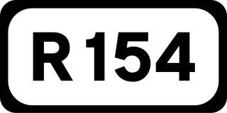
The R154 road is a regional road in Ireland, linking the R147 near Clonee, County Meath to Crossdoney in County Cavan. The road is single carriageway throughout. Many parts of the route have dangerous bends.

The R115 road is a regional road in counties Dublin and Wicklow in Ireland. It follows the Military Road for its entire length. The R115 is 40.5 km (25.2 mi) long; the full length of the Military Road is 57.9 km (36.0 mi).
The R755 road is a regional road in Ireland. It runs for its entire length in County Wicklow. From the village of Kilmacanogue on the N11 national primary road it goes north/south for 36 km (22 mi) to the town of Rathdrum.

The R116 road is a regional road in Ireland which runs east-west from the N11 at Loughlinstown to the R115 in Ballyboden. It runs through the South of County Dublin for its entire length.

The R446 road is a regional road in Ireland. The road connects Kinnegad in County Westmeath to Galway City. Prior to the construction of the M6 motorway the R446 formed the main N6 road connecting Dublin and Galway. Following the opening of the M6; the old N6 road was downgraded to regional road status and was designated as the R446. The road is an alternative route between Galway and Dublin and runs in parallel to the M6.
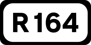
The R164 road is a regional road in Ireland, linking Kingscourt in County Cavan to the N51 near Athboy, County Meath.

The R725 road is a regional road in Ireland. From its junction with the N80 on the western outskirts of Carlow Town it takes an easterly route to its junction with the N81 in Tullow, where it crosses the River Slaney on a bridge shared with the N81 in the town centre. It continues east to Shillelagh in County Wicklow, turns due south for 6 km, then eastwards through Carnew. It then enters County Wexford for the final 15 km stretch, terminating in Gorey at the R772. The road is 53 km (33 mi) long.

The R400 road is a regional road in Ireland, linking Mullingar, County Westmeath to the R419 at Cushina, County Offaly.

The R165 road is a regional road in Ireland, linking the R188 5 km (3.1 mi) west of Cootehill in County Cavan to the N2 near Ardee, County Louth.
The R162 road is a regional road in Ireland, linking Monaghan Town to Navan, County Meath. The route is 80 km (50 mi) long.

The R421 road is a regional road in Ireland which runs southwest-northeast from the R445 south of Roscrea to the N52 north of Tullamore. The route also passes through Clareen, Kinnitty and Killurin. The bulk of the route is in County Offaly with small sections in counties Tipperary and Laois. The route is 50 km (31 mi) long.

The R420 road is a regional road in Ireland, which runs northwest-southeast from the R446 near Moate in County Westmeath to the R445 just west of Monasterevin. The road travels through the towns of Clara, Tullamore & Portarlington. The route is 35 km (22 mi) long.

The R730 road is a regional road in County Wexford, Ireland. From its junction with the R702 in Kiltealy it takes a southeasterly route to its junction with the R741 in the centre of Wexford Town, continuing south to Blackhorse to its junction on a roundabout with the N25 Wexford bypass. En route it crosses the N30 national primary road. The road is 35 km (22 mi) long.

The R810 road is a regional road in south Dublin, Ireland connecting Cornmarket to the Naas Road (N7).

The R138 road is a regional road in Ireland. It commences at the south end of O'Connell Bridge in Dublin city centre. It proceeds along D'Olier Street, College Street.


