
The island of Ireland, comprising Northern Ireland and the Republic of Ireland, has an extensive network of tens of thousands of kilometres of public roads, usually surfaced. These roads have been developed and modernised over centuries, from trackways suitable only for walkers and horses, to surfaced roads including modern motorways. Driving is on the left-hand side of the road. The major routes were established before Irish independence and consequently take little cognisance of the border other than a change of identification number and street furniture. Northern Ireland has had motorways since 1962, and has a well-developed network of primary, secondary and local routes. The Republic started work on its motorway network in the early 1980s; and historically, the road network there was once somewhat less well developed. However, the Celtic Tiger economic boom and an influx of European Union structural funding, saw national roads and regional roads in the Republic come up to international standard quite quickly. In the mid-1990s, for example, the Republic went from having only a few short sections of motorway to a network of motorways, dual carriageways and other improvements on most major routes as part of a National Development Plan. Road construction in Northern Ireland now tends to proceed at a slower pace than in the Republic, although a number of important bypasses and upgrades to dual carriageway have recently been completed or are about to begin.

A national secondary road is a category of road in Ireland. These roads form an important part of the national route network but are secondary to the main arterial routes which are classified as national primary roads. National secondary roads are designated with route numbers higher than those used for primary roads, but with the same "N" prefix. Routes N51 and higher are all national secondary roads.

The R756 road is a regional road in Ireland running west–east from Dunlavin to Laragh. Its entire 32 km (20 mi) length is within County Wicklow crossing east–west through the Wicklow Gap.
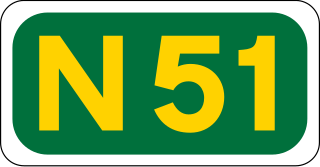
The N51 road is a national secondary road in Ireland. West to east, it starts in Delvin, County Westmeath at a junction with the N52. It passes through Athboy, a junction with M3 motorway, Navan and Slane, where it crosses the N2 road, all in County Meath, before crossing the M1 motorway and terminating near Drogheda in County Louth at a roundabout on the R132.

The N78 road is a national secondary road in Ireland. The 50-kilometer-long (31 mi) road links the N77 national secondary road north of Kilkenny, County Kilkenny to the M9 national primary route at Mullamast in County Kildare. En route it passes through the towns of Castlecomer in County Kilkenny, Ballylynan in County Laois, and Athy in County Kildare. It is single carriageway throughout.

The R417 road is a regional road in Ireland, which runs north-south from the R445 in Monasterevin, County Kildare to the R448 in Carlow, County Carlow.
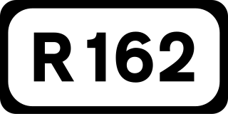
The R162 road is a regional road in Ireland, linking Monaghan Town to Navan, County Meath. The route is 80 km (50 mi) long.
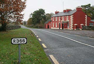
The R366 road is a regional road in Ireland linking R362 regional road to the N63 national secondary road in Roscommon Town. It passes through the hamlets of Castlecoote and Fuerty en route. The road is 9 km (5.6 mi) long and is located entirely in County Roscommon.

A local road in the Republic of Ireland is a public road not classified as a national primary road, national secondary road, or regional road but nevertheless forming a link in the national network of roads. Local roads are numbered with four- or five-digit route numbers, prefixed by "L".

The R522 road is a regional road in Ireland which runs 51 kilometres from Newcastlewest in County Limerick to the N73 national secondary road near Doneraile in County Cork, passing through Dromcolliher and Buttevant.

The R515 road is a regional road in Ireland which runs from 6 km (3.7 mi) east of Abbeyfeale in County Limerick to the N24 national secondary road in Tipperary Town. En route it passes through Dromcolliher, Charleville and Kilmallock. The road is 84 km (52 mi) long.

The R583 road is a regional road in Ireland in County Cork. It runs southwest to northeast from Millstreet to the N72 national secondary road between Mallow and Killarney. The road is 9 km long.
The R506 road is a regional road in the east of County Limerick, Ireland which runs west-east from its junction with the R445 regional road at Garraunykee, Annacotty and its junction with the R505 regional road in the townland of Dromsally on the outskirts of the village of Cappamore. En route it passes through the village of Murroe. The road is 18 km (11 mi) long.

The R123 road is a regional road in Fingal, Ireland.

The R126 road is a regional road in Fingal, Ireland.
The R129 road is a regional road in Fingal, Dublin, Ireland.

The R329 road is a regional road in east central County Mayo in Ireland. It connects the N17 road at Shanvaghera – via Knock – to the N17 road at Ballyfarnagh, 6.6 kilometres (4.1 mi) away.

The R763 road is a regional road in County Wicklow in Ireland. It connects the R764 road near Ashford to the R755 road at Annamoe, 10.8 kilometres (6.7 mi) away.

The R316 road is a regional road in County Mayo in Ireland. It connects the R312 at Boghadoon to the R315 road at Ballybrinoge near Crossmolina, 11 kilometres (6.8 mi) away.
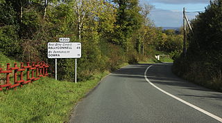
The R200 road is a regional road in County Leitrim and County Cavan, Ireland. Going from west to east, the route connects the towns of Drumkeeran, Dowra, Glangevlin and Derrynacreeve. En route it crosses the R207 at Dowra, is joined by the R206 at Glengavlen, passes through the Bellavally Gap before terminating in Derrynacreeve at the N87 national secondary route. The road is 34 kilometres (21 mi) long.
