R350 road (Ireland)

Last updated

R350 Regional Route Shield Ireland.png

R350 road
Route information
Length 12 km (7 mi)
Location
Primary
destinations
Road network
AttymonAthenryMountbellewR350 road %28Ireland%29
Sign on the R350 regional road
R350 road %28Ireland%29 Clickable image: click a name to go to its article

The R350 road is a regional road in Ireland starting in Loughrea Main St and going north for 12 km before terminating at the R348. En route it passes through Bullaun and passes close to the Turoe stone.

Regional road (Ireland) Class of road in Ireland

A regional road in Ireland is a class of road not forming a major route, but nevertheless forming a link in the national route network. There are over 11,600 kilometres of regional roads. Regional roads are numbered with three-digit route numbers, prefixed by "R".

Republic of Ireland Ireland, a country in north-western Europe, occupying 5/6 of the island of Ireland; succeeded the Irish Free State (1937)

Ireland, also known as the Republic of Ireland, is a country in north-western Europe occupying 26 of 32 counties of the island of Ireland. The capital and largest city is Dublin, which is located on the eastern side of the island. Around a third of the country's population of 4.8 million people resides in the greater Dublin area. The sovereign state shares its only land border with Northern Ireland, a part of the United Kingdom. It is otherwise surrounded by the Atlantic Ocean, with the Celtic Sea to the south, St George's Channel to the south-east, and the Irish Sea to the east. It is a unitary, parliamentary republic. The legislature, the Oireachtas, consists of a lower house, Dáil Éireann, an upper house, Seanad Éireann, and an elected President who serves as the largely ceremonial head of state, but with some important powers and duties. The head of government is the Taoiseach, who is elected by the Dáil and appointed by the President; the Taoiseach in turn appoints other government ministers.

Loughrea Town in Connacht, Ireland

Loughrea is a town in County Galway, Ireland. The town lies to the north of a range of wooded hills, the Slieve Aughty Mountains, and the lake from which it takes its name. The town is also famous for its cathedral which dominates the town's skyline. The town has increased in population in the late 20th and early 21st centuries. Although the town also serves as a commuter town for the city of Galway, it retains its vibrancy as an independent market town.

See also

Roads in Ireland

The island of Ireland, comprising Northern Ireland and the Republic of Ireland, has an extensive network of tens of thousands of kilometres of public roads, usually surfaced. These roads have been developed and modernised over centuries, from trackways suitable only for walkers and horses, to surfaced roads including modern motorways. The major routes were established before Irish independence and consequently take little cognisance of the border other than a change of identification number and street furniture. Northern Ireland has had motorways since 1962, and has a well-developed network of primary, secondary and local routes. The Republic started work on its motorway network in the early 1980s; and historically, the road network there was once somewhat less well developed. However, the Celtic Tiger economic boom and an influx of European Union structural funding, saw national roads and regional roads in the Republic come up to international standard quite quickly. In the mid-1990s, for example, the Republic went from having only a few short sections of motorway to a network of motorways, dual carriageways and other improvements on most major routes as part of a National Development Plan. Road construction in Northern Ireland now tends to proceed at a slower pace than in the Republic, although a number of important bypasses and upgrades to dual carriageway have recently been completed or are about to begin.

National primary road Ireland

A national primary road is a road classification in Ireland. National primary roads form the major routes between the major urban centres. There are 2649 km of national primary roads. This category of road has the prefix "N" followed by one or two digits. Motorways are prefixed "M" followed by one or two digits.

National secondary road Wikimedia list article

A national secondary road is a category of road in Ireland. These roads form an important part of the national route network, but are secondary to the main arterial routes which are classified as national primary roads. National secondary roads are designated with route numbers higher than those used for primary roads, but with the same "N" prefix. Routes N51 and higher are all national secondary roads.


Related Research Articles

R502 road (Ireland)

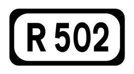
The R502 road is a regional road in Ireland. It links the R433 at a point approximately 1 km from Templemore, County Tipperary and the R639 at Johnstown, County Kilkenny where it joins the R435. It passes through Templetuohy, County Tipperary.

The R709 road is a regional road in Ireland. Located in the south of Ireland at Waterford, it forms the Inner Ring Road around the south of the inner city. It commences on the junction with the R686 at Ashe Road and ends at the junction with the R683 at Newtown Road, and passes via the Inner Ring Road, Richardson's Folly, Inner Ring Road and Passage Road.

N51 road (Ireland) road in Ireland

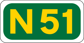
The N51 road is a national secondary road in Ireland. West to east, it starts in Delvin, County Westmeath at a junction with the N52. It passes through Athboy, a junction with M3 motorway, Navan and Slane, where it crosses the N2 road, all in County Meath, before crossing the M1 motorway and terminating near Drogheda in County Louth at a roundabout on the R132.

R357 road (Ireland)

The R357 road is a regional road in Ireland linking Athleague, County Roscommon and Blue Ball, County Offaly. It passes Ballinasloe, County Galway, crosses the River Shannon at Shannonbridge passes through Cloughan, County Offaly and then through the cutaway peatlands of Boora Bog to Blue Ball where it terminates at the N52.

R409 road (Ireland)

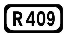
The R409 road is a regional road in Ireland that passes through the village of Caragh in County Kildare. It starts at Naas and travels north-west through Caragh village, passes Mondello Park race-track and ends at the intersection with the R403 road. The route is 13 km (8.1 mi) long.

R660 road (Ireland)

The R660 road is a regional road in Ireland which runs south-north from the centre of Cashel in County Tipperary to the centre of Thurles, also in County Tipperary. En route it passes through the village of Holycross, where it crosses the River Suir and passes the walls of Holy Cross Abbey.

R162 road (Ireland)

The R162 road is a regional road in Ireland, linking Monaghan Town to Navan, County Meath. The route is 80 km (50 mi) long.

R434 road (Ireland)

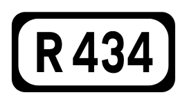
The R434 road is a regional road in Ireland linking Borris-in-Ossory on the R445 to Durrow on the N77. En route it passes through Aghaboe and Ballycolla, and over both the M7 and M8 motorways. The entire route is within County Laois.

R730 road (Ireland)

The R730 road is a regional road in County Wexford, Ireland. From its junction with the R702 in Kiltealy it takes a southeasterly route to its junction with the R741 in the centre of Wexford Town, continuing south to Blackhorse to its junction on a roundabout with the N25 Wexford bypass.

R731 road (Ireland)

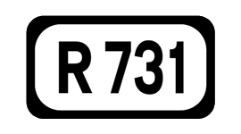
The R731 road is a regional road in County Wexford, Ireland. From its junction with the R730 it takes a route along the southeasterly flank of the Blackstairs Mountains to its junction with the R729 north of New Ross, where it terminates.

R427 road (Ireland)

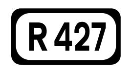
The R427 road is a regional road in Ireland, which runs southwest-northeast from the R425 in County Laois to the R417 in County Kildare.

R285 road (Ireland)

The R285 road is a regional road in Ireland linking the N4 at a point east of Boyle, County Roscommon to the R280 at Mountallen. The road lies entirely within County Roscommon.

R348 road (Ireland)

The R348 road is a regional road in Ireland stretching east-west for 51 km along a route north of the R446. It leaves the R446 east of Oranmore and rejoins it in Ballinasloe. The full length of the lies within County Galway.

R366 road (Ireland)

The R366 road is a regional road in Ireland linking R362 regional road to the N63 national secondary road in Roscommon Town. It passes through the hamlets of Castlecoote and Fuerty en route.

R251 road (Ireland)

The R251 road is a regional road in Ireland. It is located entirely in County Donegal and runs in a northerly then westerly direction from its junction with the R250 road west of Letterkenny to the N56 east of Gweedore. The route is very scenic: it passes Glenveagh, skirts around the base of Errigal and offers excellent views of the Derryveagh Mountains.

R155 road (Ireland)

The R155 road is a regional road in Ireland, linking the R147 to the N2 in County Meath via the town of Ratoath, where it crosses the R125. It passes the main entrance to Fairyhouse Racecourse near the town.

R207 road (Ireland)

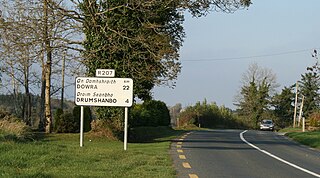
The R207 road is a regional road in Ireland linking the N16 national primary road near the Northern Ireland border to the R280 10 km north of Carrick-on-Shannon in County Leitrim.

R506 road (Ireland)

The R506 road is a regional road in the east of County Limerick, Ireland which runs west-east from its junction with the R445 regional road at Garraunykee, Annacotty and its junction with the R505 regional road in the townland of Dromsally on the outskirts of the village of Cappamore. En route it passes through the village of Murroe.

R104 road (Ireland)

The R104 road is a regional road in north Dublin, Ireland. The road passes through Finglas, Santry, and Coolock, along the northern edge of Raheny and finishes at the coast in Kilbarrack.

R149 road (Ireland)

The R149 road is a regional road in Ireland from Leixlip, County Kildare to Clonee, County Meath. It starts in Leixlip at the junction with the R148 at Main Street. It passes though Confey in Kildare; Passifyoucan and Barnhill in Fingal and Hilltown in Meath before ending in Clonee at the junction with the R156.

References

The Department of Transport, Tourism and Sport is a department of the Government of Ireland that is responsible for transport policy and overseeing transport services and infrastructure. The department is led by the Minister for Transport, Tourism and Sport who is assisted by one Minister of State.