
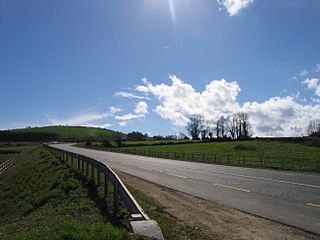
The R765 road (also known as the Newtown Road or the Roundwood Road) is a regional road in Ireland joining the villages of Roundwood and Newtownmountkennedy in County Wicklow.
Contents
The road is 10km long.
The R765 road (also known as the Newtown Road or the Roundwood Road) is a regional road in Ireland joining the villages of Roundwood and Newtownmountkennedy in County Wicklow.
The road is 10km long.
The road starts eastwards at a junction with the R755 in the village of Roundwood and terminates in Newtownmountkennedy at the R772 (the former N11 national primary road).
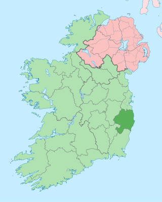
County Wicklow is a county in Ireland. The last of the traditional 32 counties, having been formed as late as 1606, it is part of the Eastern and Midland Region and the province of Leinster. It is bordered by the Irish Sea to the east and the counties of Wexford to the south, Carlow to the southwest, Kildare to the west, and South Dublin and Dún Laoghaire–Rathdown to the north.

The N11 road is a national primary road in Ireland, running for 129 km (80 mi) along the east side of Ireland from Dublin to Wexford. It passes close to Bray, Greystones, Wicklow, Arklow, Gorey, and Enniscorthy. Beyond Wexford, the route continues to Rosslare as the N25. The road forms part of European route E01. As of July 2019 the N11/M11 is of dual carriageway or motorway standard from Dublin as far as Oilgate in County Wexford.

A regional road in the Republic of Ireland is a class of road not forming a major route, but nevertheless forming a link in the national route network. There are over 11,600 kilometres of regional roads. Regional roads are numbered with three-digit route numbers, prefixed by "R". The equivalent road category in Northern Ireland are B roads.
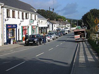
Roundwood, historically known as Tóchar, is a village in County Wicklow, Ireland. It was listed as having a population of 948 in the 2016 census.

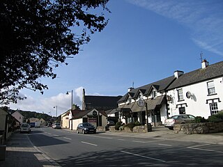
Newtownmountkennedy is a small town in County Wicklow, Ireland. It developed within the historic townland of Ballygarny, although all that remains is a motte where a church, graveyard and a castle or tower house once stood just 0.85 km (0.53 mi) north of the town. It acquired its present name in the mid-seventeenth-century, when Sir Robert Kennedy, M.P. for Kildare, made it his principal residence. It is just off the N11 road to Wexford, just south of Kilpedder and south-west of Greystones. It is about 15 km (9.3 mi) north of Wicklow town, 15 km (9.3 mi) south of Bray and approximately 35 km (22 mi) from Dublin. The R772 regional road passes through the village. This was the main Dublin-Wexford route, the N11, but the village was bypassed by the new N11 dual carriageway in 1990. This town has one of the longest place names in Ireland.

The R759 road is a regional road in Ireland running south-east to north-west through the Sally Gap in the Wicklow Mountains, from the R755 near Roundwood in East Wicklow to the N81 in West Wicklow. The other route through the Wicklow Mountains from east to west is the Wicklow Gap which is crossed by the R756.
The R755 road is a regional road in Ireland. It runs for its entire length in County Wicklow. From the village of Kilmacanogue on the N11 national primary road it goes north/south for 36 km (22 mi) to the town of Rathdrum.

The Avonmore River, also known as Abhainn Dé, flows from Lough Dan in the Wicklow Mountains west of Roundwood. It flows in a generally southerly direction for approximately 30 km (19 mi) before joining the Avonbeg at the Meeting of the Waters to form the River Avoca, which in turn discharges into the Irish Sea at Arklow. From source to sea the river remains in East Wicklow.
The R772 road is a regional road in Ireland which comprises disconnected sections of road which once formed part of the N11 but which have now been by-passed, joined together by some new road sections and some former local roads.

The R323 road is a regional road in County Mayo, Ireland. Going from west to east, the route connects the towns of Kiltimagh, Knock, and Ballyhaunis. En route it crosses over the N17 national primary road at a grade separated junction in the village of Knock.

The R409 road is a regional road in Ireland that passes through the village of Caragh in County Kildare. It starts at Naas and travels north-west through Caragh village, passes Mondello Park race-track and ends at the intersection with the R403 road. The route is 13 km (8.1 mi) long.

The R731 road is a regional road in County Wexford, Ireland. From its junction with the R730 it takes a route along the southeasterly flank of the Blackstairs Mountains to its junction with the R729 north of New Ross, where it terminates.

The R348 road is a regional road in Ireland stretching east–west for 51 km (32 mi) along a route north of the R446. It leaves the R446 east of Oranmore and rejoins it in Ballinasloe. The full length of the road lies within County Galway.

The R764 road is a regional road in Ireland joining the villages of Roundwood and Ashford in County Wicklow.
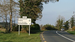
The R207 road is a regional road in Ireland linking the N16 national primary road near the Northern Ireland border to the R280 10 km north of Carrick-on-Shannon in County Leitrim.
The R506 road is a regional road in the east of County Limerick, Ireland which runs west-east from its junction with the R445 regional road at Garraunykee, Annacotty and its junction with the R505 regional road in the townland of Dromsally on the outskirts of the village of Cappamore. En route it passes through the village of Murroe. The road is 18 km (11 mi) long.

The R507 road is a regional road in the east of County Limerick, Ireland which runs south-north from its junction with the N24 national road at Cluggin Cross and its junction with the R505 regional road in the village of Doon.
The R330 road is a regional road in west central County Mayo in Ireland. It connects the N5 and N59 roads at Westport to the N84 road at the village of Partry, 21.9 kilometres (13.6 mi) away. It meets the R300 road between Cloonee and Partry.
The R339 road is a regional road in Ireland which links the R358 regional road with Galway in County Galway.

The R517 road is a regional road in Ireland which links the R512 regional road in County Limerick with Mitchelstown in County Cork. The road passes through the village of Kilfinane. It is 23 km (14 mi) long.
| | This Irish road or road transport-related article is a stub. You can help Wikipedia by expanding it. |