Blackrock is an affluent suburb of Dublin, Ireland, 3 km (1.9 mi) northwest of Dún Laoghaire. It is named after the local geological rock formation to be found in the area of Blackrock Park. In the late 18th century, the Blackrock Road was a common place for highway robberies. The Blackrock baths, provided for by the railway company in 1839, became popular in the 19th century but Blackrock is now a tourist destination.

The N11 road is a national primary road in Ireland, running for 129 km (80 mi) along the east side of Ireland from Dublin to Wexford. It passes close to Bray, Greystones, Wicklow, Arklow, Gorey, and Enniscorthy. Beyond Wexford, the route continues to Rosslare as the N25. The road forms part of European route E01. As of July 2019 the N11/M11 is of dual carriageway or motorway standard from Dublin as far as Oilgate in County Wexford.

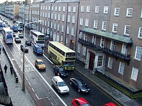
The Southside is the part of Dublin city that lies south of the River Liffey. It is an informal but commonly used term. In comparison to the city's Northside, it has historically been regarded as wealthier and more privileged, with several notable exceptions.

Belfield is a small enclave, not quite a suburb, in Dún Laoghaire–Rathdown, Ireland. It is synonymous with the main campus of University College Dublin.
Stillorgan, formerly a village in its own right, is now a suburban area of Dublin in Ireland. Stillorgan is located in Dún Laoghaire–Rathdown, and contains many housing estates, shops and other facilities, with the old village centre still present. Stillorgan is at least partly contiguous with Kilmacud and neighbours other southside districts such as Mount Merrion, Sandyford, Leopardstown, Dundrum, Blackrock, Goatstown and Foxrock.
Mount Merrion is a suburb of Dublin, Ireland. It is roughly 7 kilometres (5 mi) south of Dublin city centre and is situated on and around the hill of the same name.

The R113 road is a regional road in Ireland. Located in Dublin, it forms a semi-orbital route around the south of the city. As of 2007, clockwise, it starts at the N31 at Temple Hill in Blackrock and ends at a junction with the N4 at Palmerstown.

The N31 road is a national primary road in Ireland. It connects the harbour at Dún Laoghaire southeast of Dublin to the national route network. Both the N11 and Dublin's M50 C-ring motorway connect to the N31.

Baggot Street is a street in Dublin, Ireland.

Loughlinstown is a southern Dublin suburb, located in Dún Laoghaire–Rathdown, on the N11 national road.

Kilmacud is a suburban area of Dublin in Dún Laoghaire–Rathdown, Ireland, at least partly contiguous with Stillorgan.
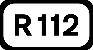
The R112 road is a regional road in south Dublin, Ireland. It begins at the junction with the R148 road at Chapelizod and arcs southeastwards, then eastwards across the middle of south Dublin, ending at the Mount Merrion junction of the R138. The road is a single carriageway, with cycle lanes on some stretches. Improvements to the road have been made over the last 10 years, the most significant being at Dundrum Cross where the road was widened to make room for the new Luas bridge and Dundrum bypass.

The R825 road is a regional road in south Dublin, Republic of Ireland. The road starts in Clonskeagh at the junction with the R117 and passes through Goatstown, Kilmacud and Stillorgan before ending at a junction with the N31 in Blackrock, County Dublin. The route is 7.6 km (4.7 mi) in length and is single carriageway apart from a small 2 lane section beside the N11.

The R824 road is a regional road in south Dublin, Ireland. The road starts somewhere between Sandford and Clonskeagh, passes through Donnybrook and finishes at the junction with the Merrion Road and Ailesbury Road close by to Sydney Parade.

The R118 road is a regional road in south Dublin and Dún Laoghaire–Rathdown, Ireland. It links Kildare Street to Cherrywood.

The R119 road is a regional road in Dún Laoghaire–Rathdown, Ireland.

The R815 road is a regional road in Dublin, Ireland.
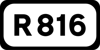
The R816 road is a regional road in Dublin, Ireland.

The R830 road is a regional road in Dún Laoghaire–Rathdown, Ireland.

Morehampton Road is a road running through Donnybrook in Dublin, Ireland. It runs from the junction of Upper Leeson Street and Sussex Road to Donnybrook Road. It meets Wellington Place, Herbert Park and Marlborough Road.