N68 road (Ireland)

Last updated

IRL N68.svg

N68 road
Route information
Length 40.569 km (25.208 mi)
Location
Primary
destinations
Road network

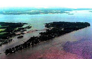
The N68 road is a national secondary road in Ireland. It runs from Ennis to Kilrush. It is entirely in County Clare.

National secondary road Wikimedia list article

A national secondary road is a category of road in Ireland. These roads form an important part of the national route network, but are secondary to the main arterial routes which are classified as national primary roads. National secondary roads are designated with route numbers higher than those used for primary roads, but with the same "N" prefix. Routes N51 and higher are all national secondary roads.

Republic of Ireland Ireland, a country in north-western Europe, occupying 5/6 of the island of Ireland; succeeded the Irish Free State (1937)

Ireland, also known as the Republic of Ireland, is a country in north-western Europe occupying 26 of 32 counties of the island of Ireland. The capital and largest city is Dublin, which is located on the eastern side of the island. Around a third of the country's population of 4.8 million people resides in the greater Dublin area. The sovereign state shares its only land border with Northern Ireland, a part of the United Kingdom. It is otherwise surrounded by the Atlantic Ocean, with the Celtic Sea to the south, St George's Channel to the south-east, and the Irish Sea to the east. It is a unitary, parliamentary republic. The legislature, the Oireachtas, consists of a lower house, Dáil Éireann, an upper house, Seanad Éireann, and an elected President who serves as the largely ceremonial head of state, but with some important powers and duties. The head of government is the Taoiseach, who is elected by the Dáil and appointed by the President; the Taoiseach in turn appoints other government ministers.

Ennis Town in Munster, Ireland

Ennis is the county town of County Clare, Ireland. The Irish name is short for Inis Cluana Rámhfhada. The town is on the River Fergus, north of where it enters the Shannon Estuary, 19 km (12 mi) from Shannon Airport. In 2016, Ennis had a population of 25,276, making it the largest town in Clare and the 12th largest in Ireland.

See also

Roads in Ireland

The island of Ireland, comprising Northern Ireland and the Republic of Ireland, has an extensive network of tens of thousands of kilometres of public roads, usually surfaced. These roads have been developed and modernised over centuries, from trackways suitable only for walkers and horses, to surfaced roads including modern motorways. The major routes were established before Irish independence and consequently take little cognisance of the border other than a change of identification number and street furniture. Northern Ireland has had motorways since 1962, and has a well-developed network of primary, secondary and local routes. The Republic started work on its motorway network in the early 1980s; and historically, the road network there was once somewhat less well developed. However, the Celtic Tiger economic boom and an influx of European Union structural funding, saw national roads and regional roads in the Republic come up to international standard quite quickly. In the mid-1990s, for example, the Republic went from having only a few short sections of motorway to a network of motorways, dual carriageways and other improvements on most major routes as part of a National Development Plan. Road construction in Northern Ireland now tends to proceed at a slower pace than in the Republic, although a number of important bypasses and upgrades to dual carriageway have recently been completed or are about to begin.

National primary road Ireland

A national primary road is a road classification in Ireland. National primary roads form the major routes between the major urban centres. There are 2649 km of national primary roads. This category of road has the prefix "N" followed by one or two digits. Motorways are prefixed "M" followed by one or two digits.

Regional road (Ireland) Class of road in Ireland

A regional road in Ireland is a class of road not forming a major route, but nevertheless forming a link in the national route network. There are over 11,600 kilometres of regional roads. Regional roads are numbered with three-digit route numbers, prefixed by "R".

Related Research Articles

Ortiz is a city in Venezuela's Guárico State, located in the country's central plains. It serves as the administrative centre for the surrounding Ortiz Municipality.

Moone

Moone is a small village in the south of County Kildare, Ireland. It is on the former N9 road about 80 km (50 mi) south of Dublin. It has only a few hundred inhabitants, a church, a National School, one shop and a small community centre. There is also pub called the Moone High Cross Inn.

Wicomico River (Potomac River tributary) river in the United States of America, tributary of the Potomac River

The Wicomico River is a 13.0-mile-long (20.9 km) tributary of the lower tidal portion of the Potomac River located in the U.S. state of Maryland south of Washington, DC. The river empties into the Potomac at Cobb Island and St. Margaret's Island. Its watershed area is 77 square miles (200 km2), with 2% impervious surface in 1994. in Charles, St. Mary's, and southern Prince George's counties. The lower section of the river forms part of the boundary between Charles and St. Mary's counties. The Wicomico River was designated a Scenic River under the Maryland Scenic River Act in 1968, and there are Scenic River Commissions for it in both Charles and St. Mary's counties.

R752 road (Ireland)

The R752 road is a regional road in County Wicklow, Ireland. From its junction with the R772 in Rathnew on the outskirts of Wicklow Town it takes a generally south-westerly route to its junction with the R747 in the village of Woodenbridge, where it terminates.

A3 road (Northern Ireland) major road in Northern Ireland

The A3 is a major road in Northern Ireland. It travels through County Antrim, County Down, County Armagh and parts of southern County Fermanagh.

N85 road (Ireland) road in Ireland

The N85 road is a national secondary road in Ireland connecting Ennis and Ennistymon. The route connects to the M18 Ennis bypass and forms part of the Ennis outer ring road as the "N85 Western Relief Road". From Ennis the route continues in a north - west direction and terminates at the junction with the N67 at Ennistymon. It is located entirely in County Clare.

Laurier Railway Bridge

The Laurier Railway Bridge carries the Canadian National Railway from Montreal (Rivière-des-Prairies–Pointe-aux-Trembles) to Repentigny via Île Bourdon.

Ignaców, Radomsko County Village in Łódź, Poland

Ignaców is a village in the administrative district of Gmina Żytno, within Radomsko County, Łódź Voivodeship, in central Poland. It lies approximately 9 kilometres (6 mi) south-east of Żytno, 28 km (17 mi) south-east of Radomsko, and 103 km (64 mi) south of the regional capital Łódź.

Rowy is a village in the administrative district of Gmina Obryte, within Pułtusk County, Masovian Voivodeship, in east-central Poland.

Pindal Village in Masovian, Poland

Pindal is a village in the administrative district of Gmina Kampinos, within Warsaw West County, Masovian Voivodeship, in east-central Poland. It lies approximately 7 kilometres (4 mi) west of Kampinos, 31 km (19 mi) west of Ożarów Mazowiecki, and 45 km (28 mi) west of Warsaw.

Ludwików is a settlement in the administrative district of Gmina Kazimierz Biskupi, within Konin County, Greater Poland Voivodeship, in west-central Poland.

Borowo, Środa Wielkopolska County Village in Greater Poland, Poland

Borowo is a village in the administrative district of Gmina Krzykosy, within Środa Wielkopolska County, Greater Poland Voivodeship, in west-central Poland. It lies approximately 7 kilometres (4 mi) north-west of Krzykosy, 11 km (7 mi) south of Środa Wielkopolska, and 39 km (24 mi) south-east of the regional capital Poznań.

Tugaske, Saskatchewan village in Saskatchewan, Canada

Tugaske is a community in Saskatchewan.

R523 road (Ireland)

The R523 road is a regional road in Ireland, located in County Kerry and County Limerick.

R552 road (Ireland)

The R552 road is a regional road in Ireland, located in County Kerry.

R473 road (Ireland)

The R473 road is a regional road in Ireland, located in the southern coastal parts of County Clare.

R474 road (Ireland)

The R474 road is a regional road in Ireland, located in western County Clare.

R554 road (Ireland)

The R554 road is a regional road in Ireland, located in County Kerry.

R488 road (Ireland)

The R488 road is a regional road in Ireland, located in County Clare.

R521 road (Ireland)

The R521 road is a regional road in Ireland, located in County Limerick.

References

The Department of Transport, Tourism and Sport is a department of the Government of Ireland that is responsible for transport policy and overseeing transport services and infrastructure. The department is led by the Minister for Transport, Tourism and Sport who is assisted by one Minister of State.

Coordinates: 52°42′10″N9°17′12″W / 52.70278°N 9.28667°W / 52.70278; -9.28667

Geographic coordinate system Coordinate system

A geographic coordinate system is a coordinate system that enables every location on Earth to be specified by a set of numbers, letters or symbols. The coordinates are often chosen such that one of the numbers represents a vertical position and two or three of the numbers represent a horizontal position; alternatively, a geographic position may be expressed in a combined three-dimensional Cartesian vector. A common choice of coordinates is latitude, longitude and elevation. To specify a location on a plane requires a map projection.