The N7 road is a national primary road in Ireland, connecting Limerick and Dublin. The majority of the route is motorway standard and is designated as the M7 motorway. At the Rosbrien interchange in Limerick the route continues as the N18 dual carriageway to Shannon and Ennis. The road passes through the midlands of Ireland, and acts as a trunk route out of Dublin for the N8 and N9 national primary routes to Cork and Waterford respectively. It forms part of European route E20.
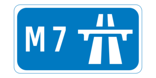
The M7 motorway is a motorway in Ireland. The motorway runs continuously from the outskirts of Naas in County Kildare to Rossbrien on the outskirts of Limerick City. The M7 forms part of the Dublin to Limerick N7 national primary road. The section of the motorway bypassing Naas, an 8 km stretch, was the first section of motorway to open in Ireland, in 1983. Following substantial works to extend the M7 to Limerick, by the end of 2010, the motorway replaced all of the old single-carriageway N7 route which is now designated as R445. At 166.5 km, the M7 is the longest motorway in Ireland.

Dromineer is a small village and townland in County Tipperary, Ireland. It is situated on the shores of Lough Derg on the River Shannon. The village is located 10 km north of Nenagh on the R495 road. It is a civil parish in the historical barony of Ormond Lower. Historic documents describe the places as "Dromynnyre".

Lough Derg, historically Lough Dergart, is a freshwater lake in the Shannon River Basin, Ireland. It is the third-biggest on the island of Ireland.

Puckane, officially Puckaun, is a village in County Tipperary, Ireland. It is also a parish in the Roman Catholic Diocese of Killaloe. The village is located 10 km north of Nenagh along the R493 and close to Lough Derg and Dromineer. It had a population of 250 people as of the 2016 census.

A regional road in the Republic of Ireland is a class of road not forming a major route, but nevertheless forming a link in the national route network. There are over 11,600 kilometres of regional roads. Regional roads are numbered with three-digit route numbers, prefixed by "R". The equivalent road category in Northern Ireland are B roads.

The R445 road is a regional road in Ireland. The route is a non-motorway alternative route to the N7/M7 motorway between Naas and Limerick, and at 170 km it is one of the longest regional roads in Ireland. Indeed, much of the route comprises roads that were formerly part of the N7 between the cities, prior to motorway and other bypasses. Some of the R445 route also comprises local link roads to new N7/M7 route sections.
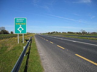
The N52 road is a national secondary road in Ireland. It links the M7 motorway from just south of Nenagh, County Tipperary to the M1 motorway north of Dundalk in County Louth. The route forms a connection between the north east of Ireland and the mid west traversing the midlands. It interchanges with the M6 at Kilbeggan and at Tyrrellspass, the N4 at Mullingar, the N3 at Kells, and the N2 at Ardee before continuing towards Dundalk.

Terryglass is a village in County Tipperary, Ireland. The small town is located on the R493 regional road on the north-eastern shore of Lough Derg near where the River Shannon enters the Lough. It is a civil parish in the historical barony of Ormond Lower. It is also an Ecclesiastical parish in the Roman Catholic Diocese of Killaloe,. Terryglass won the Irish Tidy Towns Competition in 1983 and 1997.

Newport is a town in County Tipperary in Ireland. It is in the barony of Owney and Arra. At the 2016 Census the population was 1,995.

Ballina, from Irish: Béal an Átha, meaning 'mouth of the ford', is a census town that lies on the River Shannon in County Tipperary, Ireland. It is situated on the eastern shore of Lough Derg across from its 'twin-town' of Killaloe on the west bank of the lake. The towns are joined by Killaloe Bridge.
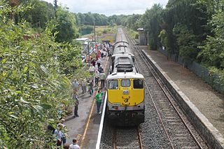
Birdhill railway station serves the town of Birdhill in County Tipperary, Ireland.
Ogonnelloe is a civil parish in east County Clare, Ireland, situated on the R463 regional road between Scariff and Killaloe and in the surrounding hills. It forms part of the Catholic parish of the same name.
Birdhill is a village in County Tipperary, Ireland. It is in the barony of Owney and Arra and is part of the parish of Newport, Birdhill and Toor in the Roman Catholic Archdiocese of Cashel and Emly. Its Irish name was historically anglicised as Knockan or Knockaneeneen.

The R466 road is a regional road in Ireland which runs southeast-northwest from the R445 at Birdhill, County Tipperary to the R352 in East Clare.

Portroe is a village in County Tipperary, Ireland. The village is located on the R494 regional road, 3 km from the eastern shore of Lough Derg and 10 km west of the town of Nenagh. Portroe spans the townlands of Garrykennedy, Glencrue and Shesharoe.
The Lough Derg Way is a long-distance trail in Ireland. It is 68 kilometres long and begins in Limerick City and ends in Dromineer, County Tipperary. It is typically completed in three days. It is designated as a National Waymarked Trail by the National Trails Office of the Irish Sports Council and is managed by Shannon Development, Tipperary County Council and Tipperary Integrated Development Company. The trail was reconfigured and relaunched in 2011 with many sections taken off road aided by an investment of €115,000 under the Comhairle na Tuaithe Walks Scheme, which supports landowners to maintain trails that cross their land.

Garrykennedy is a townland, settlement and harbour in the historical Barony of Owney and Arra, County Tipperary, Ireland. It is located on the eastern shore of Lough Derg, 2 km north of Portroe

The R495 is a regional road in Ireland. Running entirely within County Tipperary, it starts in Nenagh at Richmond Cross, a junction with the R494, and ends at Dromineer on the shores of Lough Derg. The road is approximately 7.6 km (4.7 mi) long, passing through Ballycommon, Carrkirk, Annaghly Cross and Ballyartella.

The Shannon River Basin consists of the area containing Ireland's longest river, the River Shannon, and all of its tributaries and lakes. The official Ordnance Survey Ireland length of the Shannon from its Shannon Pot source is 224 miles (360 km) made up of 63.5 miles (102.2 km) tidal water flow and 160.5 miles (258.3 km) freshwater flow.