
County Mayo is a county in Ireland. In the West of Ireland, in the province of Connacht, it is named after the village of Mayo, now generally known as Mayo Abbey. Mayo County Council is the local authority. The population was 137,231 at the 2022 census. The boundaries of the county, which was formed in 1585, reflect the Mac William Íochtar lordship at that time.

Castlebar is the county town of County Mayo, Ireland. Developing around a 13th-century castle of the de Barry family, from which the town got its name, the town now acts as a social and economic focal point for the surrounding hinterland. With a population of 13,054 in the 2022 census, Castlebar was one of the fastest growing towns in Ireland in the early 21st century.
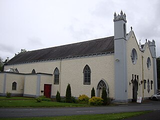
Ballyhaunis is a town in County Mayo, Ireland. It is at the crossroads of the N60 and N83 National secondary roads and on the railway line linking Dublin to Westport and Ballina. Ballyhaunis is within both the Roman Catholic and civil parishes of Annagh.

Claremorris is a town in County Mayo in the west of Ireland, at the junction of the N17 and the N60 national routes. As of the 2017, it was the fastest growing town in the county, having seen a 31% increase in population between 2006 and 2011 and a 23% increase between 2002 and 2006. Between the 2016 census and the 2022 census, the population of Claremorris grew further, from 3,687 to 3,857 inhabitants.

Ballaghaderreen is a town in County Roscommon, Ireland. It was part of County Mayo prior to 1898. It is in the north-west of the county, near the borders with counties Mayo and Sligo, just off the N5 road. The population was 1,808 in the 2016 census.

The N5 road is a national primary road in Ireland, connecting Longford town with Westport. It is the main access route from Dublin to most of County Mayo, including the county's largest towns, Castlebar, Ballina, and Westport.

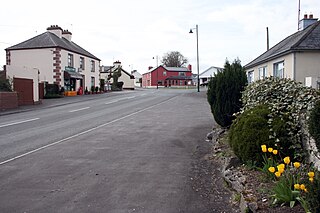
Balla is a town in County Mayo, Ireland on the N60 National secondary road, the main road between Castlebar and Claremorris. The economy of the village survives mainly on passing trade, from the busy N60 which carries over 7,000 vehicles through the town every day. It is notable for its round tower. The town is in a townland and civil parish of the same name. It used to be a significant shop and market centre. It fell into decline and lost its railway station, but has enjoyed something of a revival as a residential area for people working in Castlebar.

The N17 road is a national primary road in Ireland, and is part of the Atlantic Corridor route. It begins in County Galway and ends in County Sligo. On 27 September 2017 the southern, Tuam–Galway, section was upgraded to motorway status and designated M17.

A regional road in the Republic of Ireland is a class of road not forming a major route, but nevertheless forming a link in the national route network. There are over 11,600 kilometres of regional roads. Regional roads are numbered with three-digit route numbers, prefixed by "R". The equivalent road category in Northern Ireland are B roads.

The R293 road is a regional road in Ireland linking the N17, via a junction in the townland of Ballinabole near Collooney in County Sligo, to the outskirts of Ballyhaunis in County Mayo. En route it passes through three towns, Ballymote and Gorteen in County Sligo and Ballaghaderreen in County Roscommon. The road is 55 km (34 mi) long.

A national secondary road is a category of road in Ireland. These roads form an important part of the national route network but are secondary to the main arterial routes which are classified as national primary roads. National secondary roads are designated with route numbers higher than those used for primary roads, but with the same "N" prefix. Routes N51 and higher are all national secondary roads.

The N26 road is a national primary road in northeast County Mayo in Ireland connecting the N5 road at Swinford with the N58 at Foxford and then on to the N59 road at Ballina. The road also meets six regional roads along its route, and it is 29.79 kilometres (18.51 mi) long.

Ballinlough is a village in western County Roscommon, Ireland. The N60 national secondary road passes through it. The village is between Ballyhaunis and Castlerea on the Roscommon to Castlebar road. As of the 2016 census, Ballinlough had a population of 300 people.
The R367 road is a regional road in Ireland linking Ballymoe on the N60 with the N5 in Tulsk, all in County Roscommon. It passes through Ballintober, Knockalaghta and Castleplunket en route.

The R323 road is a regional road in County Mayo, Ireland. Going from west to east, the route connects the towns of Kiltimagh, Knock, and Ballyhaunis. En route it crosses over the N17 national primary road at a grade separated junction in the village of Knock.

The N84 road is a national secondary road in Ireland. It is a major route in the West connecting Galway city with Castlebar. The route is of poor quality with a few short good sections in County Mayo between Ballintubber and Ballinrobe. Ballinrobe has become a bottleneck on the route in recent years with up to 8,000 vehicles passing through the town's one-way streets. A bypass for the town is in the planning. The R307 connects the N84 from the N5 Castlebar bypass, into Castlebar centre.

The R331 road is a regional road in southeast County Mayo, Ireland. The route connects the towns of Claremorris and Ballinrobe, and links the N60 road with the N84 road.

The R320 road is a regional road in east County Mayo in Ireland. It connects Swinford to Claremorris via Kiltimagh, and links the N5 and N26 roads near Swinford with the N60 and N17 roads near Claremorris. The R320 connects with six other regional roads along its route. The road is in three discontiguous segments which add up to 27.1 kilometres (16.8 mi) in length.

