
County Wexford is a county in Ireland. It is in the province of Leinster and is part of the Southern Region. Named after the town of Wexford, it was based on the historic Gaelic territory of Hy Kinsella, whose capital was Ferns. Wexford County Council is the local authority for the county. The population of the county was 163,527 at the 2022 census.

The N11 road is a national primary road in Ireland, running for 129 km (80 mi) along the east side of Ireland from Dublin to Wexford. It passes close to Bray, Greystones, Wicklow, Arklow, Gorey, and Enniscorthy. Beyond Wexford, the route continues to Rosslare as the N25. The road forms part of European route E01. As of July 2019 the N11/M11 is of dual carriageway or motorway standard from Dublin as far as Oilgate in County Wexford.

New Ross is a town in southwest County Wexford, Ireland. It is located on the River Barrow, near the border with County Kilkenny, and is around 20 kilometres (12 mi) northeast of Waterford. In 2022 it had a population of 8,610 people, making it the fourth-largest town in the county.

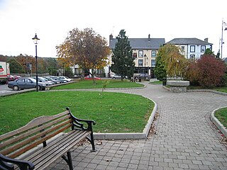
Enniscorthy is the second-largest town in County Wexford, Ireland. The town is located on the picturesque River Slaney and in close proximity to the Blackstairs Mountains and Ireland's longest beach, Curracloe.
Bunclody, formerly Newtownbarry, is a small town on the River Slaney in Wexford, Ireland. It is located near the foot of Mount Leinster. Most of the town is in County Wexford; a small area at the north end of town is in County Carlow. Bunclody has received a number of high scores in the Tidy Towns competition. The town is known for the "Streams of Bunclody Festival" held during the month of July.

A national secondary road is a category of road in Ireland. These roads form an important part of the national route network but are secondary to the main arterial routes which are classified as national primary roads. National secondary roads are designated with route numbers higher than those used for primary roads, but with the same "N" prefix. Routes N51 and higher are all national secondary roads.
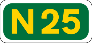
The N25 road is a national primary road in Ireland, forming the route from Cork to Rosslare Europort via Waterford City. The road is part of the E30 European route and a short section is also part of the E01 European route. It forms part of the proposed Atlantic Corridor route.
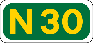
The N30 road is a national primary road in Ireland. It connects the N25 road and M11 motorway, providing a link running east-northeast through County Wexford, between New Ross and Enniscorthy. This provides for a more direct national route between the two towns, as the N25 and N11 both run to Wexford town, eastwards from New Ross and southwards from Enniscorthy respectively.

List of A roads in zone 5 in Great Britain starting north/east of the A5, west of the A6, south of the Solway Firth/Eden Estuary.
List of A roads in zone 6 in Great Britain starting east of the A6 and A7 roads, and west of the A1.

The N80 road is a national secondary road in Ireland that runs southeastwards from its junction with the N52 and R443 in the town of Tullamore in County Offaly, to the N30 at Ballynahallin, just north of Enniscorthy in County Wexford, a distance of 114.683 km. Total length is 114.683 km (71.261 mi).
The R772 road is a regional road in Ireland which comprises disconnected sections of road which once formed part of the N11 but which have now been by-passed, joined by some new road sections and some former local roads.

The R702 road is a regional road in Ireland which runs west-east from the R712 at Coolgrange in County Kilkenny through Gowran before crossing into County Carlow at Goresbridge. It continues to Borris, passes through the Blackstairs Mountains via the Scullogue Gap into County Wexford and continues east until it terminates at a junction with the R890 in Enniscorthy.
The Enniscorthy Echo was a local newspaper published once per week in County Wexford, Ireland. It was published in colour.
Enniscorthy RFC is a rugby union club based in Enniscorthy, County Wexford in Ireland. As of 2023, it fields teams in Division 2B of the All-Ireland League, having been promoted from Division 2C in 2022. It was founded in 1912. The clubhouse and pitch are located on the Ross Road in Enniscorthy.
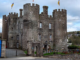
Enniscorthy Castle is situated in Enniscorthy, County Wexford, Ireland. Construction on the castle commenced in the late 1190s and was first occupied by its Norman owners in 1203 A.D. on the site of a previous wooden castle they had erected some years earlier. It was built by Philip De Prendergast

The R586 road is a long regional road in Ireland, located in west County Cork.
Enniscorthy Greyhound Stadium is a greyhound racing track located on the west side of Enniscorthy, County Wexford, Republic of Ireland.

The R744 road is a regional road in County Wexford, Ireland. It travels from the N30 road west of Enniscorthy, via Enniscorthy to Blackwater. The road is 23.6 km (14.7 mi) long.

The R745 road is a regional road in County Wexford, Ireland. It connects the R702 road at Wheelagower with the R772 road at Ferns. Following the opening of the M11 motorway from Gorey to Enniscorthy, parts of the N11 near the motorway were renumbered to R772.
