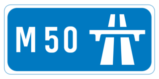
The M50 motorway is a C-shaped orbital motorway in Dublin and the busiest motorway in Ireland. The current route was built in various sections over the course of 27 years, from 1983 to 2010. It begins at Dublin Port, running northward through the Dublin Port Tunnel and along a portion of the Airport Motorway. It then turns west at its junction with the M1, circling the northern, western and southern suburbs of Dublin, before merging with the M11 at Shankill in South East Dublin. The road forms part of European route E01.
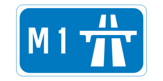
The M1 motorway is a motorway in Ireland. It forms the large majority of the N1 national primary road connecting Dublin towards Belfast along the east of the island of Ireland. The route heads north via Swords, Drogheda and Dundalk to the Northern Irish border just south of Newry in County Armagh, where it joins the A1 road and further on, the M1 motorway in Northern Ireland. It also forms a significant part of the road connection between Dublin and the Northern Irish cities of Newry, and Lisburn. The route is part of European route E01.
The N2 road is a national primary road in Ireland, running from Dublin to the border with Northern Ireland at Moy Bridge near Aughnacloy, County Tyrone to connect Dublin with Derry and Letterkenny via the A5. A section of the route near Dublin forms the M2 motorway.

Dunleer is a town and townland in County Louth, Ireland. Dunleer is situated midway between Dundalk and Drogheda and is located on the junction of the R132, R169 and R170 regional roads that intersect the town. As of the 2022 census, the town had a population of 2,143.

The N10 road is a national primary road in Ireland, connecting Kilkenny to the M9 Dublin – Waterford route. It consists of a route from northeast of Kilkenny, a ring road around the city, and a route southeast of the city.

A regional road in the Republic of Ireland is a class of road not forming a major route, but nevertheless forming a link in the national route network. There are over 11,600 kilometres of regional roads. Regional roads are numbered with three-digit route numbers, prefixed by "R". The equivalent road category in Northern Ireland are B roads.

The N14 road is a national primary road in the Republic of Ireland. The entirety of the route is located in the northwest of Ireland, in County Donegal, connecting Manorcunningham to Lifford in the east. Here it connects to the N15 near the border with Northern Ireland and along the A38 to Strabane in County Tyrone.

A national secondary road is a category of road in Ireland. These roads form an important part of the national route network but are secondary to the main arterial routes which are classified as national primary roads. National secondary roads are designated with route numbers higher than those used for primary roads, but with the same "N" prefix. Routes N51 and higher are all national secondary roads.
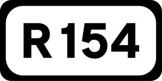
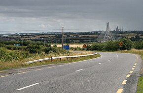
The R154 road is a regional road in Ireland, linking the R147 near Clonee, County Meath to Crossdoney in County Cavan. The road is single carriageway throughout. Many parts of the route have dangerous bends.
The R132 road is one of Ireland's newest regional roads, having been classified following the opening M1 motorway which by-passes most of the old N1 route. The R132 is 98.9 kilometres (61.5 mi) long.
The N51 road is a national secondary road in Ireland. West to east, it starts in Delvin, County Westmeath at a junction with the N52. It passes through Athboy, a junction with M3 motorway, Navan and Slane, where it crosses the N2 road, all in County Meath, before crossing the M1 motorway and terminating near Drogheda in County Louth at a roundabout on the R132.
The R164 road is a regional road in Ireland, linking Kingscourt in County Cavan to the N51 near Athboy, County Meath.
The R108 road is a regional road in Ireland, linking Drogheda in County Louth to Christchurch Place, Dublin.
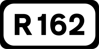
The R162 road is a regional road in Ireland, linking Monaghan Town to Navan, County Meath. The route is 80 km (50 mi) long.

The R420 road is a regional road in Ireland, which runs northwest-southeast from the R446 near Moate in County Westmeath to the R445 just west of Monasterevin. The road travels through the towns of Clara, Tullamore & Portarlington. The route is 35 km (22 mi) long.

A local road in the Republic of Ireland is a public road not classified as a national primary road, national secondary road, or regional road but nevertheless forming a link in the national network of roads. Local roads are numbered with four- or five-digit route numbers, prefixed by "L".

The R147 is a regional road in Ireland. Its first section runs from St Peters Church in Phibsborough, Dublin to its junction with the M50. It then follows the route of a former section of the N3 between Clonee and Kells. It serves as an alternative route for non-motorway traffic and traffic wishing to avoid tolls on the M3.

Delvin is a barony in north-east County Westmeath, in Ireland. It was formed by 1672. It is bordered by County Meath to the east and three other baronies: Fore, Moyashel and Magheradernon and Farbill. The largest centre of population is Delvin.

The R150 road is a regional road in Ireland. It runs from Drogheda to the Meath coast and back inland across east County Meath.

The R169 road is a regional road in Ireland linking the N2 road, at Collon townland, with the R132 road at Dunleer in County Louth. The road is 7 km (4.3 mi) long.