
County Tipperary is a county in Ireland. It is in the province of Munster and the Southern Region. The county is named after the town of Tipperary, and was established in the early 13th century, shortly after the Norman invasion of Ireland. It is Ireland's largest inland county and shares a border with eight counties, more than any other. The population of the county was 167,895 at the 2022 census. The largest towns are Clonmel, Nenagh and Thurles.
The N8 road is a national primary road in Ireland, connecting Cork with Dublin via the M7. The N8 is further classified by the United Nations as the entirety of the European route E 201, part of the trans-Europe International E-road network. The road is motorway standard from junction 19 on the M7 to the Dunkettle interchange in Cork City and is designated as the M8 motorway. From here the route continues into Cork city centre and terminates at the N22 road at St. Patrick's Street. The M8 motorway was completed in May 2010, replacing the single carriageway sections of the old N8 and bypassing towns on the main Cork to Dublin road. It is now possible to travel from Cork to Dublin on the M/N8 in about 2 hours 30 minutes. The route commences just south of Portlaoise, and reaches Cork via the midlands and the Golden Vale of Ireland, through Counties Laois, Kilkenny, Tipperary, Limerick and Cork.

Clonmel is the county town and largest settlement of County Tipperary, Ireland. The town is noted in Irish history for its resistance to the Cromwellian army which sacked the towns of Drogheda and Wexford. With the exception of the townland of Suir Island, most of the borough is situated in the civil parish of "St Mary's" which is part of the ancient barony of Iffa and Offa East.
Windgap, is a village in County Kilkenny, in Ireland. Windgap is located in the south-western part of Kilkenny on the border with Tipperary, just south of Callan. The village is located on the R689 regional road, the nearest main road being the N76 from Kilkenny to Clonmel.

Callan is a town and civil parish in County Kilkenny in Ireland. Situated 16 km (10 mi) south of Kilkenny on the N76 road to Clonmel, it is near the border with County Tipperary. It is the second largest town in the county, and had a population of 2,475 at the 2016 census. Callan is the chief town of the barony of the same name.

The N10 road is a national primary road in Ireland, connecting Kilkenny to the M9 Dublin – Waterford route. It consists of a route from northeast of Kilkenny, a ring road around the city, and a route southeast of the city.

A regional road in the Republic of Ireland is a class of road not forming a major route, but nevertheless forming a link in the national route network. There are over 11,600 kilometres of regional roads. Regional roads are numbered with three-digit route numbers, prefixed by "R". The equivalent road category in Northern Ireland are B roads.
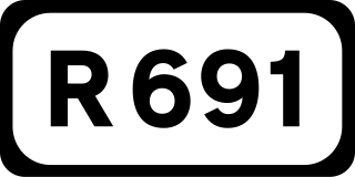
The R691 road is a regional road in Ireland which runs west-east from the centre of Cashel in County Tipperary to the N76 near Callan in County Kilkenny. The route is 46 km (29 mi) long.

A national secondary road is a category of road in Ireland. These roads form an important part of the national route network but are secondary to the main arterial routes which are classified as national primary roads. National secondary roads are designated with route numbers higher than those used for primary roads, but with the same "N" prefix. Routes N51 and higher are all national secondary roads.
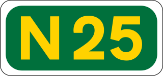
The N25 road is a national primary road in Ireland, forming the route from Cork to Rosslare Europort via Waterford City. The road is part of the E30 European route and a short section is also part of the E01 European route. It forms part of the proposed Atlantic Corridor route.

The N24 road is a national primary road in Ireland forming a route from Limerick to Waterford, running through County Tipperary and passing Tipperary town, Cahir, Carrick-on-Suir and Clonmel. The route begins at its junction with the Limerick Southern M7 ring road.

Killamery is a village in County Kilkenny, Ireland. Located near the County Tipperary border, it is in a townland and civil parish of the same name. Killamery lies on the N76 national secondary road, halfway between Kilkenny to the northeast and Clonmel to the southwest.

The R639 road is one of Ireland's regional roads. Once designated the N8 national primary road, it was reclassified in stages as the R639 following the progressive opening of sections of the M8 motorway, which rendered the single carriageway N8 redundant as a national primary road. By-passed sections of the old N8 were generally reclassified as R639 as soon as a new section of M8 opened, thereby increasing the length of the R639. With the completion of the M8 on 28 May 2010, the R639 now stretches from Durrow, County Laois to Cork, running through counties Laois, Kilkenny, Tipperary, Limerick and Cork.

The N78 road is a national secondary road in Ireland. The 50-kilometer-long (31 mi) road links the N77 national secondary road north of Kilkenny, County Kilkenny to the M9 national primary route at Mullamast in County Kildare. En route it passes through the towns of Castlecomer in County Kilkenny, Ballylynan in County Laois, and Athy in County Kildare. It is single carriageway throughout.

The R702 road is a regional road in Ireland which runs west-east from the R712 at Coolgrange in County Kilkenny through Gowran before crossing into County Carlow at Goresbridge. It continues to Borris, passes through the Blackstairs Mountains via the Scullogue Gap into County Wexford and continues east until it terminates at a junction with the R890 in Enniscorthy.

Ninemilehouse, historically called Killcullen is a village in County Tipperary, Ireland. It lies on the N76 national secondary road at its junction with the R690 regional road.

Ireland has an extensive network of public roads which connect all parts of the country with each other. Roads in Ireland are currently classified as motorways, National Primary routes, National secondary routes, Regional roads and Local roads. The introduction of this classification system began in 1977.

Burnchurch Castle, a National Monument, is a well-preserved 15th century Norman tower house with a round gate tower, situated in the parish of Burnchurch, County Kilkenny, Ireland. Burnchurch Castle and tower, along with the Church of Ireland church, and the lime trees became a National Monument in 1993.

JJ Kavanagh and Sons is Ireland's largest private coach operator. It was founded in 1919 by J.J. Kavanagh with the operation of a service connecting Urlingford with Kilkenny City.

The R699 road is a regional road in County Kilkenny, Ireland. It connects the N76 with the R448, via the M9. The road travels through the town of Callan and the villages of Dunnamaggin and Knocktopher. The road is 18.1 kilometres (11.2 mi) long.


