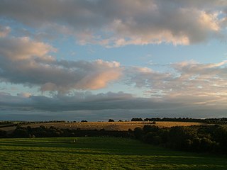
Ballinhassig is a village in County Cork, Ireland, situated 10.6 km (6.6 mi) south of Cork City just off the N71 Bandon road and near the source of the River Owenabue.

A national secondary road is a category of road in Ireland. These roads form an important part of the national route network but are secondary to the main arterial routes which are classified as national primary roads. National secondary roads are designated with route numbers higher than those used for primary roads, but with the same "N" prefix. Routes N51 and higher are all national secondary roads.

The N71 road is a national secondary road traversing counties Cork and Kerry in Ireland. Towns and villages along the route, westward from Cork city, include Innishannon, Bandon, Clonakilty, Skibbereen, Bantry and Glengarriff in County Cork. Continuing westwards from Glengarriff into County Kerry, the route passes Kenmare and terminates at Killarney.

The N72 road is a national secondary road in Ireland that runs east-west from its junction with the N25 near Dungarvan in County Waterford to the N70 in Killorglin in County Kerry.

Halfway is a village in County Cork, in Ireland. Halfway got its name from being situated approximately halfway between Cork City and Bandon.

The R599 is a regional road in County Cork, Ireland, connecting the R586 in Dunmanway to the N71 just west of Clonakilty.

The R591 road is a regional road in Ireland. It is a road on the Mizen Peninsula in County Cork. Most of the road forms part of the Wild Atlantic Way.

The R584 road is a regional road in Ireland. It is a road in west County Cork.

The R572 road is a regional road in Ireland. It is a road on the Beara Peninsula in County Cork. The road forms part of the Wild Atlantic Way. Parts of the road are on the Beara Way walking trail.

The R595 road is a regional road in Ireland. It is a road on the Haven Coast in west County Cork. The road forms part of the Wild Atlantic Way.

The R597 road is a regional road in Ireland. It is a loop road from the N71 on the Haven Coast in west County Cork. The road forms part of the Wild Atlantic Way.

The R598 road is a regional road in Ireland which links various villages, including Rathbarry and Owenahincha with the N71 road in County Cork.

The R931 road is a regional road in Ireland which links the N71 road with Skibbereen in County Cork.

The R568 road is a regional road on the Iveragh Peninsula in County Kerry, Ireland. It travels from the N70 road at Sneem to the N71 at Moll's Gap. The road is 22.9 kilometres (14.2 mi) long.

The R569 road is a regional road in County Kerry, Ireland. It travels from the N71 road at Kenmare to the N22, via the village of Kilgarvan. The road follows the course of the Roughty River for the greater part of its route. The R569 is 25.0 kilometres (15.5 mi) long.

The R593 road is a regional road in County Cork, Ireland. It travels from the N71 road at Skibbereen to the R586 at Drimoleague. The road is 12.4 kilometres (7.7 mi) long.

The R605 road is a regional road in County Cork, Ireland. It travels from the N71 road at Innishannon to Kinsale, via the village of Dunderrow. The road is 13.7 kilometres (8.5 mi) long.

The R607 road is a regional road in County Cork, Ireland. It travels from the N71 road to Kinsale. The road is 12.5 kilometres (7.8 mi) long.

The R641 road is a regional road in Cork, Ireland. It connects the N22 road to the N40, via Wilton. The road is 1.9 kilometres (1.2 mi) long. The road was formerly part and known as the N71.

The R603 road is a regional road in County Cork, Ireland. It travels from the R586 at Bandon Bridge in Bandon south to the R600 at Garranereagh, via Kilbrittain. In Bandon, the route is split on joining and leaving the N71 road. The road is 13.0 kilometres (8.1 mi) long.


