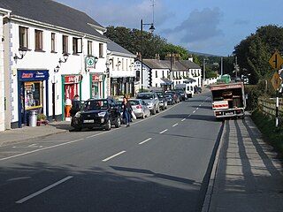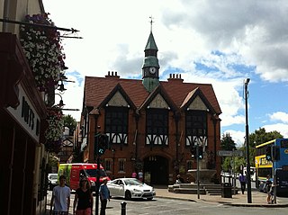
The N11 road is a national primary road in Ireland, running for 129 km (80 mi) along the east side of Ireland from Dublin to Wexford. It passes close to Bray, Greystones, Wicklow, Arklow, Gorey, and Enniscorthy. Beyond Wexford, the route continues to Rosslare as the N25. The road forms part of European route E01. As of July 2019 the N11/M11 is of dual carriageway or motorway standard from Dublin as far as Oilgate in County Wexford.

The R236 road runs in County Donegal in Ulster, and links Stranorlar, via Convoy and Raphoe, to St. Johnston and Carrigans, becoming the A40 into Derry in Northern Ireland.

The R148 road is one of Ireland's regional roads which was classified following the opening of a by-passed national primary road.

The R774 road is a regional road in County Wicklow, Ireland, which has been named the Farenkelly Road. It is a 4.7 km (2.9 mi) dual-carriageway that connects the town of Greystones with the N11 national primary road at J11.

Loughlinstown is a southern Dublin suburb, located in Dún Laoghaire–Rathdown, on the N11 national road.

The R755 road is a regional road in Ireland. It runs for its entire length in County Wicklow. From the village of Kilmacanogue on the N11 national primary road it goes north/south for 36 km (22 mi) to the town of Rathdrum.

The N80 road is a national secondary road in Ireland that runs southeastwards from its junction with the N52 and R443 in the town of Tullamore in County Offaly, to the N30 at Ballynahallin, just north of Enniscorthy in County Wexford, a distance of 114.683 km. Total length is 114.683 km (71.261 mi).

The R116 road is a regional road in Ireland which runs east-west from the N11 at Loughlinstown to the R115 in Ballyboden. It runs through the South of County Dublin for its entire length.

The R446 road is a regional road in Ireland. The road connects Kinnegad in County Westmeath to Galway City. Prior to the construction of the M6 motorway the R446 formed the main N6 road connecting Dublin and Galway. Following the opening of the M6; the old N6 road was downgraded to regional road status and was designated as the R446. The road is an alternative route between Galway and Dublin and runs in parallel to the M6.

The R639 road is one of Ireland's regional roads. Once designated the N8 national primary road, it was reclassified in stages as the R639 following the progressive opening of sections of the M8 motorway, which rendered the single carriageway N8 redundant as a national primary road. By-passed sections of the old N8 were generally reclassified as R639 as soon as a new section of M8 opened, thereby increasing the length of the R639. With the completion of the M8 on 28 May 2010, the R639 now stretches from Durrow, County Laois to Cork, running through counties Laois, Kilkenny, Tipperary, Limerick and Cork.

The R761 road is a regional road in County Wicklow in Ireland. From its junction with the M11 and R119 in Bray it takes a southerly route to its junction with the R750 in the village of Rathnew, on the outskirts of Wicklow, where it terminates.

The R415 road is a regional road in Ireland, which runs north-south from its junction with the R403 in Allenwood to the R448 at Crookstown, passing through Kildare town, and crossing the N78 between Kilcullen and Athy. The route is entirely within County Kildare.

The R702 road is a regional road in Ireland which runs west-east from the R712 at Coolgrange in County Kilkenny through Gowran before crossing into County Carlow at Goresbridge. It continues to Borris, passes through the Blackstairs Mountains via the Scullogue Gap into County Wexford and continues east until it terminates at a junction with the R890 in Enniscorthy.

The Glen of the Downs is a 2 km long wooded glacial valley with steep sides rising to almost 250m on the east coast of Ireland. It contains a designated Nature Reserve comprising 59 ha, and is a Special Area of Conservation (SAC).

The R825 road is a regional road in south Dublin, Republic of Ireland. The road starts in Clonskeagh at the junction with the R117 and passes through Goatstown, Kilmacud and Stillorgan before ending at a junction with the N31 in Blackrock, County Dublin. The route is 7.6 km (4.7 mi) in length and is single carriageway apart from a small 2 lane section beside the N11.

The R147 is a regional road in Ireland. Its first section runs from St Peters Church in Phibsborough, Dublin to its junction with the M50. It then follows the route of a former section of the N3 between Clonee and Kells. It serves as an alternative route for non-motorway traffic and traffic wishing to avoid tolls on the M3.

The R767 road is a regional road in Ireland which connects J7 of the N11 to Bray Town Hall on Bray Main Street. The majority of the road is known as the Killarney Road.

The R768 road is a regional road in Ireland which connects J7 of the N11 to the junction of the R761 at Irishtown, Bray. The road is commonly known as the Southern Cross or the Southern Bypass, though it is officially known as the Southern Ring Road.

The R138 road is a regional road in Ireland. It commences at the south end of O'Connell Bridge in Dublin city centre. It proceeds along D'Olier Street, College Street.

The R150 road is a regional road in Ireland. It runs from Drogheda to the Meath coast and back inland across east County Meath.


