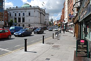
The Southside is the part of Dublin city that lies south of the River Liffey. It is an informal but commonly used term. In comparison to the city's Northside, it has historically been regarded as wealthier and more privileged, with several notable exceptions.

South Dublin is a county in Ireland, within the province of Leinster and the Eastern and Midland Region. It is one of three successor counties to County Dublin, which was disestablished for administrative purposes in 1994. South Dublin County Council is the local authority for the county. The county contains both dense suburbs of Dublin and stretches of unpopulated mountain. In 2016 it had a population of 278,767, making it the third most populous county in the state.

Tallaght is the largest settlement, and county town, of South Dublin, Ireland, and the largest satellite town of Dublin. The central village area was the site of a monastic settlement from at least the 8th century, which became one of medieval Ireland's more important monastic centres.

Templeogue is a southwestern suburb of Dublin in Ireland. It lies between the River Poddle and River Dodder, and is about halfway from Dublin's centre to the mountains to the south.
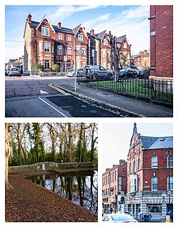
Terenure, originally called Roundtown, is an affluent, middle class suburb of Dublin in Ireland. It is located in the city's D6W postcode area.

The N81 road is a national secondary road in Ireland, from the M50 motorway to Tullow, County Carlow, north to south. The N81 continues past Tullow for another 8 km to terminate at the village of Closh, County Carlow, where it intersects the N80. The N81 is 76.784 km (47.711 mi) long. The road is a dual carriageway between M50 motorway and west of Tallaght, known as the Tallaght Bypass or Blessington Road. It intersects with the M50 motorway at Junction 11. There are plans to extend the dual carriageway by 5 km (3.1 mi) to the urban boundary.

The R113 road is a regional road in Ireland. Located in Dublin, it forms a semi-orbital route around the south of the city. As of 2007, clockwise, it starts at the N31 at Temple Hill in Blackrock and ends at a junction with the N4 at Palmerstown.
Greenhills is a suburb of Dublin in Ireland. It lies between Kimmage, Tallaght, Ballymount, Templeogue, Terenure and Walkinstown, which the area of Greenhills was historically part of, and includes a number of residential developments. A number of roads in the Greenhills area are named after saints, including Saint Peter's Road, Saint James Road, Saint Joseph's Road and Saint Patrick's Road. Greenhills is in the Dublin 12 postal area of County Dublin and is in the jurisdiction of South Dublin County Council.
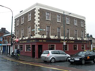
Several notable junctions in Dublin city in Ireland still carry the name of the pub or business which once occupied the corner.
The R136 road is a regional road in Ireland, located in the southwest of Dublin. Named the Outer Ring Road, the route, which is dual carriageway, runs from the N4 at Lucan to the N81 at Tallaght, bypassing west of Clondalkin and crossing the N7 near Citywest. It was built as part of the planning for the new town of Adamstown.

The River Poddle is a river in Dublin, Ireland, a pool on which gave the city its English language name. Boosted by a channel made by the Abbey of St. Thomas à Becket, taking water from the far larger River Dodder, the Poddle was the main source of drinking water for the city for more than 500 years, from the 1240s. The Poddle, which flows wholly within the traditional County Dublin, is one of around a hundred members of the River Liffey system, and one of over 135 watercourses in the county; it has just one significant natural tributary, the Commons Water from Crumlin.
The R112 road is a regional road in south Dublin, Ireland. It begins at the junction with the R148 road at Chapelizod and arcs southeastwards, then eastwards across the middle of south Dublin, ending at the Mount Merrion junction of the R138. The road is a single carriageway, with cycle lanes on some stretches. Improvements to the road have been made over the last 10 years, the most significant being at Dundrum Cross where the road was widened to make room for the new Luas bridge and Dundrum bypass.
The R114 road is a regional road in south Dublin, Ireland. The road runs from the city centre to Brittas in remote southwest County Dublin via Rathmines, Rathgar, Rathfarnham, Knocklyon, Firhouse and the mountainous area of Boharnabreena. The final stretch of the road runs just north of the border between County Dublin and County Wicklow, parallel to the Brittas River and a canal to the River Camac, which rises just to the north.

The R111 road is a regional road in south Dublin, Ireland, and includes a major element of the Dublin Outer Orbital Route.

The R817 road is a suburban road in south Dublin, Ireland connecting Harold's Cross to Ballyboden via Kimmage, Templeogue, and Ballyroan.

The R818 road is a regional road in Dublin, Ireland.
The R819 road is a regional road in Dublin, Ireland.

The R138 road is a regional road in Ireland. It commences at the south end of O'Connell Bridge in Dublin city centre. It proceeds along D'Olier Street, College Street.