
County Sligo is a county in Ireland. It is located in the Border Region and is part of the province of Connacht. Sligo is the administrative capital and largest town in the county. Sligo County Council is the local authority for the county. The population of the county was 65,535 at the 2016 census. It is noted for Benbulben Mountain, one of Ireland's most distinctive natural landmarks.
Tubbercurry or Tobercurry is the second-largest town in terms of both population and land area in County Sligo, Ireland. It lies at the foot of the Ox Mountains, on the N17 national primary road. The village is twinned with Viarmes in France. Tubbercurry achieved status as a Fairtrade town in September 2008.

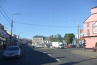
Ballymote is a market town in southern County Sligo, approx. 24 km south east of Sligo town in the province of Connacht, which is located in the north-west of Ireland. Ballymote lies in the barony of Corran. A commuter town with a strong history of independent enterprises along with firm local health, school, and transport services. It is located on the main Dublin to Sligo Train Line, and situated 10 minutes from the N4 / N17 Roadways. Ballymote serves a large hinterland area in south east County Sligo.
Gurteen or Gorteen is a village in County Sligo, Ireland. It is in the civil parish of Kilfree in the baronry of Coolavin.

A regional road in the Republic of Ireland is a class of road not forming a major route, but nevertheless forming a link in the national route network. There are over 11,600 kilometres of regional roads. Regional roads are numbered with three-digit route numbers, prefixed by "R". The equivalent road category in Northern Ireland are B roads.

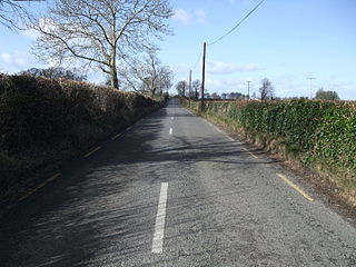
The R293 road is a regional road in Ireland linking the N17, via a junction in the townland of Ballinabole near Collooney in County Sligo, to the outskirts of Ballyhaunis in County Mayo. En route it passes through three towns, Ballymote and Gorteen in County Sligo and Ballaghaderreen in County Roscommon. The road is 55 km (34 mi) long.

The Book of Ballymote, was written in 1390 or 1391 in or near the town of Ballymote, now in County Sligo, but then in the tuath of Corann.

The R295 road is a regional road in Ireland that runs from Ballymote, County Sligo to Boyle, County Roscommon. From Ballymote the road passes by Feenagh lough and of past the Caves of Kesh. It continues by ascending over the Curlew Mountains before descending into Boyle from the west.

Ballymote railway station serves the town of Ballymote in County Sligo, Ireland.

Ballymote Castle is a large rectangular keepless castle, built around 1300. It is located in the townland of Carrownanty on the outskirts of Ballymote in southern County Sligo, Ireland. This area was known historically as Átha Cliath an Chorainn, which roughly translates as The Ford of the Hurdles of Corann. It is the last of the Norman castles in Connacht. It was probably built in order to protect the newly won possessions of Richard Óg de Burgh, 2nd Earl of Ulster, in County Sligo, some distance from an earlier motte.
The R670 road is a regional road in Ireland. The route runs from its junction with the R639 and N24 at Cloughabreeda 2 km north of Cahir through Cahir town and onwards for a further 8 km to Ardfinnan, where it joins the R665 road. The R670 is located entirely in County Tipperary.

The R106 road is a regional road in north Dublin, Ireland. It runs from Sutton, passing Baldoyle, Portmarnock and Malahide before finishing in Swords.

The R109 road is a regional road in west Dublin, Ireland. It runs from Kylemore Road via Chapelizod, the Phoenix Park and the western edge of the city centre.

The R123 road is a regional road in Fingal, Ireland.

The R124 road is a regional road in Fingal, Ireland.

The R131 road is a regional road in Dublin, Ireland.

The R812 road, or Davitt Road, is a regional road in Dublin, Ireland.

The R820 road is a regional road in Dublin, Ireland.

The R829 road is a regional road in Dún Laoghaire–Rathdown, Ireland connecting Monkstown and Dalkey.

Bunnanadden, Bunnanaddan or Bunninadden is a small village in south County Sligo, Ireland. It is on the R296 road, 9 km from Tubbercurry and 8 km from Ballymote.

