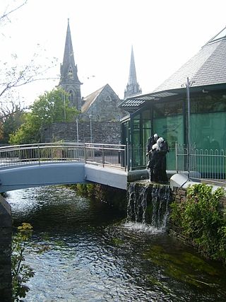
Clonakilty, sometimes shortened to Clon, is a town in County Cork, Ireland. The town is at the head of the tidal Clonakilty Bay. The rural hinterland is used mainly for dairy farming. The town's population was 4,946 at the 2022 census. The town is a tourism hub in West Cork, and was recognised as the "Best Town in Europe" in 2017, and "Best Place of the Year" in 2017 by the Royal Institute of the Architects of Ireland. Clonakilty is in the Dáil constituency of Cork South-West, which has three seats.

West Cork is a tourist region and municipal district in County Cork, Ireland. As a municipal district, West Cork falls within the administrative area of Cork County Council, and includes the towns of Bantry, Castletownbere, Clonakilty, Dunmanway, Schull and Skibbereen, and the 'key villages' of Baltimore, Ballydehob, Courtmacsherry, Drimoleague, Durrus, Glengarriff, Leap, Rosscarbery, Timoleague and Union Hall.

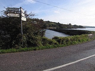
Timoleague is a village in the eastern division of Carbery East in County Cork, Ireland. It is located along Ireland's southern coast between Kinsale and Clonakilty, on the estuary of the Argideen River. Nearby is the village of Courtmacsherry. It is about 17 km (11 mi) south of Bandon and 48 km (30 mi) from Cork on the R600 coastal road.

A regional road in the Republic of Ireland is a class of road not forming a major route, but nevertheless forming a link in the national route network. There are over 11,600 kilometres of regional roads. Regional roads are numbered with three-digit route numbers, prefixed by "R". The equivalent road category in Northern Ireland are B roads.

The N27 road is a national primary road in Cork city, Ireland. The road forms a route from the city centre to Cork Airport, and onto the R600 connecting to the port town of Kinsale.

The N71 road is a national secondary road traversing counties Cork and Kerry in Ireland. Towns and villages along the route, westward from Cork city, include Innishannon, Bandon, Clonakilty, Skibbereen, Bantry and Glengarriff in County Cork. Continuing westwards from Glengarriff into County Kerry, the route passes Kenmare and terminates at Killarney.

A national primary road is a road classification in Ireland. National primary roads form the major routes between the major urban centres. There are 2649 km of national primary roads. This category of road has the prefix "N" followed by one or two digits. Motorways are prefixed "M" followed by one or two digits.

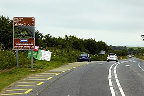
The R599 is a regional road in County Cork, Ireland, connecting the R586 in Dunmanway to the N71 just west of Clonakilty.

The Wild Atlantic Way is a tourism trail on the west coast, and on parts of the north and south coasts, of Ireland. The 2,500 km driving route passes through nine counties and three provinces, stretching from County Donegal's Inishowen Peninsula in Ulster to Kinsale, County Cork, in Munster, on the Celtic Sea coast.

The R291 road is a regional road in Ireland linking Sligo and Rosses Point in County Sligo. The road is part of the Wild Atlantic Way.

The R575 road is a regional road in Ireland. It is a road on the Beara Peninsula in County Cork. The road forms part of the Wild Atlantic Way. Parts of the road form part of the Beara Way walking trail.

The R591 road is a regional road in Ireland. It is a road on the Mizen Peninsula in County Cork. Most of the road forms part of the Wild Atlantic Way.

The R572 road is a regional road in Ireland. It is a road on the Beara Peninsula in County Cork. The road forms part of the Wild Atlantic Way. Parts of the road are on the Beara Way walking trail.

The R595 road is a regional road in Ireland. It is a road on the Haven Coast in west County Cork. The road forms part of the Wild Atlantic Way.

The R597 road is a regional road in Ireland. It is a loop road from the N71 on the Haven Coast in west County Cork. The road forms part of the Wild Atlantic Way.
The 1996 Cork Senior Football Championship was the 108th staging of the Cork Senior Football Championship since its establishment by the Cork County Board in 1887. The draw for the opening fixtures took place on 10 December 1995. The championship began on 27 April 1996 and ended on 20 October 1996.

The R604 road is a regional road in County Cork, Ireland. It travels in a loop from the R600 road near Ballinspittle south to the Old Head of Kinsale and then north again to rejoin the R600. The road is 10.5 kilometres (6.5 mi) long.

The R605 road is a regional road in County Cork, Ireland. It travels from the N71 road at Innishannon to Kinsale, via the village of Dunderrow. The road is 13.7 kilometres (8.5 mi) long.

The R603 road is a regional road in County Cork, Ireland. It travels from the R586 at Bandon Bridge in Bandon south to the R600 at Garranereagh, via Kilbrittain. In Bandon, the route is split on joining and leaving the N71 road. The road is 13.0 kilometres (8.1 mi) long.
The R606 road is a regional road in County Cork, Ireland. It travels from the R605 at Ballythomas Cross south to the R600 at Archdeacon Duggan Bridge near Kinsale. The road's southern section runs along Whitecastle Creek. The R606 is 5.5 kilometres (3.4 mi) long.