
The N11 road is a national primary road in Ireland, running for 129 km (80 mi) along the east side of Ireland from Dublin to Wexford. It passes close to Bray, Greystones, Wicklow, Arklow, Gorey, and Enniscorthy. Beyond Wexford, the route continues to Rosslare as the N25. The road forms part of European route E01. As of July 2019 the N11/M11 is of dual carriageway or motorway standard from Dublin as far as Oilgate in County Wexford.

Gorey is a market town in north County Wexford, Ireland. It is beside the main M11 Dublin to Wexford road. The town is also connected to the railway network along the same route. Local newspapers include the Gorey Guardian.

Castlebridge is a small town on the R741 regional road in County Wexford, Ireland, north of Wexford Town. It is located near the River Slaney and just north of Wexford Harbour. Castlebridge is a rapidly expanding suburb of Wexford Town; its population has almost tripled in 20 years, increasing from 783 in 1996 to a population of 1,840 in 2016.

Kilmuckridge, formerly Ford or The Ford, is a village in County Wexford in Ireland, near the Irish Sea coast. As of the 2016 census, the village had a population of 722 people, having more than tripled in size in the 20 years since the 1996 census. It is known for the nearby beach at Morriscastle.

A regional road in the Republic of Ireland is a class of road not forming a major route, but nevertheless forming a link in the national route network. There are over 11,600 kilometres of regional roads. Regional roads are numbered with three-digit route numbers, prefixed by "R". The equivalent road category in Northern Ireland are B roads.
The N30 road is a national primary road in Ireland. It connects the N25 road and M11 motorway, providing a link running east-northeast through County Wexford, between New Ross and Enniscorthy. This provides for a more direct national route between the two towns, as the N25 and N11 both run to Wexford town, eastwards from New Ross and southwards from Enniscorthy respectively.

Courtown is a village in County Wexford, Ireland. It was developed after Lord Courtown ordered the construction of a harbour during the Famine years, 1839–1846. The economic boost of the new harbour led to a small village developing with fishing being the primary economy of the village. Courtown is situated on the Irish Sea coast and with the recent development during the Celtic Tiger years, has merged into the adjoining village of Riverchapel. It lies on the R742 regional road.

The R752 road is a regional road in County Wicklow, Ireland. From its junction with the R772 in Rathnew on the outskirts of Wicklow Town it takes a generally south-westerly route to its junction with the R747 in the village of Woodenbridge, where it terminates. The road is 26 km (16 mi) long.

The N80 road is a national secondary road in Ireland that runs southeastwards from its junction with the N52 and R443 in the town of Tullamore in County Offaly, to the N30 at Ballynahallin, just north of Enniscorthy in County Wexford, a distance of 114.683 km. Total length is 114.683 km (71.261 mi).
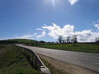
The R772 road is a regional road in Ireland which comprises disconnected sections of road which once formed part of the N11 but which have now been by-passed, joined together by some new road sections and some former local roads.

The R725 road is a regional road in Ireland. From its junction with the N80 on the western outskirts of Carlow Town it takes an easterly route to its junction with the N81 in Tullow, where it crosses the River Slaney on a bridge shared with the N81 in the town centre. It continues east to Shillelagh in County Wicklow, turns due south for 6 km, then eastwards through Carnew. It then enters County Wexford for the final 15 km stretch, terminating in Gorey at the R772. The road is 53 km (33 mi) long.

Tara Hill is an isolated hill and associated village near the Irish Sea coast in north County Wexford, Ireland. Though only 253 metres high, it dominates the landscape of northeast Wexford. It provides extensive views of the Wexford coast line, from Courtown harbour to Castletown.
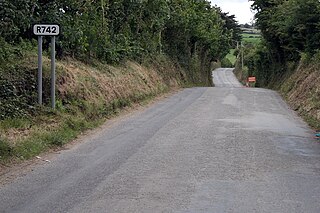
The R742 road is a regional road in County Wexford, Ireland. From its junction with the R772 in Gorey it takes a southerly route to its junction with the R741 north of Wexford Town where it terminates.

Clogh is a small rural village in Ireland. Many local residents refer to the village as "Clough", and this is regarded as the proper spelling.

Ballycanew is a small rural village in Ireland. It is situated in County Wexford, on the R741 regional road 8 km (5.0 mi) south of Gorey. This road is locally known as the "Coast Road".

The R702 road is a regional road in Ireland which runs west-east from the R712 at Coolgrange in County Kilkenny through Gowran before crossing into County Carlow at Goresbridge. It continues to Borris, passes through the Blackstairs Mountains via the Scullogue Gap into County Wexford and continues east until it terminates at a junction with the R890 in Enniscorthy.
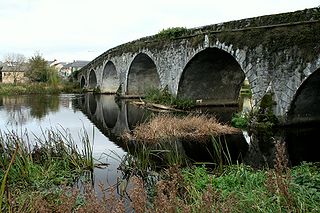
The R700 road is a regional road in Ireland which runs northwest–southeast from Kilkenny city centre to New Ross in County Wexford.

The R730 road is a regional road in County Wexford, Ireland. From its junction with the R702 in Kiltealy it takes a southeasterly route to its junction with the R741 in the centre of Wexford Town, continuing south to Blackhorse to its junction on a roundabout with the N25 Wexford bypass. En route it crosses the N30 national primary road. The road is 35 km (22 mi) long.
The R114 road is a regional road in south Dublin, Ireland. The road runs from the city centre to Brittas in remote southwest County Dublin via Rathmines, Rathgar, Rathfarnham, Knocklyon, Firhouse and the mountainous area of Boharnabreena. The final stretch of the road runs just north of the border between County Dublin and County Wicklow, parallel to the Brittas River and a canal to the River Camac, which rises just to the north.

The R729 road is a regional road in County Carlow and County Wexford in Ireland. It connects the R702 near Borris to the R714 near New Ross, 22.1 km (13.7 mi) to the south.


