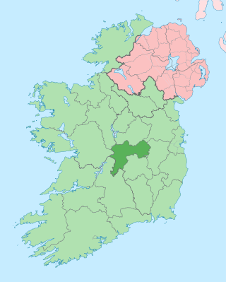
County Offaly is a county in Ireland. It is part of the Eastern and Midland Region and the province of Leinster. It is named after the ancient Kingdom of Uí Failghe. It was formerly known as King's County, in honour of Philip II of Spain. Offaly County Council is the local authority for the county. The county population was 82,668 at the 2022 census.

The Grand Canal is the southernmost of a pair of canals that connect Dublin, in the east of Ireland, with the River Shannon in the west, via Tullamore and a number of other villages and towns, the two canals nearly encircling Dublin's inner city. Its sister canal on the Northside of Dublin is the Royal Canal. The last working cargo barge passed through the Grand Canal in 1960.

Tullamore is the county town of County Offaly in Ireland. It is on the Grand Canal, in the middle of the county, and is the fourth most populous town in the Midlands Region, with 15,598 inhabitants at the 2022 census.

Ferbane is a town in County Offaly, Ireland. It is on the north bank of the River Brosna, between Birr and Athlone at the junction of the N62 and R436 roads, 20 km south of Athlone. The name of the town is said to come from the white bog cotton which grows in the surrounding Bog of Allen.

Daingean, formerly Philipstown, named after King Philip II of Spain, is a small town in east County Offaly, Ireland. It is situated midway between the towns of Tullamore and Edenderry on the R402 regional road. The town of Daingean had a population, as of the 2022 census, of 1,223. It is the principal town of the Daingean Catholic Parish. The other main poles of this parish are Ballycommon, Kilclonfert and Cappincur.

Kilcormac is a small town in County Offaly, Ireland, located on the N52 at its junction with the R437 regional road, between the towns of Tullamore and Birr. It is a small town of 935 people, many of whom were previously employed by Bord na Móna to work the local peat bogs. The town is located near the Slieve Bloom Mountains. The Silver River flows through the town. The town was more commonly referred to as Frankford prior to Irish independence.

Edenderry is a town in east County Offaly, Ireland. It is near the borders with Counties Kildare, Meath and Westmeath. The Grand Canal runs along the south of Edenderry, through the Bog of Allen, and there is a short spur to the town centre.

The R440 road is a regional road in Ireland linking Birr, County Offaly and Mountrath, County Laois. It passes through the village of Kinnity, County Offaly and from there climbs to the watershed of the Slieve Bloom Mountains north of Stillbrook Hill, crossing at an elevation of 1,503 feet (458 m) into County Laois on the plateau and descending to Mountrath.
The R436 road is a regional road in Ireland linking Kilbeggan, County Westmeath and Ferbane, County Offaly. It passes through the town of Clara, County Offaly, Ballycumber, through cutaway peat bogs to Ferbane where it terminates at the N62. The road is 25 km (16 mi) long.

Pollagh, also spelled Pullough, is a village in County Offaly, Ireland, located in the midlands of Ireland. It is a rural village on the Grand Canal and lies between Ferbane and Tullamore. Much of the surrounding area is bogland, and is used to produce fossil fuels such as peat turf. The River Brosna flows close to the village. The Grand Canal was used for transporting peat and bricks produced in the area. Pollagh benefited from the canal in earlier years when it brought investment and employment from Bord na Móna, and it is now a tourist attraction. Pollagh is also known for its church, including its bog oak altar and stained glass windows, designed by the Harry Clarke studios.

The R400 road is a regional road in Ireland, linking Mullingar, County Westmeath to the R419 at Cushina, County Offaly.

The R421 road is a regional road in Ireland which runs southwest-northeast from the R445 south of Roscrea to the N52 north of Tullamore. The route also passes through Clareen, Kinnitty and Killurin. The bulk of the route is in County Offaly with small sections in counties Tipperary and Laois. The route is 50 km (31 mi) long.
Eileen MacDonagh was born in Geevagh, County Sligo in 1956 and has worked as a sculptor since the 1980s. For her contribution to sculpture and the Arts in Ireland, MacDonagh was elected in 2004 to Aosdána, the Irish organisation that recognises artists that have contributed a unique body of work.

The R391 road is a regional road in Ireland linking Clara, County Offaly to Mullingar, County Westmeath. It passes through the villages of Horseleap and Dysart and several hamlets before terminating west of Mullingar.

The R355 road is a regional road in Ireland linking Ballinasloe to Portumna, all in County Galway. The road is 32 km (20 mi) long.
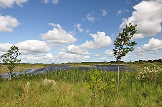
Boora Bog is a cutaway peat bog situated in County Offaly, Ireland. Peat was harvested for fuel between the 1950s and 1970s, and the land is now being reclaimed for agricultural and eco-tourism use. There was a lake called Lough Boora, which was drained by Bord na Móna, but was not used for peat production: this area is now maintained as a nature reserve by the Irish Wildlife Trust. There are two angling lakes.

The Sculpture in the Parklands is a 50-acre (200,000 m2) land and environmental sculpture park located in Lough Boora, County Offaly, Ireland. The park is open to the public 365 days of the year and admission is free.

The Offaly Way is a long-distance trail in County Offaly, Ireland. It is 37 kilometres long and begins in Cadamstown and ends at Lemanaghan, on the R436 road between the towns of Clara and Ferbane. It is typically completed in two days. It is designated as a National Waymarked Trail by the National Trails Office of the Irish Sports Council and is managed by Offaly County Council, Bord na Mona and the Offaly Integrated Development Company. The trail provides a link between the Slieve Bloom Way and the Grand Canal Way.

The Little Brosna River rises near Dunkerrin, County Offaly, Ireland. It flows for 36 miles before joining the River Shannon.

Clonlonan is a barony in south–west County Westmeath, Ireland. It was formed by 1672. It is bordered by County Offaly to the south and a small part of County Roscommon at Long Island on the River Shannon to the west. It also borders four other Westmeath baronies: Kilkenny West and Rathconrath, Moycashel and Brawny. The largest centre of population in the barony is the town of Moate.


