Strabane is a town in County Tyrone, Northern Ireland.

The island of Ireland, comprising Northern Ireland and the Republic of Ireland, has an extensive network of tens of thousands of kilometres of public roads, usually surfaced. These roads have been developed and modernised over centuries, from trackways suitable only for walkers and horses, to surfaced roads including modern motorways. Driving is on the left-hand side of the road. The major routes were established before Irish independence and consequently take little cognisance of the border other than a change of identification number and street furniture. Northern Ireland has had motorways since 1962, and has a well-developed network of primary, secondary and local routes. The Republic started work on its motorway network in the early 1980s; and historically, the road network there was once somewhat less well developed. However, the Celtic Tiger economic boom and an influx of European Union structural funding, saw national roads and regional roads in the Republic come up to international standard quite quickly. In the mid-1990s, for example, the Republic went from having only a few short sections of motorway to a network of motorways, dual carriageways and other improvements on most major routes as part of a National Development Plan. Road construction in Northern Ireland now tends to proceed at a slower pace than in the Republic, although a number of important bypasses and upgrades to dual carriageway have recently been completed or are about to begin.

Lifford is the county town of County Donegal, Ireland, the administrative centre of the county and the seat of Donegal County Council, although the town of Letterkenny is often mistaken as holding this role.
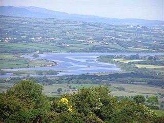
The River Foyle is a river in west Ulster in the northwest of the island of Ireland, which flows from the confluence of the rivers Finn and Mourne at the towns of Lifford in County Donegal, Republic of Ireland, and Strabane in County Tyrone, Northern Ireland. From here it flows to the city of Derry, where it discharges into Lough Foyle and, ultimately, the Atlantic Ocean. The total length of the River Foyle is 32 km (20 mi). The river separates part of County Donegal from parts of both County Londonderry and County Tyrone. The district of County Donegal that borders the western bank of the River Foyle is traditionally known as the Laggan. This district includes the villages of St Johnston and Carrigans, both of which are nestled on the banks of the River.
The N3 road is a national primary road in the Republic of Ireland, running between Dublin, Cavan and the border with County Fermanagh. The A509 and A46 roads in Northern Ireland form part of an overall route connecting to Enniskillen, and northwest to the border again where the N3 reappears to serve Ballyshannon in County Donegal.
The N2 road is a national primary road in Ireland, running from Dublin to the border with Northern Ireland at Moy Bridge near Aughnacloy, County Tyrone to connect Dublin with Derry via the A5. A section of the route near Dublin forms the M2 motorway.

Stranorlar is a town, townland and civil parish in the Finn Valley of County Donegal, in Ireland. Stranorlar and Ballybofey form the Twin Towns.
The N9 road is a national primary road in Ireland running from Junction 11 on the M7, located near Kilcullen, County Kildare, to Waterford city. The route connects Dublin and Waterford. The section of the route from junction 11 on the M7 at Kilcullen to the intersection with the N24 road outside Waterford is motorway standard since 2010 and is designated as the M9 motorway. In line with Irish practice, all sections previously designated N9 were renumbered at that time. Only a short (550-metre) section of the route is still designated as N9 between the Quarry roundabout junction with the N24 and the N25 Grannagh Roundabout junction. This section is dual carriageway.

The N13 road is a national primary road in Ireland, running in County Donegal in Ulster from Stranorlar to just outside Derry. This road connects Letterkenny to Sligo, Derry and onwards to other destinations.

The R236 road runs in County Donegal in Ulster, and links Stranorlar, via Convoy and Raphoe, to St Johnston and Carrigans, becoming the A40 into Derry in Northern Ireland.
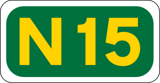
The N15 road is a national primary road in the north-west of Ireland. It runs from Sligo to Lifford, County Donegal. It forms part of the proposed Atlantic Corridor route. It also goes to the border with Northern Ireland.

The Republic of Ireland–United Kingdom border, sometimes referred to as the Irish border or British–Irish border, runs for 499 km (310 mi) from Lough Foyle in the north-west of Ireland to Carlingford Lough in the north-east, separating the Republic of Ireland from Northern Ireland.

Castlefin, sometimes spelt Castlefinn, is a market town and townland in the Finn Valley of County Donegal in Ulster, the northern province in Ireland. It is located between Ballybofey and Lifford in East Donegal and, as of 2016, the population was 705. The River Finn flows by the town. The town is located in along the main N15 national primary road, which runs from Bundoran to Lifford. The town lies 6 miles from Lifford and 8 miles from the twin towns of Ballybofey and Stranorlar. It has close links to Letterkenny, to the twin towns of Ballybofey and Stranorlar, and to West Tyrone in Northern Ireland, especially with the towns of Strabane and Castlederg.

Lifford Bridge is a cross-border bridge spanning the River Foyle in Ireland. It connects Strabane in County Tyrone, Northern Ireland, and Lifford in County Donegal in the Republic of Ireland, joining the A38 road to the N15. It remains a vital part of the trans-border route from the North, West and East of County Donegal, to Dublin via County Tyrone.

The A4 is a major east–west road in Northern Ireland. It travels for 69.2 miles from Portadown to Belcoo through County Armagh, County Tyrone and County Fermanagh.

The A5 is a major primary route in Northern Ireland. It links the city of Derry in County Londonderry with Aughnacloy, County Tyrone via the towns of Strabane and Omagh. Just south of Aughnacloy is the border with the Republic of Ireland, where the A5 meets the N2 to Dublin. Between them the A5 and N2 are the main road link between County Donegal in the Republic and Dublin.

Manorcunningham, or Manor is a small village and townland in County Donegal, Ireland. It is located 7 kilometers from Letterkenny on the main road to Derry. It is known locally and throughout Donegal as just Manor.
The Strabane and Letterkenny Railway was a 3 ft narrow gauge railway line between Strabane, County Tyrone and Letterkenny, County Donegal in Ireland.

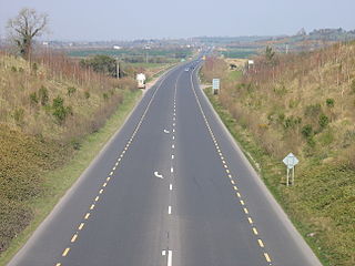
The A38 links Strabane, County Tyrone and the A5 through the meadows of the river Foyle and over Lifford Bridge to Lifford, the County Town of County Donegal, where it links into the N14 and the N15. The N15, which continues into County Donegal to Stranorlar, Donegal Town, Ballyshannon, Bundoran and then leaving County Donegal, before heading to Sligo. The N14, which continues through Rossgeir, Drumbeg to Letterkenny.

Letterkenny bus station is a Bus Éireann station serving the County of Donegal in Ireland. It is located in the Cathedral Town of Letterkenny. It is a particularly important transport hub in the county, as there are no rail services in the area.