
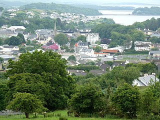
Letterkenny, nicknamed the Cathedral Town, is a large town in County Donegal, Ireland, on the River Swilly in the north-west of Ulster. Along with the nearby city of Derry, Letterkenny is a regional economic gateway for the north-west of Ireland.

Lifford is the county town of County Donegal, Ireland, the administrative centre of the county and the seat of Donegal County Council, although the town of Letterkenny is often mistaken as holding this role.

Bundoran is a town in County Donegal, Ireland. The town is located near the N15 road near Ballyshannon, and is the most southerly town in Donegal. The town is a tourist seaside resort, and tourism has been at the heart of the local economy since the 18th century. Bundoran is a surfing destination and was listed by National Geographic magazine in 2012 as one of the world's top 20 surf towns.
Donegal is a town in County Donegal in Ulster, the northern province in Ireland. Although Donegal gave its name to the county, now Lifford is the county town. From the 15th until the early 17th century, Donegal was the "capital" of Tyrconnell, a Gaelic kingdom controlled by the O'Donnell dynasty of the Northern Uí Néill.

Dunfanaghy is a small town, former fishing port, and commercial centre on the north coast of County Donegal, Ireland. It lies on Donegal's North West coast, specifically the west side of Sheephaven Bay, on the N56 road, 30 km north-west of Letterkenny.

Stranorlar is a town, townland and civil parish in the Finn Valley of County Donegal, in Ireland. Stranorlar and Ballybofey form the twin towns of Ballybofey–Stranorlar.

The N13 road is a national primary road in Ireland, running in County Donegal in Ulster from Stranorlar to just outside Derry. This road connects Letterkenny to Sligo, Derry and onwards to other destinations.

The N14 road is a national primary road in the Republic of Ireland. The entirety of the route is located in the northwest of Ireland, in County Donegal, connecting Manorcunningham to Lifford in the east. Here it connects to the N15 near the border with Northern Ireland and along the A38 to Strabane in County Tyrone.

The R236 road runs in County Donegal in Ulster, and links Stranorlar, via Convoy and Raphoe, to St Johnston and Carrigans, becoming the A40 into Derry in Northern Ireland.
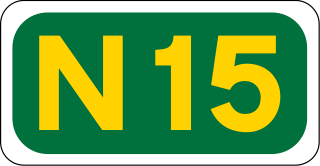
The N15 road is a national primary road in the north-west of Ireland. It runs from Sligo to Lifford, County Donegal. It forms part of the proposed Atlantic Corridor route. It also goes to the border with Northern Ireland.

Ballybofey is a town located on the south bank of the River Finn, County Donegal, Ireland. Together with the smaller town of Stranorlar on the north side of the River Finn, the towns form the twin towns of Ballybofey-Stranorlar. The twin towns, a census town, had a population of 5,406 in 2022.

The Londonderry and Lough Swilly Railway Company was an Irish public transport and freight company that operated in parts of County Londonderry and County Donegal between 1853 and 2014. Incorporated in June 1853, it once operated 99 miles of railways. It began the transition to bus and road freight services in 1929. It closed its last railway line in July 1953 but continued to operate bus services under the name Lough Swilly Bus Company until April 2014, becoming the oldest railway company established in the Victorian era to continue trading as a commercial concern into the 21st century. Following a High Court petition by HM Revenue and Customs, the company went into liquidation and operated its final bus services on 19 April 2014.

Castlefin, sometimes spelt Castlefinn, is a market town and townland in the Finn Valley of County Donegal, Ireland. It is located between Stranorlar and Lifford in East Donegal. As of 2022, the population was 730. The River Finn flows by the town. The town is located in along the main N15 national primary road, which runs from Bundoran to Lifford. The town lies 6 miles from Lifford and 8 miles from the twin towns of Ballybofey and Stranorlar. It has close links to Letterkenny, to the twin towns of Ballybofey and Stranorlar, and to West Tyrone in Northern Ireland, especially with the towns of Strabane and Castlederg.

The A5 is a major primary route in Northern Ireland. It links the city of Derry in County Londonderry with Aughnacloy, County Tyrone via the towns of Strabane and Omagh. Just south of Aughnacloy is the border with the Republic of Ireland, where the A5 meets the N2 to Dublin. Between them the A5 and N2 are the main road link between County Donegal in the Republic and Dublin.
The Finn Valley Post was a free local newspaper in County Donegal, Ireland, based in the town of Ballybofey. The paper was first published on 18 July 2007 by the River Media group, which produced other local titles such as the Donegal Post and Letterkenny Post. The newspaper covers much of east and central County Donegal, including Ballybofey, Stranorlar, Raphoe and Lifford. Its name derives from the River Finn which flows through the area.

The N56 road is a national secondary road in the Republic of Ireland that runs from Donegal Town clockwise to Letterkenny. As originally designated, it included the section of the N13 between Stranorlar and Letterkenny, forming a circular route including parts of the N15.
The High Sheriff of Donegal was the British Crown's judicial representative in County Donegal in Ulster, Ireland, from the late 16th century until 1922, when the office was abolished in the new Irish Free State and replaced by the office of Donegal County Sheriff. The High Sheriff had judicial, electoral, ceremonial and administrative functions and executed High Court Writs. In 1908, an Order in Council made the Lord-Lieutenant the Sovereign's prime representative in a county and reduced the High Sheriff's precedence. However, the sheriff retained his responsibilities for the preservation of law and order in the county. The usual procedure for appointing the sheriff from 1660 onwards was that three persons were nominated at the beginning of each year from the county and the Lord Lieutenant then appointed his choice as High Sheriff for the remainder of the year. Often the other nominees were appointed as under-sheriffs. Sometimes a sheriff did not fulfil his entire term through death or other event and another sheriff was then appointed for the remainder of the year. The dates given hereunder are the dates of appointment. All addresses are in County Donegal unless stated otherwise.

Killygordon is a small village in the Finn Valley in the east of County Donegal, Ireland. As of 2022, the population was 716. It is located on the N15 between Stranorlar and Castlefin. The separate hamlet and townland of Crossroads, usually known as The Cross, lies half a mile from Killygordon. The River Finn passes by the village on its way towards its confluence with the River Mourne and the River Foyle.

The R265 is a regional road in County Donegal, Ireland. It runs north to south from near Newtown Cunningham to Rossgier near Lifford. The road runs from near Lough Swilly and generally along the west bank of the River Foyle. The road runs through mostly arable farmland in the East Donegal area.

The R267 road is a regional road in County Donegal, Ireland. The road links Donegal Town with the N15, a road which runs around the eastern and south-eastern edge of Donegal Town. The N15 forms part of the main road between Derry and Sligo Town. The R267, parts of which are known as the Derry Road or the Ballybofey Road within Donegal Town, crosses the Drumenny Burn between The Northern Garage and the District Hospital, near where the burn enters the River Eske. The road is 5.6 km (3.5 mi) long.

