
The River Bann is one of the longest rivers in Northern Ireland, its length, Upper and Lower Bann combined, being 129 km (80 mi). However, the total length of the River Bann, including its path through the 30 km (19 mi) long Lough Neagh is 159 km (99 mi). Another length of the River Bann given is 90 mi. The river winds its way from the southeast corner of Northern Ireland to the northwest coast, pausing in the middle to widen into Lough Neagh. The River Bann catchment has an area of 5,775 km2. The River Bann has a mean discharge rate of 92 m3/s. According to C. Michael Hogan, the Bann River Valley is a settlement area for some of the first human arrivals in Ireland after the most recent glacial retreat.

York Road railway station served the north of Belfast in Northern Ireland. It was formerly one of the three terminus railway stations in Belfast. The others were Great Victoria Street, and Queen's Quay.

The N19 road is a national primary road in Ireland, connecting from the N18 Limerick–Ennis–Galway road to Shannon Airport. It forms part of European route E20.

The A2 is a major road in Northern Ireland, a considerable length of which is often referred to the Antrim Coast Road because much of it follows the scenic coastline of County Antrim; other parts of the road follow the coasts in Counties Down and Londonderry.

The N26 road is a national primary road in northeast County Mayo in Ireland connecting the N5 road at Swinford with the N58 at Foxford and then on to the N59 road at Ballina. The road also meets six regional roads along its route, and it is 29.79 kilometres (18.51 mi) long.

The A36 is a road in Northern Ireland. It travels through County Antrim, connecting the large towns of Ballymena and Larne.

Bendooragh is a small village and townland in County Antrim, Northern Ireland, 2+1⁄2 miles (4.0 km) south west of Ballymoney. It is part of Causeway Coast and Glens District Council. It had a population of 622 people in the 2011 Census.
The Birches is a small village in northern County Armagh, Northern Ireland. It is 6 miles northwest of Portadown, close to junction 12 on the M1 Motorway and to the southern shore of Lough Neagh. In the 2001 Census it had a population of 150. It is within the Armagh City, Banbridge and Craigavon council area.
The A8(M) is a motorway in County Antrim, Northern Ireland. It is 1 mile (1.6 km) long and is a spur of the M2 motorway. It was opened on 24 October 1966 and built at the same time as the M2 section to which it connects. It is part of the unsigned European routes E01 and E18.

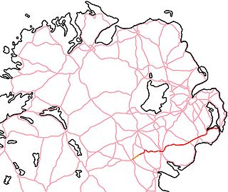
The A29 is a major road in Northern Ireland; it is mostly a single carriageway and goes through a number of main towns and connects in several places to other major roads.

The A6 road in Northern Ireland runs for 71.4 miles (114.9 km) from Belfast to Derry, via County Antrim and County Londonderry. From Belfast to Randalstown the route has been superseded by a motorway. Mostly single carriageway, there are sections of dual carriageway in Antrim town centre and from Randalstown to Toome, including the Toome bypass. In urban and suburban districts of Belfast and Derry the route is single carriageway with 4 lanes. In rural parts, there are numerous climbing lanes along the route. The A6 is one of Northern Ireland's most important arterial routes, as the road runs between its two largest cities and urban areas. Between Randalstown and Derry the road forms part of European route E16. There is a new dual carriageway between Drumahoe and Dungiven, which is still under construction as of February 2023.

The A26 is a road in Northern Ireland. It travels in a north–south direction from Coleraine, County Londonderry to Banbridge, County Down.

European route E1 is a series of roads in Europe, part of the United Nations International E-road network, running from Larne, Northern Ireland to Seville, Spain. There is a sea crossing between Rosslare Harbour, in Ireland, and Ferrol, but no ferry service. The road also passes through Portugal – past the city of Porto, through the capital, Lisbon, and then south to the Algarve, passing Faro before reaching the Spanish border west of Huelva.

The A46 is a road in County Fermanagh, in Northern Ireland. It forms part of the route from Dublin to Ballyshannon. It stretches 23.6 miles from Enniskillen to Belleek along the southwestern shoreline of Lower Lough Erne.

The A22 is a road in County Down, in Northern Ireland. Its route starts in Dundonald and runs to Comber, forming the main transport corridor connecting Belfast and Comber, a commuter town situated 8 miles outside of the city. After bypassing Comber town itself, the route continues along the eastern shores of, though not directly adjacent to, Strangford Lough. The route passes through Lisbane, Balloo, and Killyleagh, terminating in Downpatrick.
The A25 is the name given to the sections of the main route connecting Strangford with Castleblayney that lie in Northern Ireland. It is a road of regional importance, serving much of south Armagh and south Down. The road commences in the village of Strangford, on the shores of Strangford Lough, from which the Portaferry - Strangford Ferry service transports vehicles to Portaferry on the Ards peninsula. The entirety of the route is 61.2 miles, of which 54.5 miles are located north of the border, forming the A25 - the remaining 6.7 miles form the R182 in the Republic of Ireland.

The A32 is a route in Northern Ireland connecting Omagh, County Tyrone and Swanlinbar, County Cavan. The road passes through Dromore in Tyrone and the Fermanagh towns of Irvinestown and Enniskillen.

The A34 is a road in County Fermanagh in Northern Ireland. The route carries traffic from the A4 in Maguiresbridge via Lisnaskea and Newtownbutler to Clones in County Monaghan.
The Londonderry and Enniskillen Railway (L&ER) was an Irish gauge railway in Ireland.
The Route was a medieval territory in Gaelic Ireland, located on the north-east coast of Ulster. It stretched between Coleraine and Ballycastle and as far south as the Clogh River. Originally part of Twescard, a county of the Earldom of Ulster, it was later ruled by the MacQuillans and then the MacDonnells.
