Comber is a town in County Down, Northern Ireland. It lies 5 miles (8 km) south of Newtownards, at the northern end of Strangford Lough. It is situated in the townland of Town Parks, the civil parish of Comber and the historic barony of Castlereagh Lower. Comber is part of the Ards and North Down Borough. It is also known for Comber Whiskey which was last distilled in 1953. A notable native was Thomas Andrews, the designer of the RMS Titanic and was among the many who went down with her. Comber had a population of 9,071 people in the 2011 Census.

The Lagan Valley is an area of Northern Ireland between Belfast and Lisburn. The River Lagan rises on Slieve Croob in County Down and flows generally northward discharging into Belfast Lough. For a section, the river forms part of the border between the counties of Antrim and Down.
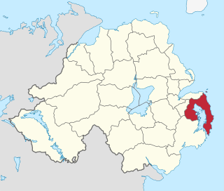
Ards was a local government district in Northern Ireland with the status of borough. It was one of twenty-six districts formed on 1 October 1973, and had its headquarters in Newtownards. It was merged with neighbouring North Down on 1 May 2015 to form the new Borough of Ards and North Down. Other towns in the defunct Borough included Portaferry, Comber, and Donaghadee, and the population of the area was 78,078 according to the 2011 census.

Strangford is a parliamentary constituency in the United Kingdom House of Commons.
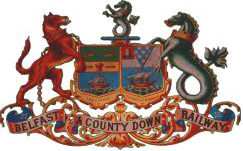
The Belfast and County Down Railway (BCDR) was an Irish gauge railway in Ireland linking Belfast with County Down. It was built in the 19th century and absorbed into the Ulster Transport Authority in 1948. All but the line between Belfast and Bangor was closed in the 1950s, although some of it has been restored near Downpatrick by a heritage line, the Downpatrick and County Down Railway.

Ballygowan is a village in County Down, Northern Ireland. It is within the Ards and North Down Borough. The town of Comber is a short distance to the north-east, the town of Saintfield to the south, and the city of Belfast further to the north-west. It is within the civil parishes of Killinchy and Comber and is split between the historic baronies of Castlereagh Lower and Castlereagh Upper. It had a population of 3,138 people in the 2021 Census.

Comber Whiskey was an Irish whiskey distilled in Comber, County Down, Northern Ireland. It was last distilled in 1956. However, some reserves were discovered and bottled in the 1980s as "Old Comber" and some of these bottles occasionally come up for sale.
Moneyreagh or Moneyrea is a small village and townland in County Down, Northern Ireland. It is just off the main road between Belfast and Ballygowan. It is situated in the civil parish of Comber and the historic barony of Castlereagh Lower. It had a population of 1,594 people in the 2021 Census.
Terra Nova is a town located southwest of Glovertown on the island of Newfoundland. It was served by the Canadian National Railway in the 1950s. The population in 2006 was 68, this from a historic low of just 28 in 1996. By 2016, the population had risen to 73, down slightly from the total of 83 recorded in 2011. There is a sizable leisure and summer population here seasonally as well as the stable permanent population.
EWAY is a bus rapid transit route being built in Northern Ireland to link the town of Dundonald in County Down with Belfast City Centre. If completed it will be about 5.5 miles (9 km) long.
Calders is a summit of 2,211 feet (674 m) in the Howgill Fells, Cumbria, England. It lies about 2⁄3 mile (1 km) south-east of the summit of The Calf and is classified as a Hewitt.
The Comber Greenway is a 7-mile (11 km) traffic-free section of the National Cycle Network that runs along the old Belfast-Comber railway line. The cycle path starts on Dee Street in east Belfast and finishes at Comber in County Down. As well as a cycling path, it is also popular with people on foot. The most recent addition to the route was in November 2008 when the final link between Old Dundonald Road/Comber Rd junction and Comber was opened. This added 1.6 miles (2.6 km) to the route. One section runs through a SLNCI-designated Wetland ecosystem.
The A21, also Comber road, is a road in County Down in Northern Ireland. The route commences in Bangor, passing through Newtownards, Comber, and Ballygowan, and finishes on the northern outskirts of Ballynahinch.
The Green is a cricket ground in Comber, Northern Ireland and the home of North Down Cricket Club. The ground was established in 1857 and had capacity of 2000 in early days. The two ends are Pavilion End and Mount Alexander End. In 1995, the ground hosted its first List A match when Ireland played Kent in the 1995 Benson & Hedges Cup. In 2005, the ground hosted three further List A matches in the 2005 ICC Trophy, which saw matches between Ireland and Uganda, Bermuda and Uganda, and Namibia and Oman.

Ballygowan railway station was a rural station in Ballygowan, County Down between Comber and Saintfield on the Belfast and County Down Railway which ran from Belfast Queens Quay station to Newcastle railway station in Northern Ireland. The station had only one platform on the south side. There was a level crossing at the Comber end. The goods store on the Saintfield end was added in 1898. The station has since been demolished and rebuilt into a shop and a private residence but the goods shed still stands, now used by the company Station Autos. Part of the former train yard on the west side is now used as a bus depot by Translink Ulsterbus.

Comber railway station was on the Belfast and County Down Railway which ran from Belfast to Newcastle, County Down in Northern Ireland.
Knock railway station was on the Belfast and County Down Railway which ran from Belfast to Newcastle, County Down in Northern Ireland.

Dharmavaram railway station is the primary railway station serving Dharmavaram, Anantapur district. It is one of the major train junctions in Andhra Pradesh. The station comes under the jurisdiction of Guntakal division of South Coast Railways. The station has five platforms.

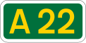
Lisbane is a small village and townland in the parish of Tullynakill and the barony of Castlereagh Lower in County Down, Northern Ireland. It is between Balloo and Comber on the A22 road, 5 kilometres south-east of Comber. It is near Strangford Lough in the Ards and North Down Borough Council.