The A69 is a major northern trunk road in England, running east–west across the Pennines, through the counties of Tyne and Wear, Northumberland and Cumbria. Originally, the road started in the centre of Newcastle upon Tyne then later near Birtley, but since the creation of the A1 Western Bypass around Newcastle upon Tyne, it now starts at Denton Burn, a suburb of Newcastle upon Tyne.

Down District Council was a Local Council in County Down in Northern Ireland. It merged with Newry and Mourne District Council in April 2015 under local government reorganisation in Northern Ireland to become Newry, Mourne and Down District Council.

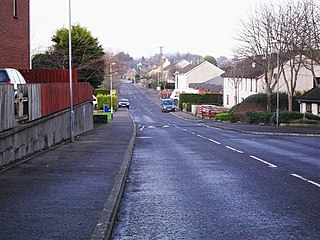
Carryduff is a small town and townland in County Down, Northern Ireland, about 10 kilometres (6.2 mi) south of Belfast city centre. It had a population of 7,173 people in the 2021 census. Most of the settlement lies within the townland of Carryduff, although part of it extends into the neighbouring townlands of Killynure and Mealough.

Ballynahinch is a town in County Down, Northern Ireland. It had a population of 6,164 people in the 2021 census.

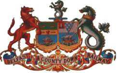
The Belfast and County Down Railway (BCDR) was an Irish gauge railway in Ireland linking Belfast with County Down. It was built in the 19th century and absorbed into the Ulster Transport Authority in 1948. All but the line between Belfast and Bangor was closed in the 1950s, although some of it has been restored near Downpatrick by a heritage line, the Downpatrick and County Down Railway.

Crossgar is a village and townland in County Down, Northern Ireland. It is about 15 miles (24 km) south of Belfast – between Saintfield and Downpatrick. Crossgar had a population 1,997 people in the 2021 UK Census.

Saintfield is a village and civil parish in County Down, Northern Ireland. It is about halfway between Belfast and Downpatrick on the A7 road. It had a population of 3,588 in the 2021 Census, made up mostly of commuters working in both south and central Belfast, which is about 18 km away. The population of the surrounding countryside is mostly involved in farming.
Killynure is a townland in County Down, Northern Ireland, lying on the south-east border of Carryduff.

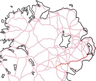
The A24 is a major road in Northern Ireland running from Belfast to Clough near Newcastle, passing through Carryduff and Ballynahinch. In Belfast, the route forms the Ormeau Road. At Clough it meets the A2.

Clough is a village and townland in County Down, Northern Ireland. It sits about 3 miles from Dundrum on the A2 between Newcastle and Belfast. The A2 continues via Downpatrick and the coast via Strangford and the Portaferry – Strangford Ferry to Portaferry to Belfast, whilst most road traffic heads along from Clough along the A24 via Carryduff to Belfast. It had a population of 255 people in the 2001 census. Clough is situated within the Newry, Mourne and Down area.
The Carryduff River is a minor river in County Down, Northern Ireland. It is a direct tributary of the River Lagan and is not navigable.
Ouley Hill is 180 m high and lies in County Down Northern Ireland between Carryduff and Saintfield. Its name is derived from Irish Baile Eochaille '‘townland of the yew-wood’ or simply Eochoillidh ‘yew wood’'

The A588 is a road in western Lancashire, England, which runs for around 20 miles (32 km), from Poulton-le-Fylde northeastwards to Lancaster. It is the main route serving the Over Wyre areas of the Fylde.
East Down was a constituency of the Parliament of Northern Ireland.

The A22 is a road in County Down, in Northern Ireland. Its route starts in Dundonald and runs to Comber, forming the main transport corridor connecting Belfast and Comber, a commuter town situated 8 miles outside of the city. After bypassing Comber town itself, the route continues along the eastern shores of, though not directly adjacent to, Strangford Lough. The route passes through Lisbane, Balloo, and Killyleagh, terminating in Downpatrick.

The A25 is the name given to the sections of the main route connecting Strangford with Castleblayney that lie in Northern Ireland. It is a road of regional importance, serving much of south Armagh and south Down. The road commences in the village of Strangford, on the shores of Strangford Lough, from which the Portaferry - Strangford Ferry service transports vehicles to Portaferry on the Ards peninsula. The entirety of the route is 61.2 miles, of which 54.5 miles are located north of the border, forming the A25 - the remaining 6.7 miles form the R182 in the Republic of Ireland.

Listooder is a hamlet and townland situated outside Crossgar towards both Ballynahinch and Saintfield in County Down, Northern Ireland. Listooder derives its name from the Irish word Lios an tSúdaire meaning "fort of the leather tanner" or "ring-fort". From the mid 19th century, the hamlet was known as the Cock, while the townland which centres around the fort was called Listooder.
The High Sheriff of Down is the Sovereign's judicial representative in County Down. Initially an office for lifetime, assigned by the Sovereign, the High Sheriff became annually appointed from the Provisions of Oxford in 1258. Besides his judicial importance, he has ceremonial and administrative functions and executes High Court Writs.


