County Leitrim is a county in Ireland. It is in the province of Connacht and is part of the Northern and Western Region. It is named after the village of Leitrim. Leitrim County Council is the local authority for the county, which had a population of 35,199 according to the 2022 census.

The N4 road is a national primary road in Ireland, running from Dublin to the northwest of Ireland and Sligo town. The M6 to Galway diverges from this route after Kinnegad, while the N5 to Westport diverges at Longford town. Most sections of the N4 that are motorway-standard are designated the M4 motorway.

Ballinamore is a small town in the south-east of County Leitrim in Ireland.

Mohill is a town in County Leitrim, Ireland. The town of Carrick-on-Shannon is approximately 16 km (10 miles) away.
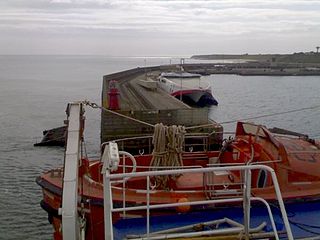
The village of Rosslare Harbour, also known as Ballygeary, grew up to serve the needs of the harbour of the same name, first developed in 1906 by the Great Western Railway and the Great Southern and Western Railway to accommodate steamferry traffic between Great Britain and Ireland. This port also serves France and Spain, traffic is mainly roll-on roll-off (RoRo). Rosslare Harbour railway station opened on 30 August 1906.

Swanlinbar is a small village on the N87 national secondary road in north-west County Cavan, Ireland, close to the Cladagh river and near the Fermanagh border.

The N17 road is a national primary road in Ireland, and is part of the Atlantic Corridor route. It begins in County Galway and ends in County Sligo. On 27 September 2017 the southern, Tuam–Galway, section was upgraded to motorway status and designated M17.

A regional road in the Republic of Ireland is a class of road not forming a major route, but nevertheless forming a link in the national route network. There are over 11,600 kilometres of regional roads. Regional roads are numbered with three-digit route numbers, prefixed by "R". The equivalent road category in Northern Ireland are B roads.
Dromod railway station serves the village of Dromod in County Leitrim and nearby Roosky in County Roscommon. It is a station on the Dublin Connolly to Sligo InterCity service.

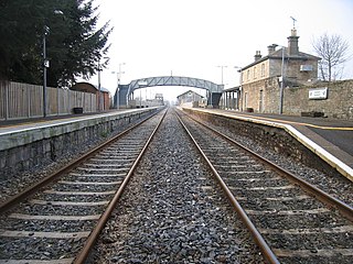
Sligo railway station, also known as MacDiarmada station, is a mainline railway station which serves the town of Sligo in County Sligo, Ireland. It is a terminal station which now has two platforms and an intermediate carriage siding. The railway at the station is elevated above the surrounding streets and the station building dominates its surrounds. There is a passing loop at the approach to the station. It is named after Irish patriot Seán Mac Diarmada. Iarnród Éireann, Ireland's national railway operator, runs inter-city rail services between Sligo and Dublin on the Dublin-Sligo railway line.
Kevin Coen was a volunteer in the Sligo Brigade of the Provisional Irish Republican Army (IRA) who was killed in County Fermanagh, Northern Ireland, by the British Army.

The R292 road is a regional road in Ireland that runs from Sligo town via Strandhill to Ballysadare, all in County Sligo. A more direct road from Sligo to Ballysadare is available using the N4 road.

The N87 road is a national secondary road in the north of County Cavan, Ireland.

The R393 road is a regional road in Ireland linking Longford to Mullingar in County Westmeath.

A 2+2 road is a specific type of dual-carriageway that exists primarily in Ireland, Sweden, Estonia and Finland, consisting of two lanes in each direction separated by a steel cable barrier.

The A46 is a road in County Fermanagh, in Northern Ireland. It forms part of the route from Dublin to Ballyshannon. It stretches 23.6 miles from Enniskillen to Belleek along the southwestern shoreline of Lower Lough Erne.

The A32 is a route in Northern Ireland connecting Omagh, County Tyrone and Swanlinbar, County Cavan. The road passes through Dromore in Tyrone and the Fermanagh towns of Irvinestown and Enniskillen.

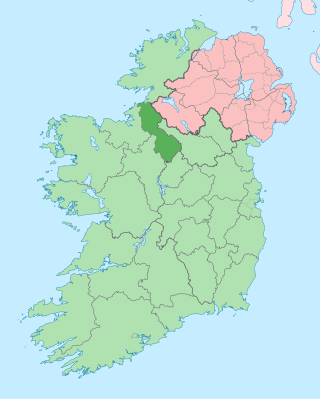
The Border Region is a NUTS Level III statistical region of Ireland. The name of the region refers to its location along the Republic of Ireland–United Kingdom border. It is not a cross-border region. It comprises the Irish counties of Cavan, Donegal, Leitrim, Monaghan and Sligo. The Border Region spans 11,516 km2, 16.4% of the total area of the state, and has a population of 419,473 persons as of the 2022 census, 8.14% of the state total.
Drumod Glebe is a townland in the civil parish of Kinawley, barony of Tullyhaw, County Cavan, Ireland.

The R267 road is a regional road in County Donegal, Ireland. The road links Donegal Town with the N15, a road which runs around the eastern and south-eastern edge of Donegal Town. The N15 forms part of the main road between Derry and Sligo Town. The R267, parts of which are known as the Derry Road or the Ballybofey Road within Donegal Town, crosses the Drumenny Burn between The Northern Garage and the District Hospital, near where the burn enters the River Eske. The road is 5.6 km (3.5 mi) long.


