 | |
|---|---|
| Bóthar R835 | |
| Route information | |
| Length | 3.9 km (2.4 mi) |
| Location | |
| Country | Ireland |
| Primary destinations | |
| Highway system | |
The R835 road is a regional road in Ireland which links Lucan with the N4 in County Dublin. [1]
The road is 3.9 km (2.4 mi) long.
| | |
|---|---|
| Bóthar R835 | |
| Route information | |
| Length | 3.9 km (2.4 mi) |
| Location | |
| Country | Ireland |
| Primary destinations | |
| Highway system | |
The R835 road is a regional road in Ireland which links Lucan with the N4 in County Dublin. [1]
The road is 3.9 km (2.4 mi) long.

The island of Ireland, comprising Northern Ireland and the Republic of Ireland, has an extensive network of tens of thousands of kilometres of public roads, usually surfaced. These roads have been developed and modernised over centuries, from trackways suitable only for walkers and horses, to surfaced roads including modern motorways. Driving is on the left-hand side of the road. The major routes were established before Irish independence and consequently take little cognisance of the border other than a change of identification number and street furniture. Northern Ireland has had motorways since 1962, and has a well-developed network of primary, secondary and local routes. The Republic started work on its motorway network in the early 1980s; and historically, the road network there was once somewhat less well developed. However, the Celtic Tiger economic boom and an influx of European Union structural funding, saw national roads and regional roads in the Republic come up to international standard quite quickly. In the mid-1990s, for example, the Republic went from having only a few short sections of motorway to a network of motorways, dual carriageways and other improvements on most major routes as part of a National Development Plan. Road construction in Northern Ireland now tends to proceed at a slower pace than in the Republic, although a number of important bypasses and upgrades to dual carriageway have recently been completed or are about to begin.

The N4 road is a national primary road in Ireland, running from Dublin to the northwest of Ireland and Sligo town. The M6 to Galway diverges from this route after Kinnegad, while the N5 to Westport diverges at Longford town. Most sections of the N4 that are motorway-standard are designated the M4 motorway.
The N3 road is a national primary road in the Republic of Ireland, running between Dublin, Cavan and the border with County Fermanagh. The A509 and A46 roads in Northern Ireland form part of an overall route connecting to Enniskillen, and northwest to the border again where the N3 reappears to serve Ballyshannon in County Donegal.

The N16 road is a national primary road in Ireland. It begins in County Sligo in the northwest of Ireland, and ends at Blacklion, County Cavan, at the border with Northern Ireland, where it becomes the A4 road. At 47.49 kilometres (29.51 mi), The N16 is one of the shorter national primary routes, as it forms only part of a major route from Sligo to Enniskillen and onwards to Belfast.

The R148 road is one of Ireland's regional roads which was classified following the opening of a by-passed national primary road.
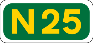
The N25 road is a national primary road in Ireland, forming the route from Cork to Rosslare Europort via Waterford City. The road is part of the E30 European route and a short section is also part of the E01 European route. It forms part of the proposed Atlantic Corridor route.

The N28 road is a national primary road in Ireland. It connects the port and village of Ringaskiddy to the N40 South Ring Road in Cork city.

A national primary road is a road classification in Ireland. National primary roads form the major routes between the major urban centres. There are 2649 km of national primary roads. This category of road has the prefix "N" followed by one or two digits. Motorways are prefixed "M" followed by one or two digits.

The N75 road is a national secondary road in Ireland. It runs for its entire length in County Tipperary, east to west from Thurles to its junction with the M8 motorway close to the village of Two-Mile Borris.

The N77 road is a national secondary road in Ireland. It links the N10 national primary on the ring road south of Kilkenny, County Kilkenny to the M7 motorway at Portlaoise in County Laois.

The N61 road is a national secondary road in County Roscommon in Ireland, linking Athlone, Roscommon, Tulsk, and Boyle. It also connects the N6, N63, N60, N5, and N4 national primary and national secondary roads, as well as seven regional roads. The road is 74.193 kilometres (46.101 mi) long.

The N83 road is a national secondary road in Ireland that runs from its junction with the N17 just south of Ireland West Airport Knock in County Mayo to a point just north of Tuam, County Galway where it rejoins the N17. On 27 September 2017, the old N17 from the Kilmore Roundabout in Tuam to the junction with the N6 in Galway city was redesignated as the N83.

The N87 road is a national secondary road in the north of County Cavan, Ireland.

In Ireland, the highest category of road is a motorway, indicated by the prefix M followed by a one- or two-digit number. The motorway network consists entirely of motorway-grade dual carriageways and is largely focused upon Dublin. There are also several three-lane motorways, while Ireland's busiest road, the M50, incorporates four-lane, five-lane, and six-lane stretches.

Ireland has an extensive network of public roads which connect all parts of the country with each other. Roads in Ireland are currently classified as motorways, National Primary routes, National secondary routes, Regional roads and Local roads. The introduction of this classification system began in 1977.
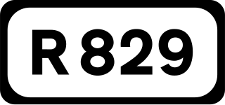
The R829 road is a regional road in Dún Laoghaire–Rathdown, Ireland connecting Monkstown and Dalkey.

The R177 road is a regional road in Ireland linking Lisdoo and the Border with Northern Ireland in County Louth. The road continues as the A29 across the border in Northern Ireland. The road is 5.5 km (3.4 mi) long.

The R213 road is a regional road in Ireland which links the N2 at Castleshane with the N12 near the border with Northern Ireland in County Monaghan. The road is 4.1 km (2.5 mi) long.

The R214 road is a regional road in Ireland which links Castleshane with the Republic of Ireland–United Kingdom border. The road is 4.2 km (2.6 mi) long.

The R237 road is a regional road in Ireland which links the Republic of Ireland–United Kingdom border at Killea with the N13 road in County Donegal.
| | This Irish road or road transport-related article is a stub. You can help Wikipedia by expanding it. |