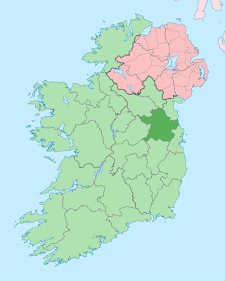
County Meath is a county in the Eastern and Midland Region of Ireland, within the province of Leinster. It is bordered by Dublin to the southeast, Louth to the northeast, Kildare to the south, Offaly to the southwest, Westmeath to the west, Cavan to the northwest, and Monaghan to the north. To the east, Meath also borders the Irish Sea along a narrow strip between the rivers Boyne and Delvin, giving it the second shortest coastline of any county. Meath County Council is the local authority for the county.

Cavan is the county town of County Cavan in Ireland. The town lies in Ulster, near the border with County Fermanagh in Northern Ireland. The town is bypassed by the main N3 road that links Dublin with Enniskillen, Ballyshannon and Donegal Town.

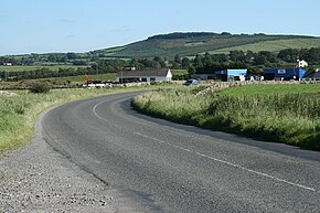
Kiltale is a small rural community district in County Meath, Ireland with a population of approx. 300. Kiltale is situated on the R154 regional road, the main Dublin to Trim road. It is approximately 9 km east of Trim, about 9 km west of Dunshaughlin and 19 km south of Navan. Kiltale is just over 7 km from the historical seat of the High King of Ireland at the Hill of Tara.
The N3 road is a national primary road in the Republic of Ireland, running between Dublin, Cavan and the border with County Fermanagh. The A509 and A46 roads in Northern Ireland form part of an overall route connecting to Enniskillen, and northwest to the border again where the N3 reappears to serve Ballyshannon in County Donegal.

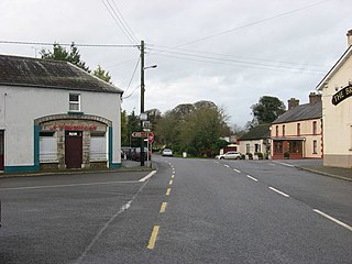
Moynalty is a village in the north-west of County Meath in Ireland. It is located at the junction of the R194 and R164 regional roads 8 km (5 mi) north of Kells, near the border with County Cavan. It was part of the Kells Poor Law Union. The Borora river flows through the village. Its population in 2011 was 116 people.

The N12 road is one of the shortest national primary roads in the Republic of Ireland, running 6.87 km (4.27 mi) from outside Monaghan to the border with County Armagh, Northern Ireland, at Ardgonnell Bridge outside Middletown. The N12 is part of an overall route running from Cavan Town to Belfast.

A regional road in the Republic of Ireland is a class of road not forming a major route, but nevertheless forming a link in the national route network. There are over 11,600 kilometres of regional roads. Regional roads are numbered with three-digit route numbers, prefixed by "R". The equivalent road category in Northern Ireland are B roads.
Athboy is a small agricultural town located in County Meath. The town is located on the Yellow Ford River, in wooded country near the County Westmeath border. Local Clubs are Clann Na nGael and Athboy Celtic.
Clonee is a village and a townland in County Meath, Ireland. It borders Fingal to the east at the townlands of Huntstown and Littlepace, and is sometimes used in addresses for housing in those townlands. The River Tolka passes the village.

Batterstown is a small rural village in the townland of Rathregan, County Meath, Ireland. It is about 23 km (14 mi) northwest of Dublin, on the R154 regional road. It hosts a yearly cycling race. There are approximately forty houses in Batterstown. The population of Batterstown is approximately 150 people.
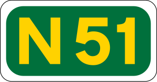
The N51 road is a national secondary road in Ireland. West to east, it starts in Delvin, County Westmeath at a junction with the N52. It passes through Athboy, a junction with M3 motorway, Navan and Slane, where it crosses the N2 road, all in County Meath, before crossing the M1 motorway and terminating near Drogheda in County Louth at a roundabout on the R132.
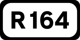
The R164 road is a regional road in Ireland, linking Kingscourt in County Cavan to the N51 near Athboy, County Meath.
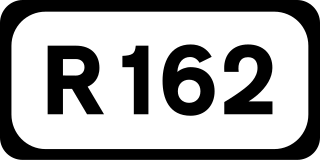
The R162 road is a regional road in Ireland, linking Monaghan Town to Navan, County Meath. The route is 80 km (50 mi) long.

The River Inny is a river within the Shannon River Basin in Ireland. It is 88.5 kilometres (55.0 mi) in length, and has a number of lakes along its course.

Crossdoney is a village and townland in County Cavan, Ireland. The village is on the R154 regional road where it terminates at a junction with the R198. Peculiarly, all buildings in the village sit on one side of the road, and this gives rise to the widely used local expression: "All to one side like Crossdoney".
Mountnugent, historically known as Dalysbridge, is a village and townland in southern County Cavan, Ireland. The village is on the R154 regional road, at a river crossing near Lough Sheelin.

The R147 is a regional road in Ireland. Its first section runs from St Peters Church in Phibsborough, Dublin to its junction with the M50. It then follows the route of a former section of the N3 between Clonee and Kells. It serves as an alternative route for non-motorway traffic and traffic wishing to avoid tolls on the M3.

Farbill is a barony in east County Westmeath, in the Republic of Ireland. It was formed by 1672. It is bordered by County Meath to the south and east and three other baronies: Fartullagh, Moyashel and Magheradernon and Delvin. The largest centre of population in the barony is the town of Kinnegad.

Crossakiel or Crossakeel is a village in County Meath, Ireland. It is situated in the north-west of the county, at the junction of the R154 and the L2801, approximately 13km south of Oldcastle and 12km north of Athboy.